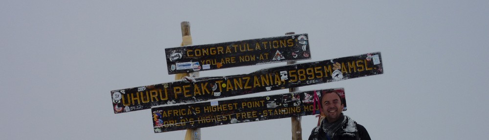
So it’s obviously been way way too long since I last put up a blog post. That’s because about 11 months ago I took the decision to stop my apparently futile attempts at high altitude success. I had three or four goes at getting above 6,000m, and they all seemed to end in one thing – me heading downwards feeling like shit. So in the meantime I’ve done some nice sensible things, like change job, move house, and do some cycling.
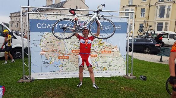
Lots of cycling in fact, culminating in a fabulous 160-odd mile ride doing the coast to coast in a day. Details of that here of that ride, less the last 6 or so miles as my Garmin battery decided it didn’t want to go for over 12 hours! See Strava section here: https://www.strava.com/activities/623638383
The Coast to Coast was at the end of June, and it was great, but (as is the way with me :)) I finished it and needed a new thing to aim for. And so after a bit of an impromptu flight purchasing, I was off to Switzerland at the end of July for a bit of ‘hill practice’ as they say!
I originally intended to head to Grindelwald, and trek around the North Face of the Eiger, something that has been ‘on the list’ for a little while. But after contacting my friend Verena, who lives in nearby Bern, she suggested that the Eiger and surrounds would be stupidly busy that weekend. She suggested Zermatt instead, as she hadn’t been there before, and would come along too!
And so off to Zermatt it was, for what proved to be an amazingly beautiful weekend in what is such a fabulous part of the world. For those who don’t know me, I have a bit (ok a lot!) of a fixation with The Matterhorn – I just find it a staggeringly beautiful and transfixing mountain. Spellbinding in fact. I also put my only ever Youtube video online with the mountain in it – I could still watch it every day! Skiing down towards Zermatt in 2013:
After a flight to Zurich and a train ride to Bern to meet Verena, we departed at the crack of dawn on the Saturday morning for the drive to Zermatt, about two and a half hours away. After a great drive which went under part of the Alps near to the Eiger in a car train, we arrived in the car free resort of Zermatt and headed up the mountain via cablecar to the Trockener Steg area of the resort. Cable cars aren’t cheap in Zermatt (nothing is cheap in Zermatt in fact!) at about £40 per single ride, but at least it got us up to 2,900m very quickly.
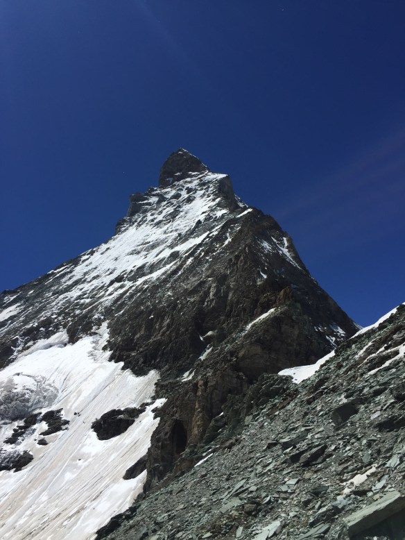
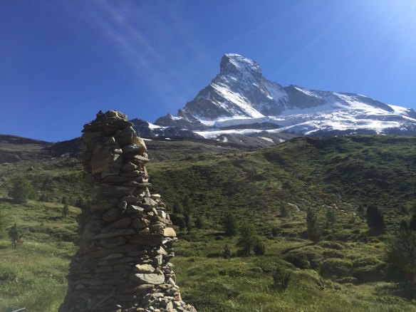
The great thing about the Zermatt area is that from practically anywhere you are, you can see The Matterhorn! It just dominates the place like the outrageous behemoth that it is, towering to 4,478m (14,700 feet), looking all Toblerone-shaped (the Toblerone logo is modelled on it for those who don’t know) and pointy, and just incredible.
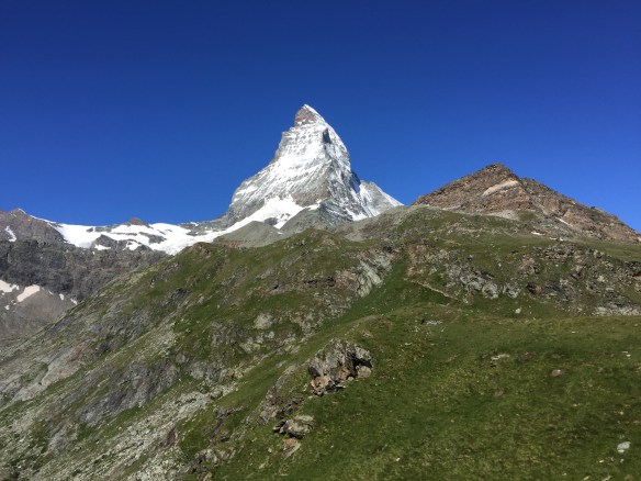
The Matterhorn rearing up above Zermatt
We had chosen a trail which took us from Trockener Steg down to the Schwarzsee, and then around the west face of the Matterhorn and up to a mountain hut called the Schonbielhutte. I managed to persuade Verena though that en route we should try a tricky path up to the Hornlihutte, which is perched somewhat precariously on the North east ridge of the mountain at 3,260m. Thankfully she didn’t take too much convincing, and after trekking down to about 2,400m initially on what was a fairly uneventful route, we began the very eventful path up.
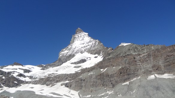
Approaching the Matterhorn – the Hornlihutte is on the tip of snow middle right of the picture.
It was slow going, as a.) we were up at 3,000m and unacclimatised, and also b.) the path has several places where in simple terms a missed footing could be your last ever step on earth. To add to the perils of point b.) the path was still snowy and icy in places, and without crampons (which I have to say weren’t required at this time of year, but a month earlier and you wouldn’t venture up any of this without them) it added to the general feeling of precariousness. Thankfully at the most tricky parts there was a metal rope in place to cling onto, which I gladly took advantage of.
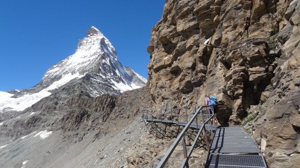
The path starts easily with a footpath and metal railing
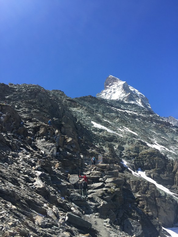
The path starts to wend its way up quite steeply….
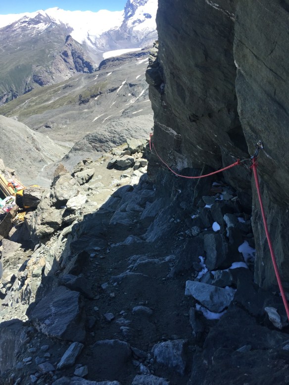
…and there are parts where you have something to hold on to….
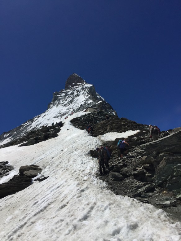
…and finally the hut comes into view just in the snowline.
It was a really great climb, requiring the use of hands as well in places to add to the mind’s focus. We reached the hut at about 1.45pm, and sat at the terrace for lunch (it would have been rude not to really) and it became apparent as soon as we stopped moving that the temperature when stopped was considerably colder than it had felt whilst climbing up, so jackets and hoods were quickly donned. The views were majestic – including the view directly upwards of the top of the mountain, which whilst still over 1,100 vertical metres above us, seemed much closer. I vowed looking upwards at the near vertical face to never, ever feel brave or stupid enough to try to climb it :).
This is the closest to the top I am ever going to get, promise!
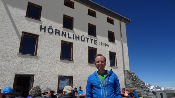
Just to prove I made it there!
The area around Zermatt is also home to around 25 4,000m+ mountains, including the Dufourspitze and the Dom, at 4,630m and 4,550m respectively the second and third highest mountains in the Alps, and the highest points in Switzerland.
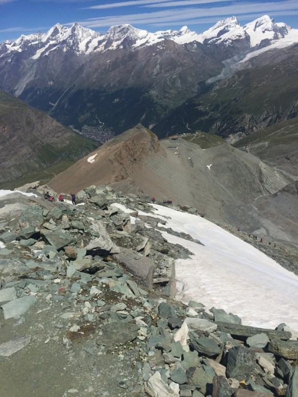
Starting the descent, Zermatt a long way down the valley in the distance and lots of 4,000m peaks up above.
From the Hornlihutte we took trail 27 and then a black-marked steep track down the mountain (see attached map) to Stafel, where we intended to begin the trek back up to Schonbielhutte. http://www.matterhornparadise.ch/pdf/panoramakarten/panoramakarte_sommer.pdf
However on getting down near to Stafel at about 4.30pm, Verena was struggling with a twisted and sore knee, and so the climb up to the hut at about 2,700m and about three miles distant all of a sudden looked a bit of a long way. This was more relevant given the fact that the hut needed us there by 6.30pm latest (the cut off point for evening meals) and also there was no alternative should we not make it as the hut is at the end of a long and isolated valley.
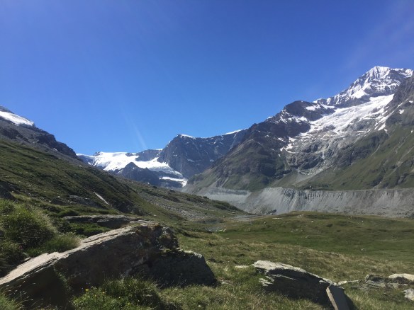
Near Stafel – the Schonbielhutte in the far distance.
We thus phoned the hut and said we would not be able to make it, and then tried to find alternatives continuing steadily down the mountain towards Furi. Cutting a very long story short (about which I could write not just another blog post, but actually a fairly lengthy novel) we ended up all the way back in Zermatt itself at about 8pm. This at least left us best-placed for the next day, when we intended to head up to the other side of the resort, the Rothorn area.
The Matterhorn looking quite different from Stafel, this it’s western face.
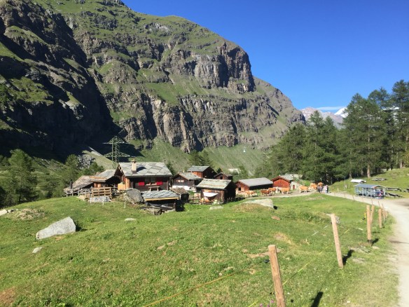
One of the very pretty hamlets we passed on our way back down towards Zermatt. This is Zmutt, I think.
Our route is in the attached Strava link – it was a fabulous walk of around 22km, showcasing some fabulous views of much of the Matterhorn area, and a lot of ascent and descent https://www.strava.com/activities/643124049
After a very long day, sleep would come very easily, and at the thought of seeing the ‘5 Lakes Trail’ the next morning, where each lake held a different reflection of the Matterhorn, I was very very much looking forward to day 2!
