So here I am for only the second time in my life in the beautiful Yorkshire Dales. For those who don’t know, the Dales are at the westernmost fringe of Yorkshire, the largest county in England, and border Cumbria, home to the Lake District. The Dales are essentially valleys, and there are many caves and hills too to punctuate the landscape. A very rural area, some of the Dales have become rightly famous for all manner of means, including Wensleydale for its cheese, and a number of dogs too, including Airedale.
I am here of course for the Yorkshire Three Peaks, but it is such a shame to be anywhere and not look around you and appreciate the area itself for what it is. Arriving last night after a long drive from Buckinghamshire (made considerably longer by a combination of Bank Holiday traffic and people making the most of the beautifully sunny weather), the first thing I did upon arrival was to have a further drive around the area to get my bearings.
Although this is early in the season as far as the total beauty of the landscape is concerned, the one thing that struck me more than anything else was the fact that we are still at the end of lambing season. There are lambs absolutely everywhere! – a truly joyous sight – there is little more pleasing sight in this country for me than a field of gambolling pristine white baby sheep. Bliss!
So my arrival in the evening was all about settling in for the next day. The trek was to start at 6.15am (I arranged an organised trip through the same company I am doing the subsequent Three Peaks Challenge with). I struggled to find accommodation in the area, and the nearest place I could find was a pub (what a shame!) called the Craven Heifer in the village of Stainforth, about 5 miles from the meeting point. The folk at the pub were wonderfully accommodating, illustrated by the following: Upon arrival they asked me what time I would like breakfast, to which I said that I was doing the Y3P, and that I would therefore need to leave at 6am. They immediately without hesitation said that they would have breakfast for me at 5.45, to which I thanked them hugely, knowing that a good breakfast, even at that time in the morning, was essential to get me through 26 miles.
The breakfast was indeed something to savour, and at precisely 5.58am I was out of the door on my way to the departure point in Horton in Ribblesdale, on a very cold morning, under stunningly cloudless skies, accompanied by a frost to boot. The temperature was -2 degrees. A coach awaited us to take folks up to Chapel Le Dale, where the trek over to Ingleborough, the first hill, would start.
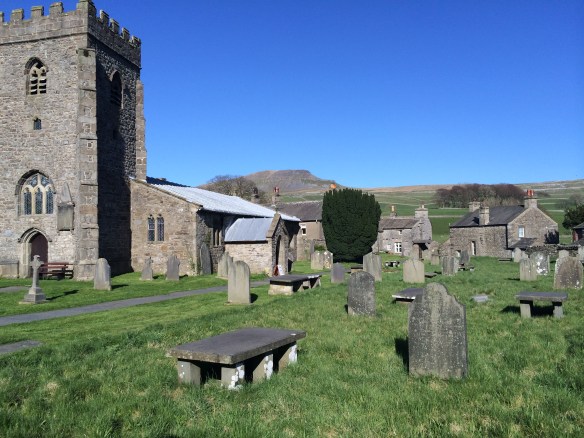
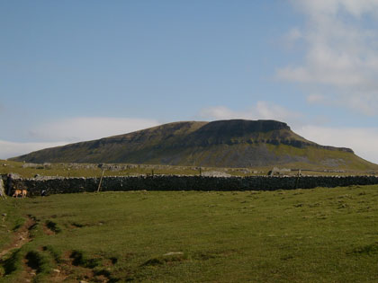
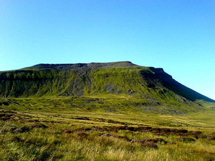
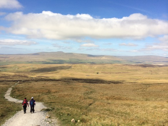
The churchyard in Horton in Ribblesdale, Pen-Y-Ghent in the background.
At Chapel Le Dale, about 100 trekkers had congregated, and people were being assigned into various groups, of about 10 each, and each group was accompanied by a mountain guide. I was put into Group 1, and was then asked if that was ok as it would be the fastest group. I said yes, and was pleased with this, if a little trepidatious, as I was not sure that my physical shape was going to be good enough to stand up to a quick pace. As I joined Group 1, I discovered that I was the only male, and my immediate thoughts (because I am just stupid sometimes) was to think “have I joined the right group, can this really be the fastest one?”
Well at 6.50 precisely we were underway. It was a straight shot up Ingleborough, and the path became fairly steep within the first mile. The idiocy of my presupposition that the group of ‘girls’ that I was with wouldn’t be the quickest group was immediately dispelled. Firstly they were steamrollering ahead of everyone, including the guide, and secondly I overheard one of them say that “this would be much easier if we could run it”. It turned out that they were mostly marathon runners from a running club in Cheltenham. Lessons to be learned from this little exercise are innumerable, but I learned my place, and suffice to say that it was at the back!
Ingleborough looks like the most innocuous and frankly easy of peaks, but it is far from it. There is a very steep, if not overlong, approach at probably 55 degrees or more. It certainly got the old heart pumping. The walk was all uphill to the summit at around 2,400 feet which came just under three miles in. We had been walking for exactly one hour. Our guide Trevor, of whom more later, told us that an hour and a half was the norm, so that made us all feel pretty good, and me pretty out of breath.
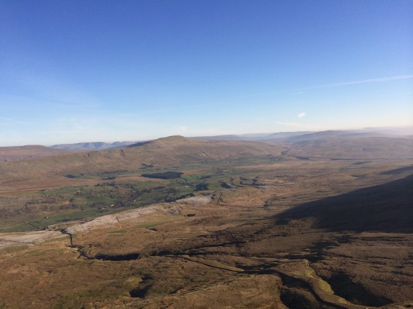
From near the summit of Ingleborough, looking back down towards Whernside and the Ribblehead valley.
The weather by now was wonderfully clear, as it would stay pretty much all day as seen in the photograph above.
From the summit of Ingleborough, and after turning back on ourselves at the trig point, we set off on a long downhill meander towards Horton in Ribblesdale prior to hill two, which would be Pen-Y-Ghent.
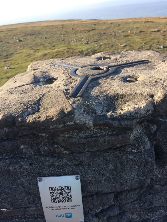
The trig point on Ingleborough, adorned with QR code – an interesting blend of the old and the new.
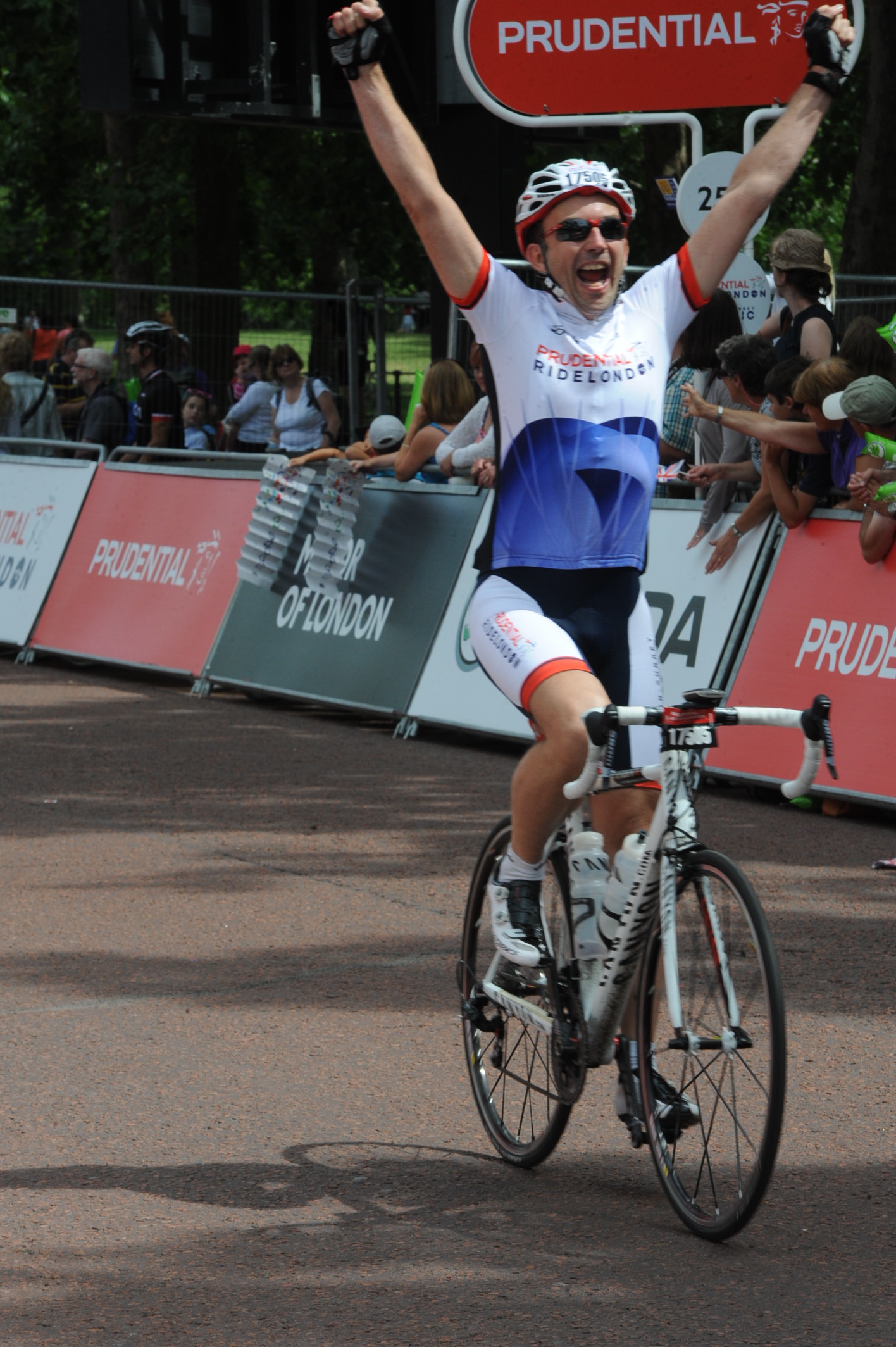
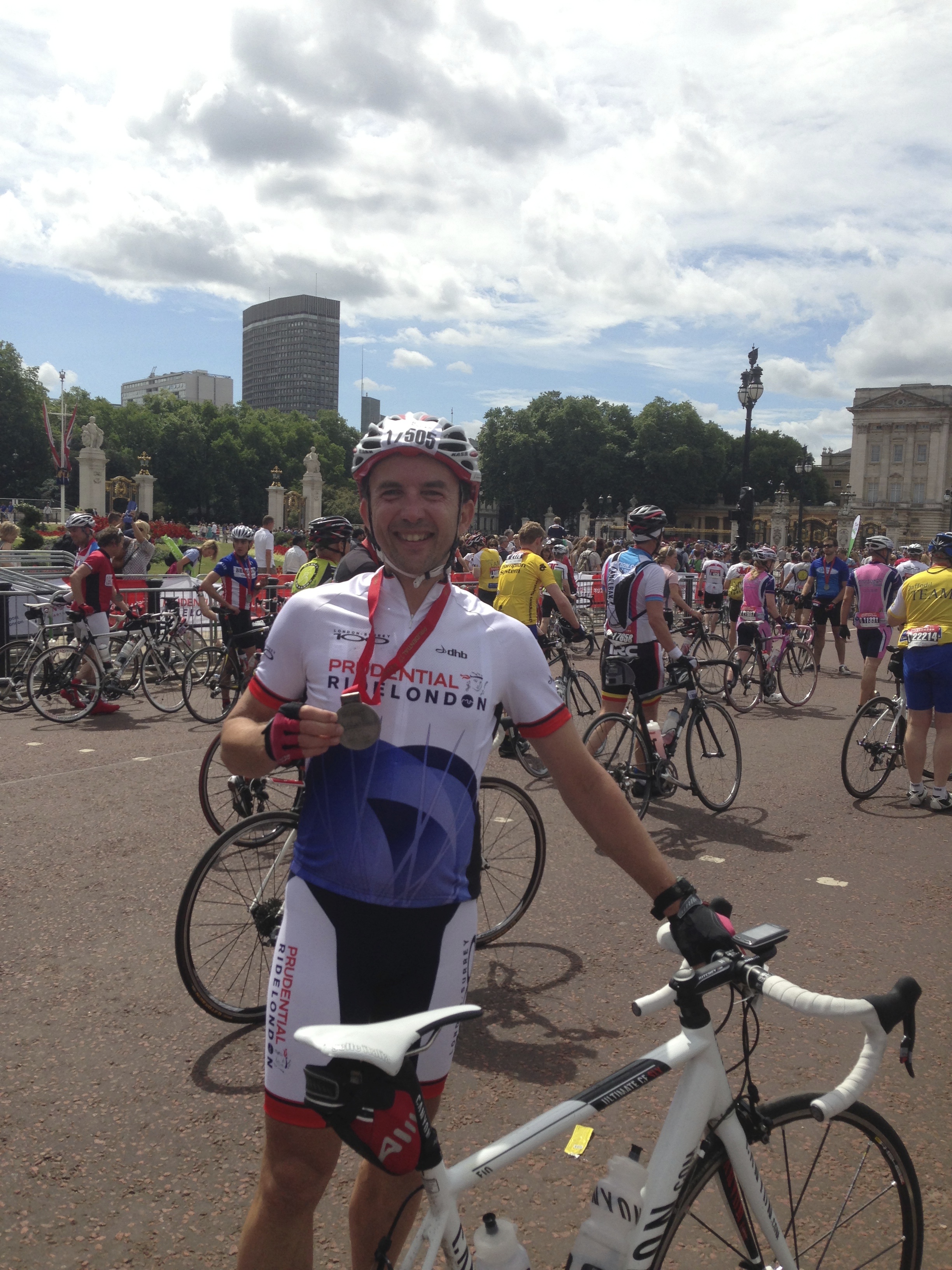
On the way down to Horton, at about 7 and a half miles in, I spent some time talking to our guide Trevor. It turns out that he is a very keen cyclist, as well as a qualified mountain guide, and we got talking about all manner of cycling escapades. It turns out that he had once cycled from the tip of Argentina to Alaska, some 16,000 miles, over 10 months, amongst a number of other amazing achievements. he was quite inspirational, and his company was one of the highlights of an amazing day. Amongst other things that he does, Trevor runs a tandem hire business in Yorskhire too, called Times Two Tandems, so if you ever find yourself there and are looking for a great way to explore, do look him up – his link is here: http://www.timestwotandems.co.uk
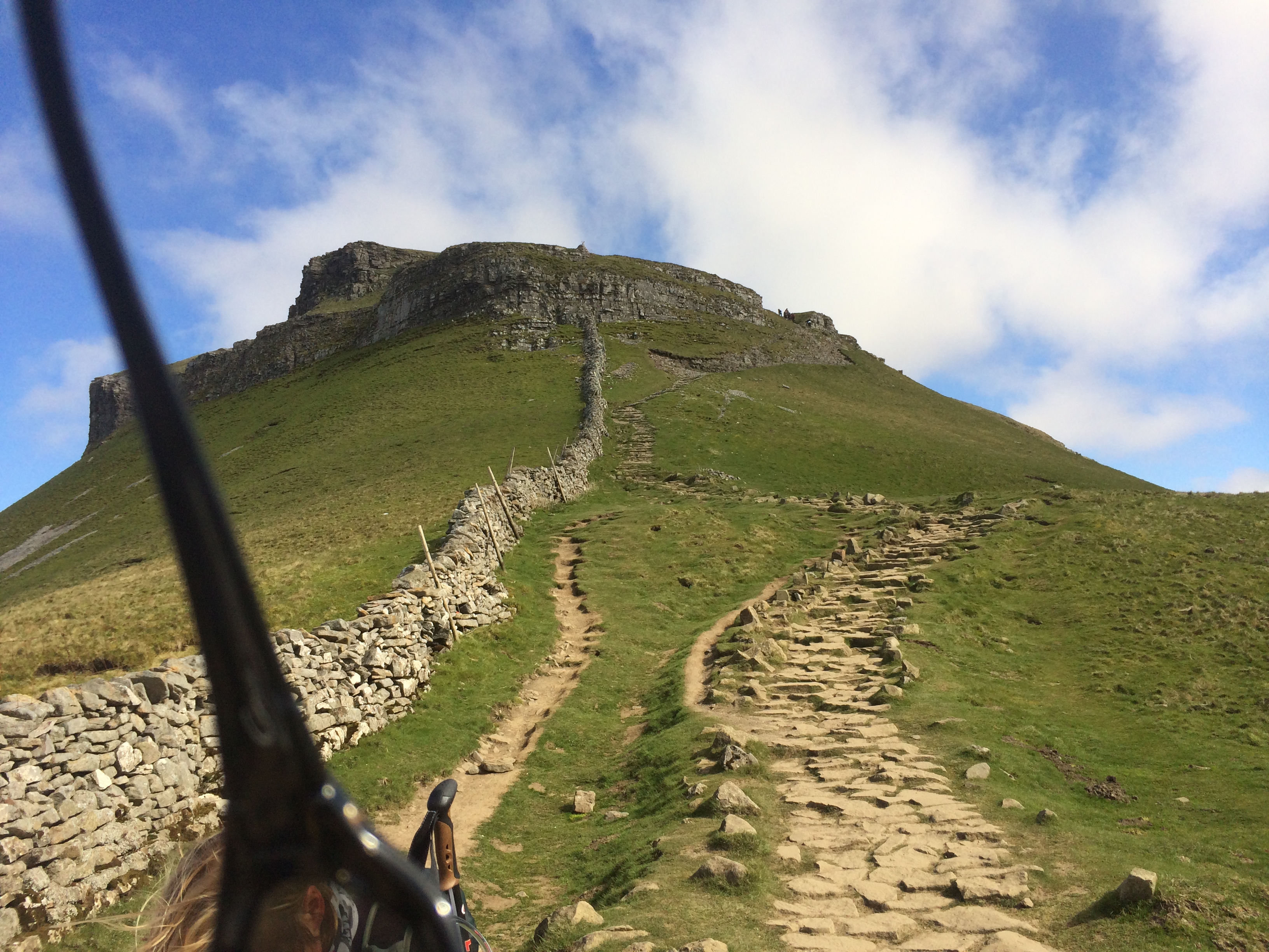
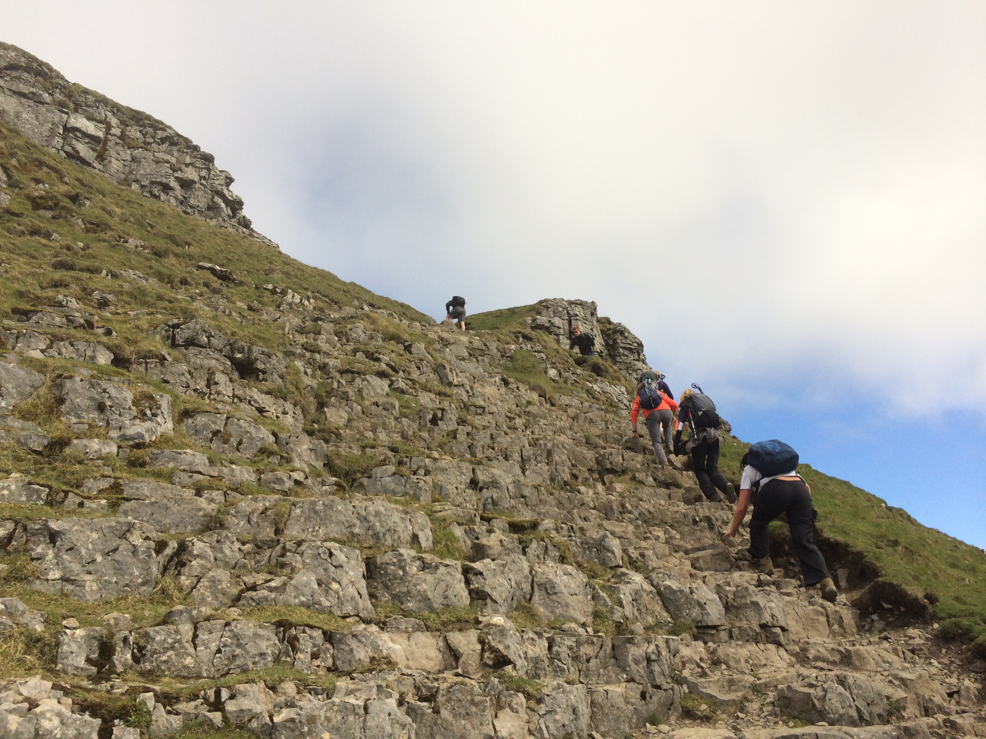
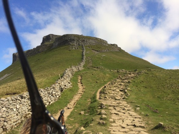
After a ‘bio break’ and an energy bar or two, we then headed from Horton straight up to Pen-Y-Ghent. Again, this hill looks really innocuous from the road, but proved to be quite a good pull. Again it was about 2 and a half miles of ascent, to the summit at about 2,400 feet. The top was almost a scramble in places, and my hands were down a couple of times.
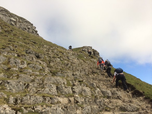
Towards the top of Pen-Y-Ghent – they have done a good job with paving these areas to help stop erosion.
And getting closer now to the very summit…..
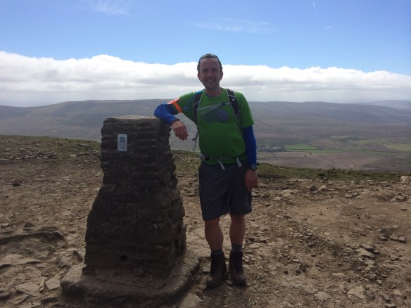
And finally on the very top, just to prove I made it 🙂
From the top of Pen-Y-Ghent, after taking lunch there in the well designed S-shaped shelter (it’s a bit of a windy spot), we headed down again for the long trek to Whernside.
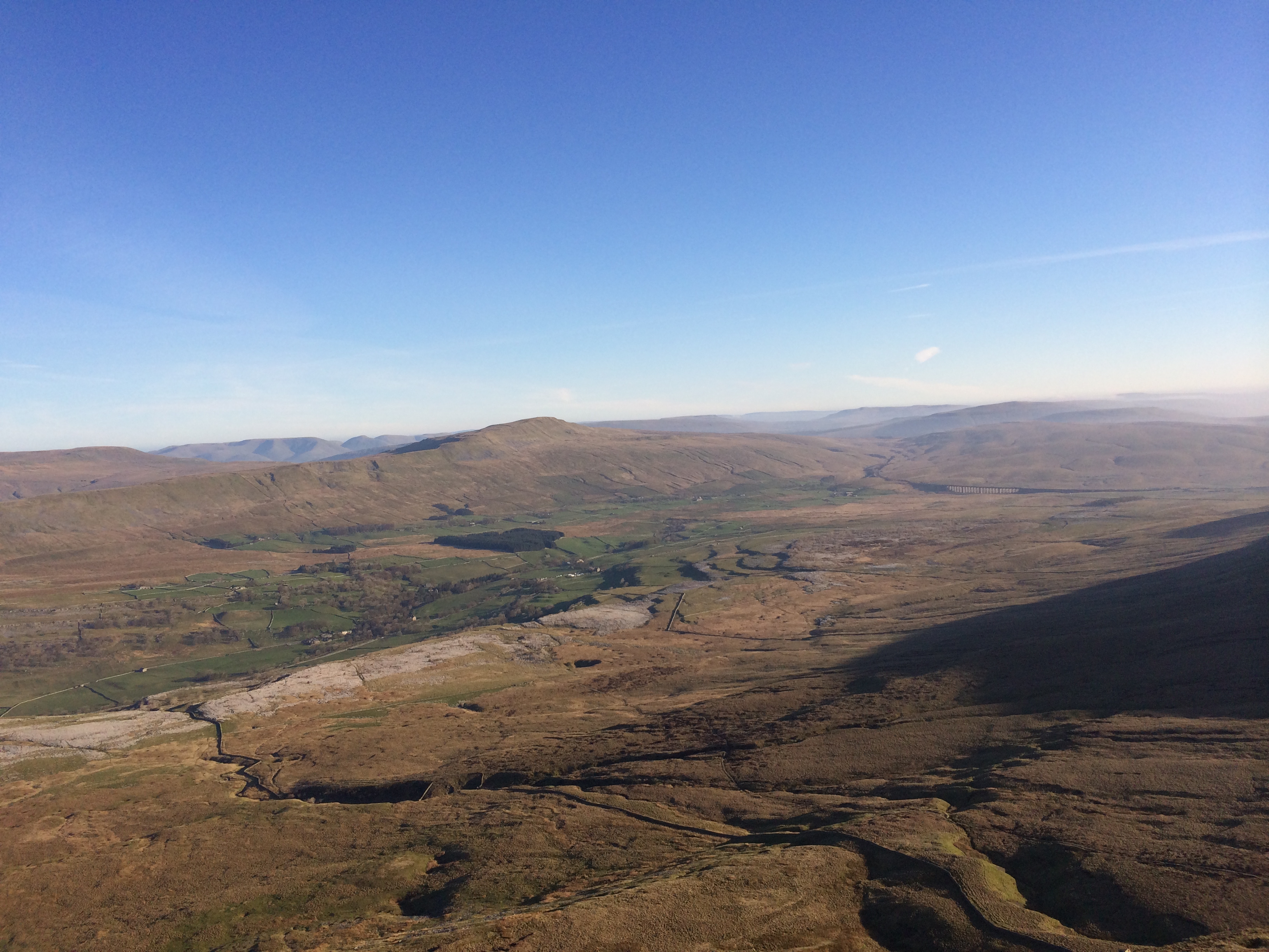
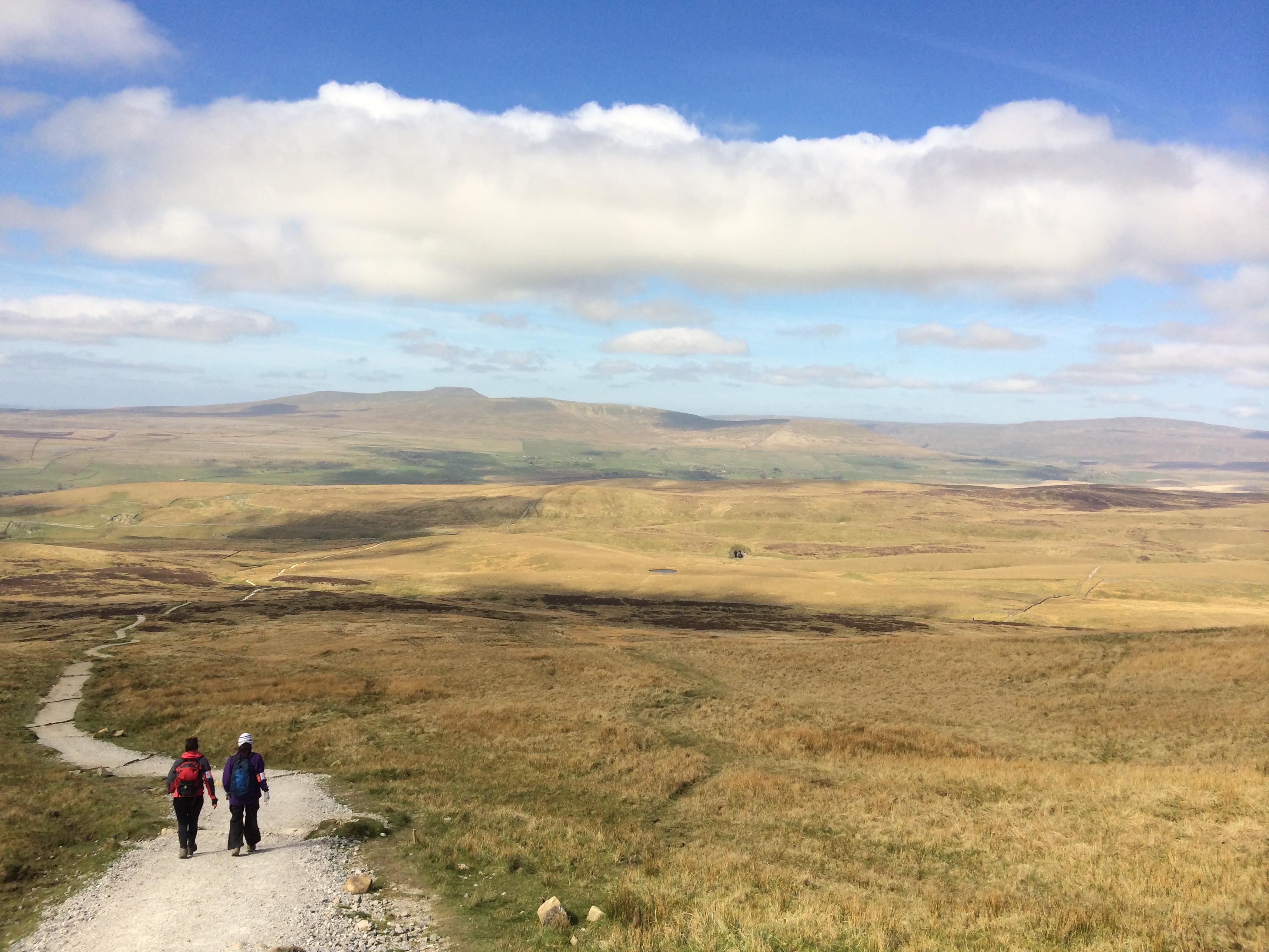
Starting the long trek to Whernside (far right) – Ingleborough can be seen in the far (centre left) distance too.
Peak to peak, Whernside is about 12 miles from Pen-Y-Ghent, although only about 8 or 9 until you start your ascent from the Ribblehead viaduct. The Ribblehead viaduct is rightly famous for one of the UK’s most picturesque train journeys, on the Settle to Carlisle railway, and was built in around 1870.
The walk down is straightforward, and was nicely punctuated by a tea and cake stop from a minibus, provided by the organisers. Tea, I have to say, never tasted so good, and it was nice to have a brief rest and a sit down, even if I was itching to get up and go again before most of the others were.
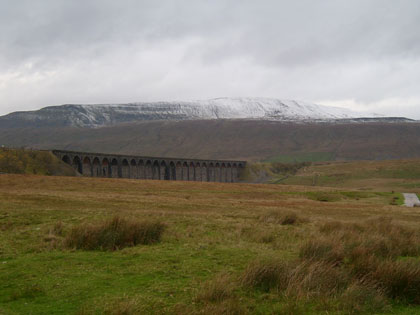
Upon reaching the Ribblehead viaduct we began on a meandering path along the edge of the railway, which gradually then began to talk a big wide S turn to a ridge leading up Whernside itself.
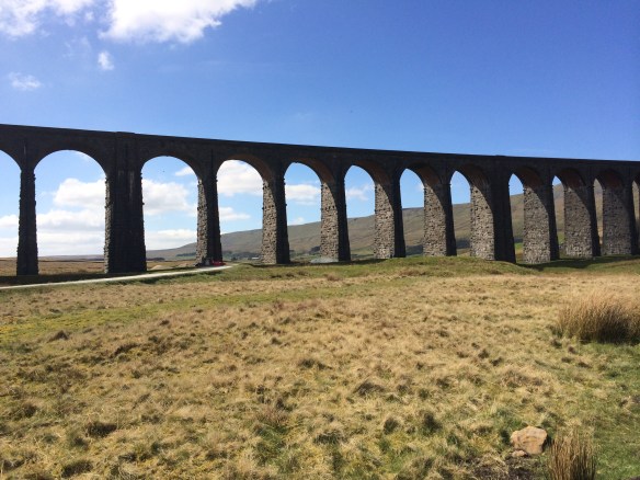
Underneath the mightily impressive Ribblehead Viaduct, the lower slopes of Whernside in the distance.
The climb up Whernside is fairly long, but reasonably gentle, and well paved for most of the way. About two thirds of the way up though, the wind (which had been very gentle for most of the day) whipped up along the summit ridge to the point where it made just standing up a significant challenge. I have to say it was about the most brutal wind I have ever encountered, and had it been in our faces, I am sure that many people would not have actually made the top at all. As it was, the wind blew sideways, and so it was a mere balancing act, albeit still of some at times epic proportions.
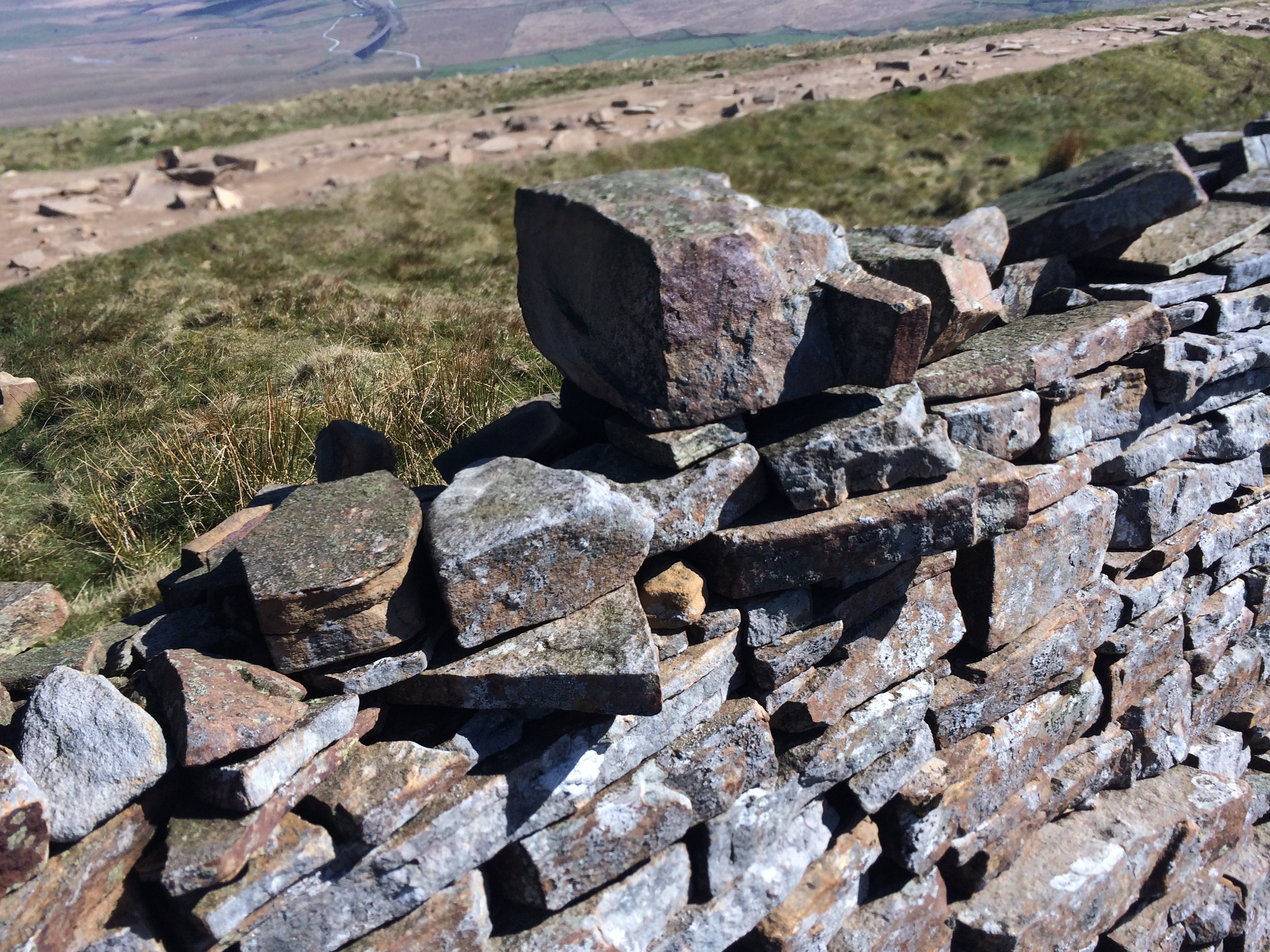
The summit of Whernside is flat, and characterised by a wall with a trig point on the other side of the path from where the summit ridge is. The trig point is actually in the neighbouring county of Cumbria, from where I took this photograph:

From the trig point on top of Whernside. in the far distance below you can just make out the Ribblehead viaduct way below.
As you can see from the above, I’ll never make a photographer, but never mind, at least it means something to me!
The descent from here was for the most part cold (everyone put at least two layers on at the top, and hats and gloves too), and steep, making for very achy legs after 24 or 25 miles of walking. The group split at this point, and everyone basically took the descent at their own pace, which for me is quite quickly. I find it more tiring to go slowly on a steep descent, and find I just have to go at my own pace. The guides had described the descent here as a bit of a staircase, and I’d say it is steeper than that for the most part. I’m just glad it was dry on the day I did it.
From the bottom of Whernside, there was about a flat mile through farmland back to the start at Chapel Le Dale, and the appropriately named Hill Inn. A very pleasant pint of Black Sheep Bitter later, and our certificates duly despatched, it was all over.
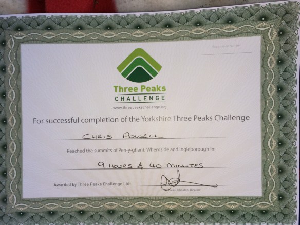
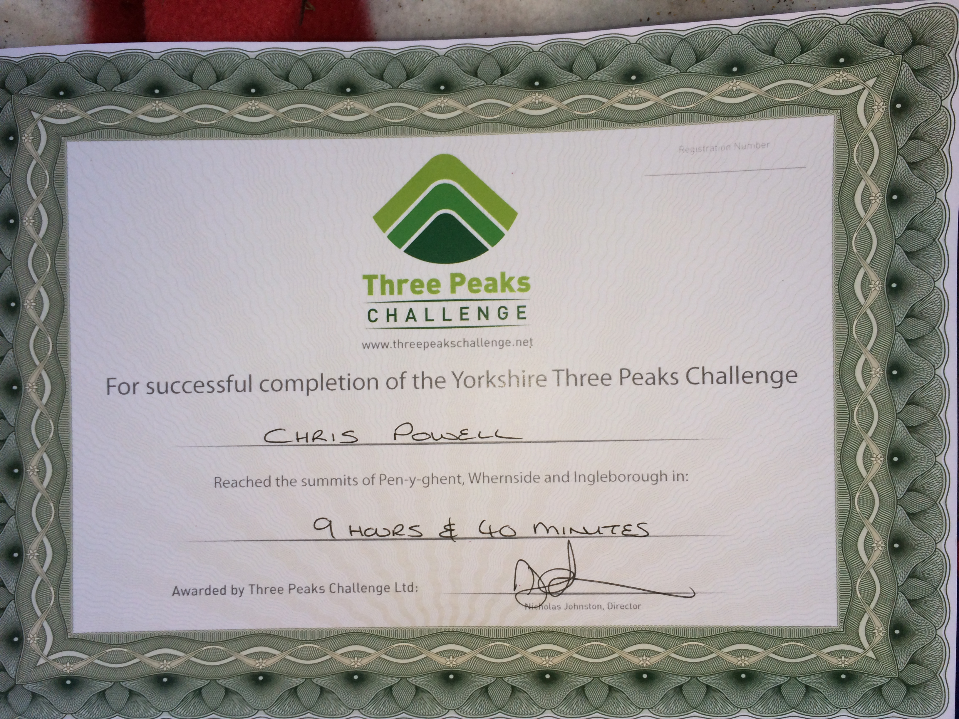
My finishers certificate – we were in the first group to finish on the day. ‘Average’ time is apparently around 12 hours.
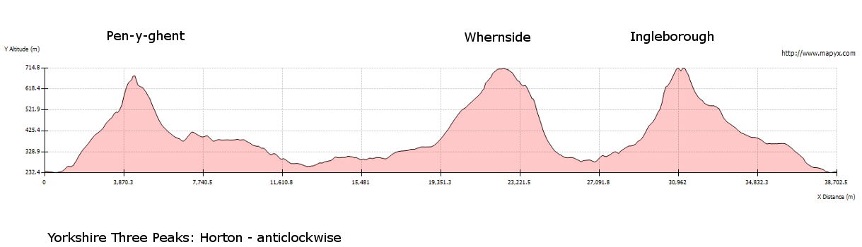
The tale of the tape then reads as follows: Mileage covered 25 miles, ascent about 1,700m, or 5,600 feet. Total time was 9 hrs 40 mins, of which just over 8hrs was actually walking time. Here are my stats from my Garmin:
http://http://www.strava.com/activities/132258938
My takeaways from the day are so many. For one, I was so lucky with the weather. The Yorkshire Dales can be incredibly wet, even in the summer, and this was just the most beautiful of days. Secondly, it was a great group of like minded and lovely people to be walking with, and that always helps a huge amount, especially when you are away on your own. Thirdly it gave me an appetite to come back to the Dales, it is a beautiful area and needs more exploring. Fourthly I met a great guide in Trevor, who provided me with advice, inspiration, and not just a desire to do more of this sort of thing, but also he actually helped me (inadvertently or not, who knows) to look at myself from a different angle. To question myself, and to push myself, and to realising that life is sometimes just too short. More of that in a later post perhaps…….
All I’ll say for now is that my next post will be about Yoga For Dummies! I’ll say no more for now 🙂
My final thanks go to The Three Peaks Challenge
http://www.thethreepeakschallenge.co.uk
who were brilliant throughout, from point of booking, to follow up emails, and all sorts of help along the way. I’m doing the Welsh Three Peaks, and also the National Three Peaks with them in the coming two months too, so it seems like I have chosen very well, which is a great thing. Look them up, if you are considering a challenge like this, and then book with confidence – you are in very safe and knowledgeable hands.