Coast to Coast – the final day to Robin Hood’s Bay!

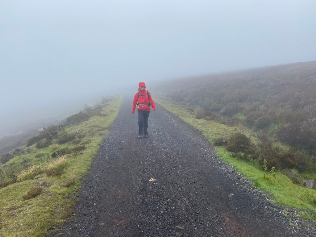
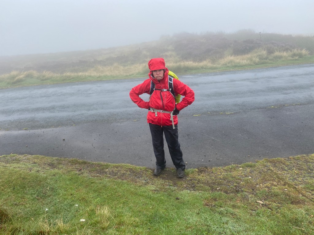
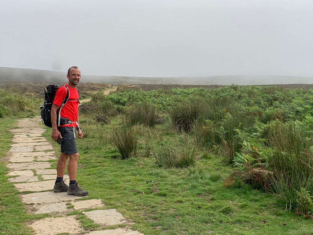
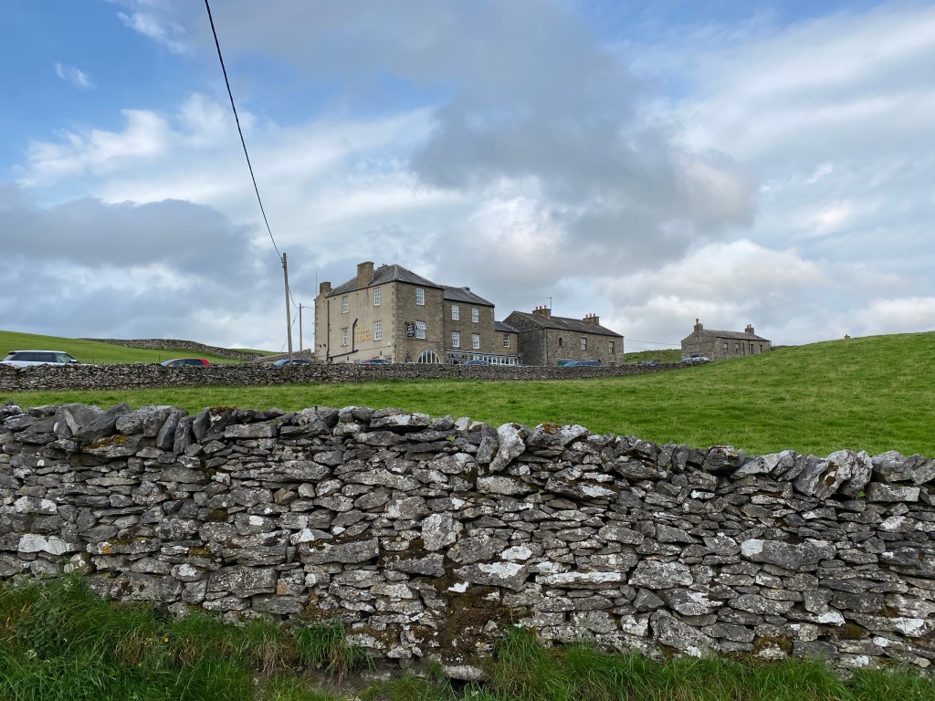
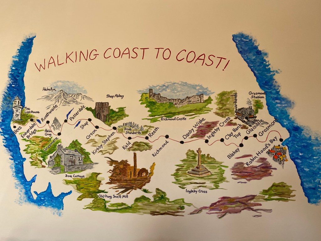
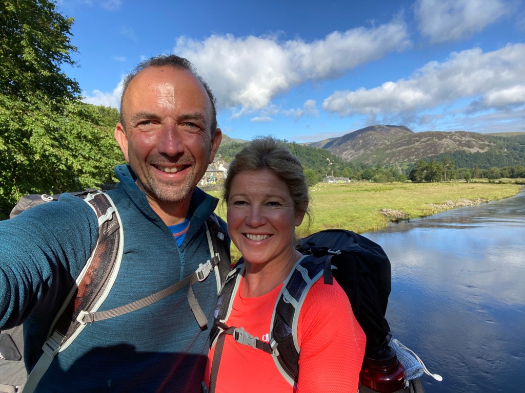
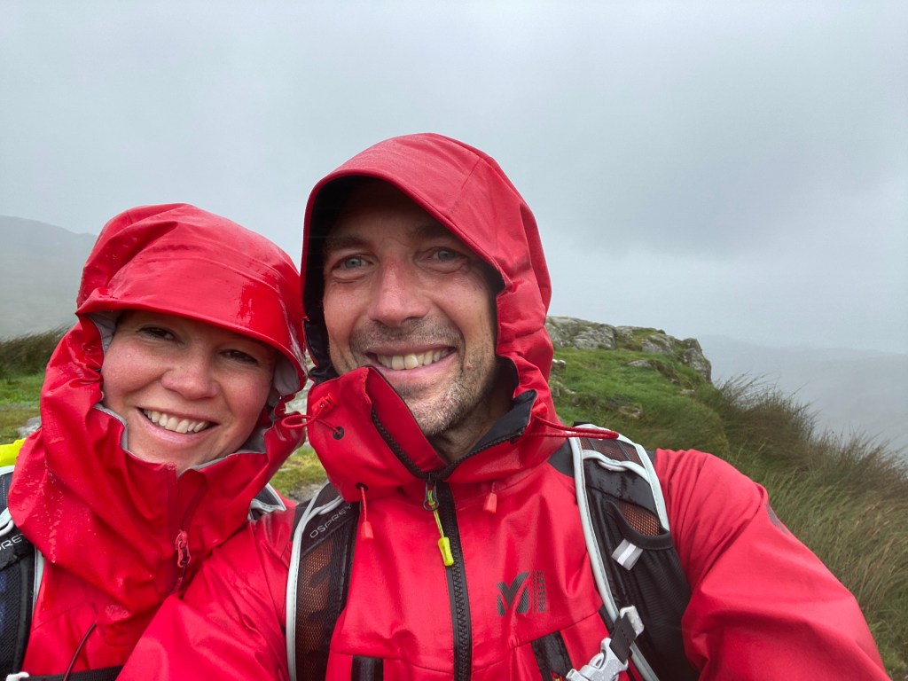
And so it had arrived! We were finally ready to do the final day of our adventure, and what an adventure it had been. Just 19 miles lay before us until we got to throw our pebbles that we had carried for 177 miles so far into the North Sea at Robin Hood’s Bay. Meantime it was time to put the waterproofs on for one final time, as the weather it seems wasn’t going to let us see the sea until we got to dip our toes in it, but that was ok.

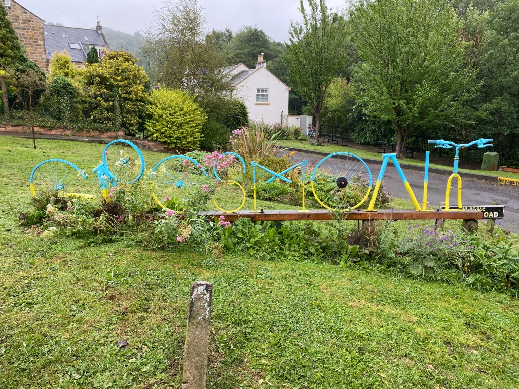
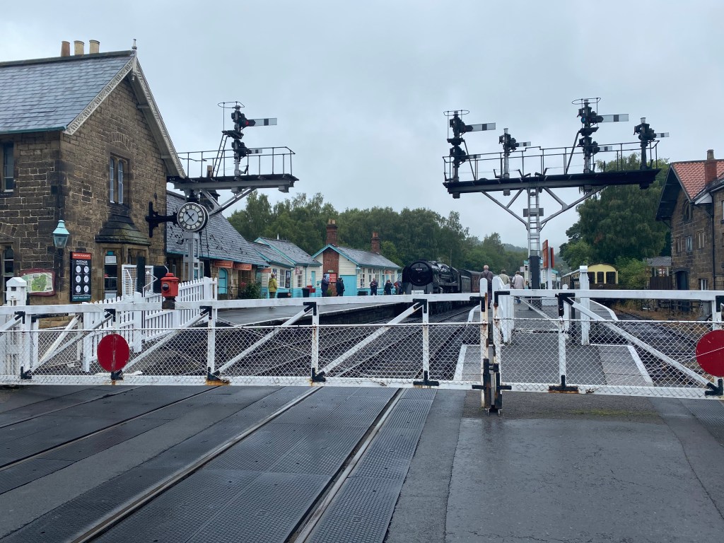
Leaving Glaisdale and The Arncliffe Arms behind, we came first through East Arncliffe Wood, and then to the very pretty village of Egton Bridge, clearly a place where the well-heeled inhabit around these parts. We even saw Llama in someone’s very grand garden. It was then onto the slightly grittier but no less attractive Grosmont. Grosmont is a place for the steam train enthusiast and the train that we saw lingering on the platform is apparently the one known as Hogwarts Express in the Harry Potter films. The village is also famed for its steep streets and climbs and is used in both the Tour de Yorkshire cycling stages and was also part of the 2014 Tour de France. The hill that comes out of town is a whopping 33% for a short while.

Grosmont’s nod to its recent cycling heritage…..
The station at Grosmont with the ‘Hogwarts Express’ at the ready.

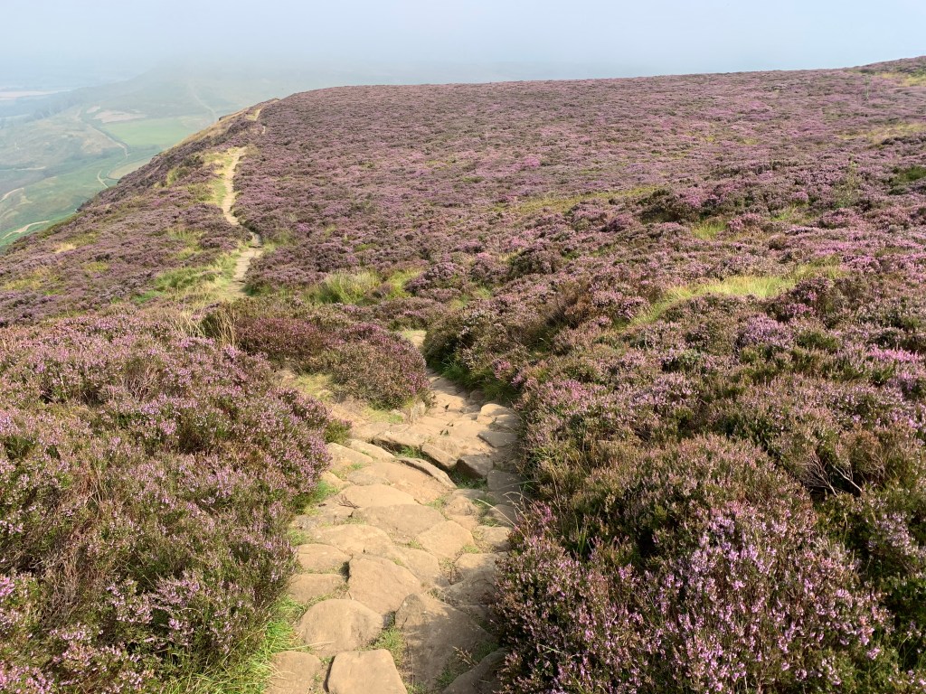
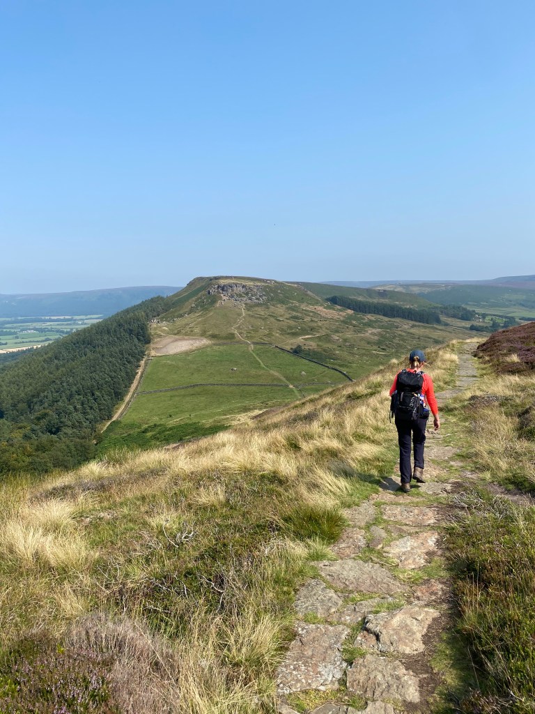
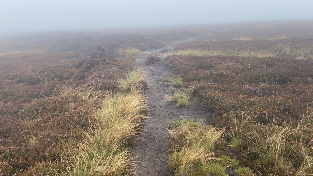
From Grosmont the steep hill out along a roadside takes you up via Eskdaleside Cum Ugglebarnby (!) to Sleights Moor, where the mist and fret decided to descend upon us once more and deprive us of any views whatsoever for the rest of the day. A shame as apparently we would otherwise have been able to see to Whitby from here on a clear day.

More moors to navigate – we took a wrong turn on this one!

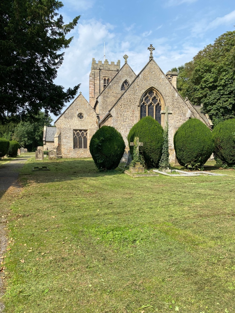
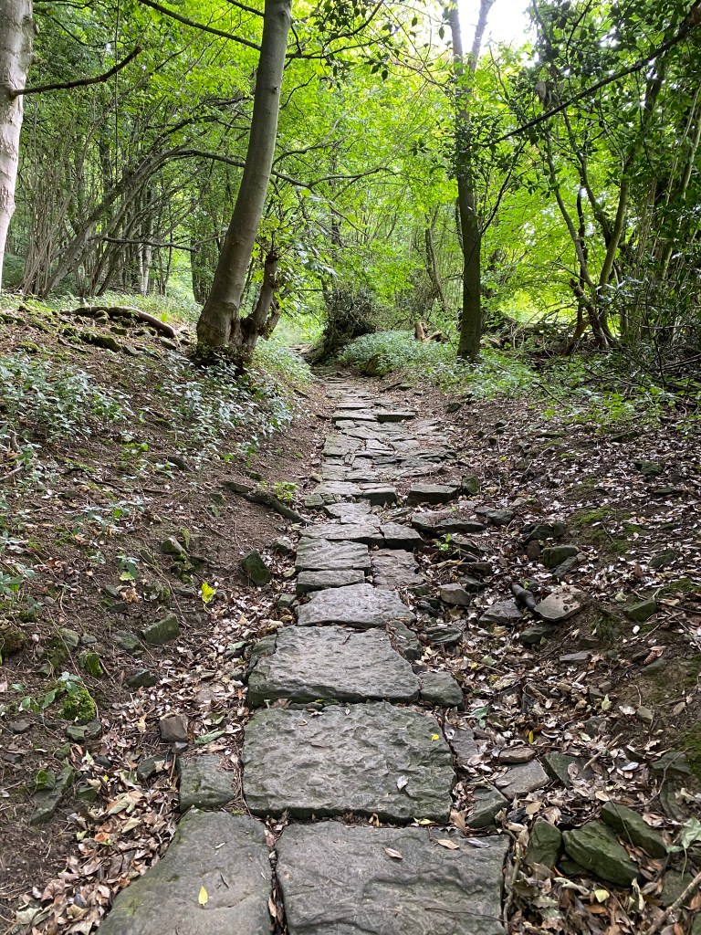
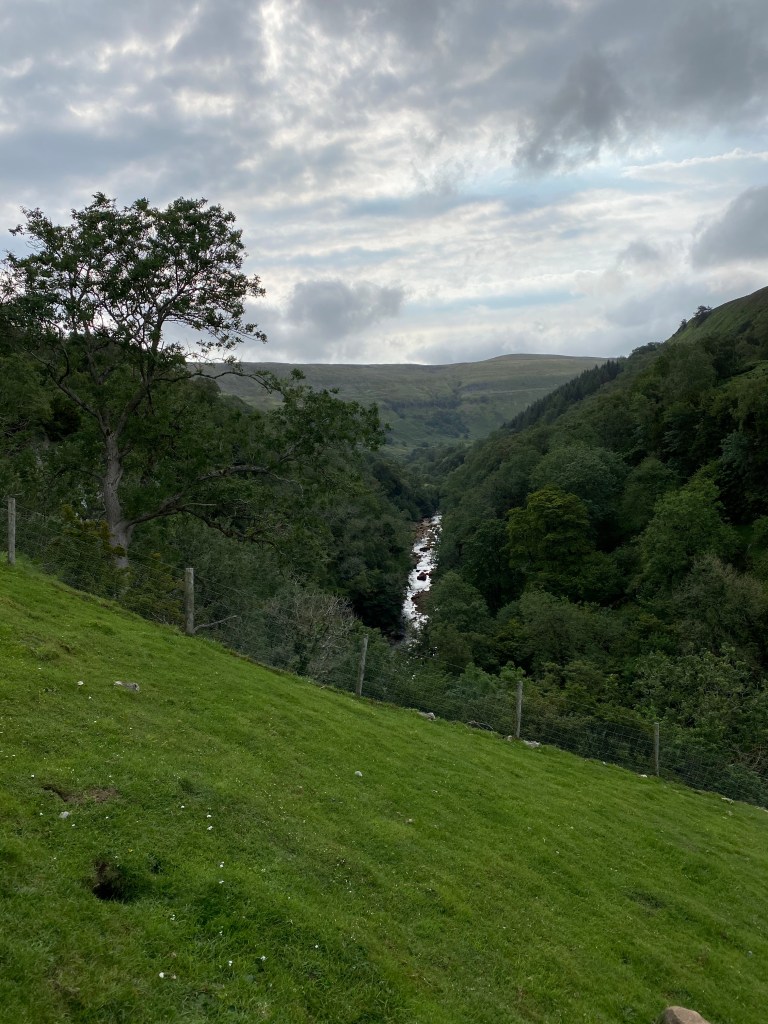
We then entered the village of Littlebeck, which was just as pretty as Egton Bridge if not more so, and then the woods of the same name, which stretched for 3 or 4 miles and are a big local tourist attraction. It was very strange in fact walking with our boots and packs on to go past day trippers in flip flops and sandals to the waterfalls and cafes there.

The Hermitage Stone in Littlebeck Woods.

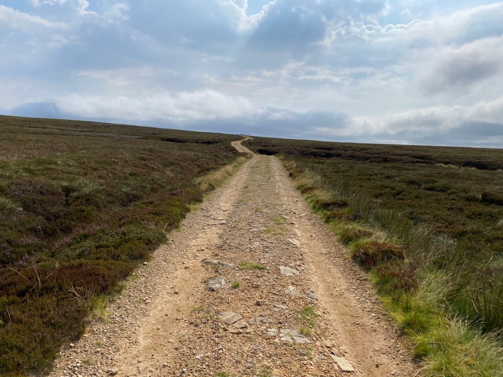
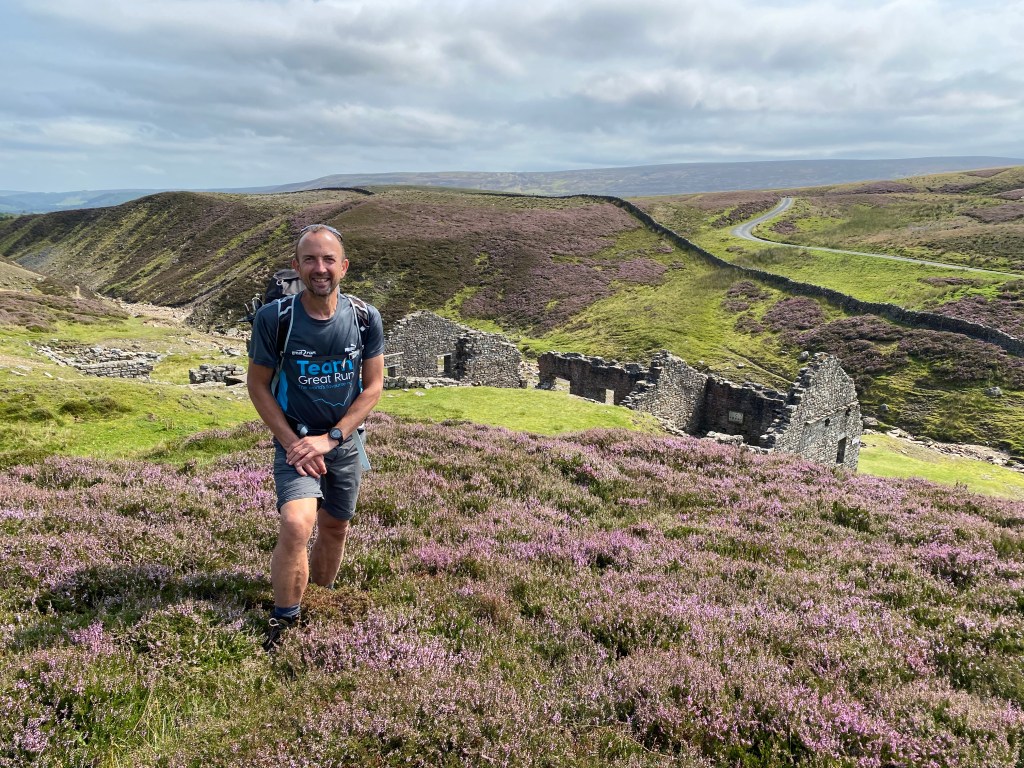
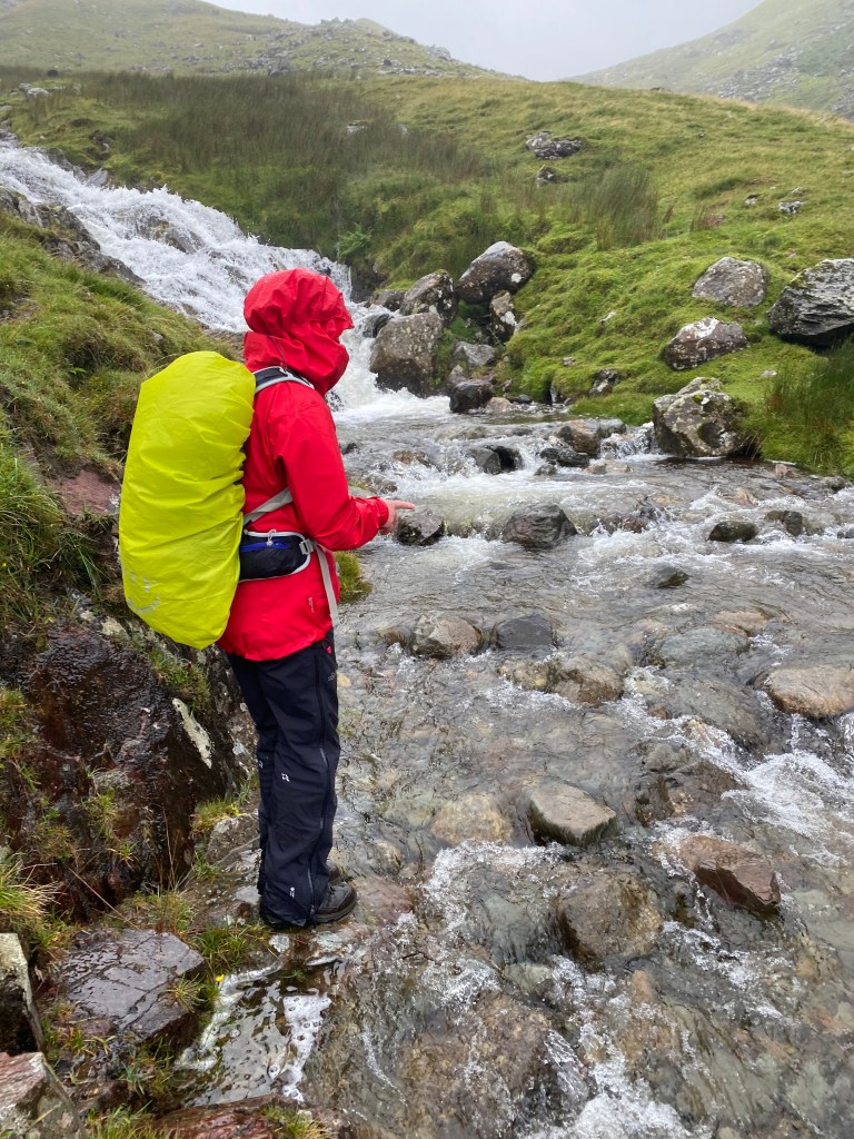
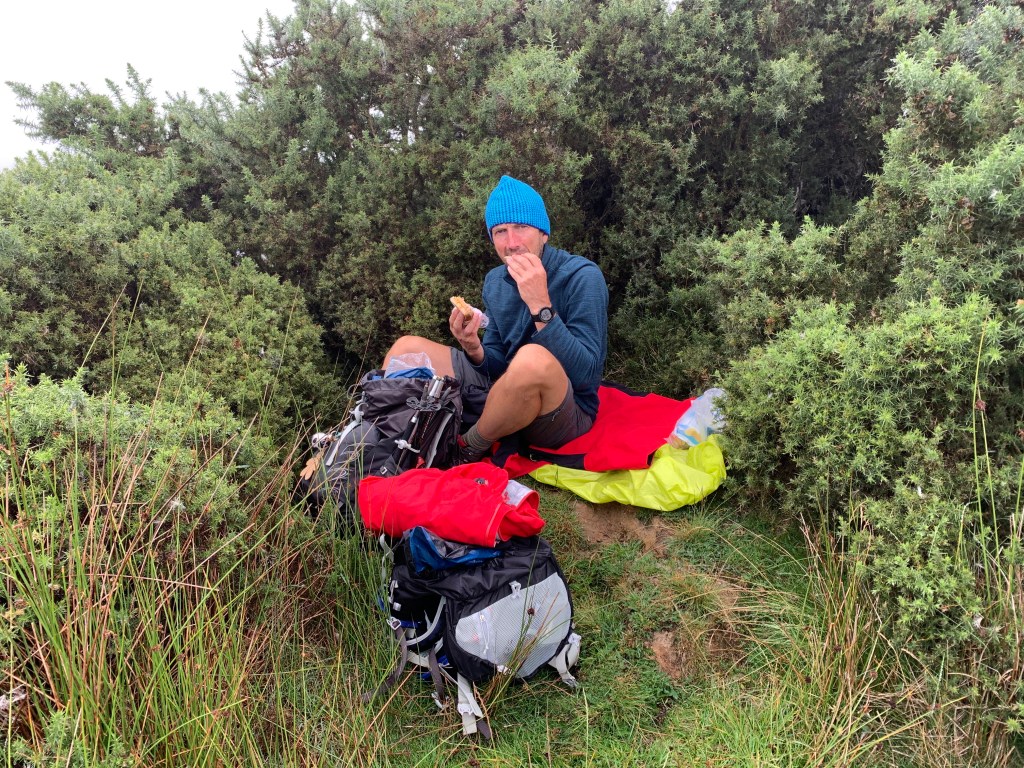
Leaving the woods behind we once again made our way over our final moorland, which would take us all the way to the sea. The rains came for our final packed lunch of the trip and we found shelter in some gorse and heather albeit briefly.

You have to grab lunch and take shelter wherever you can.

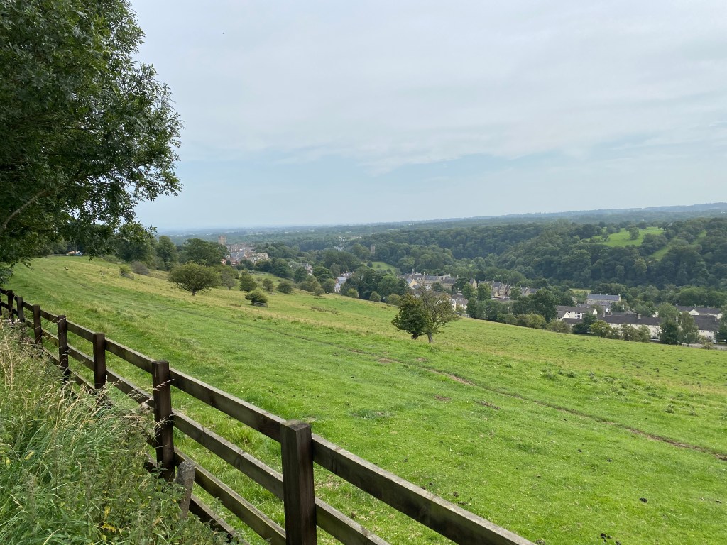
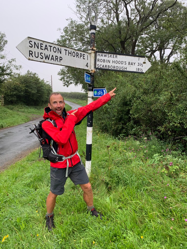
It was then on via a hamlet called High Hawsker to reach a path which again met up with the Cleveland Way which we had followed a few days ago. This took us via some fairly depressing looking static caravan sites down towards the sea at last.

The End is in sight, almost!
Our very first sight of The North Sea 🙂

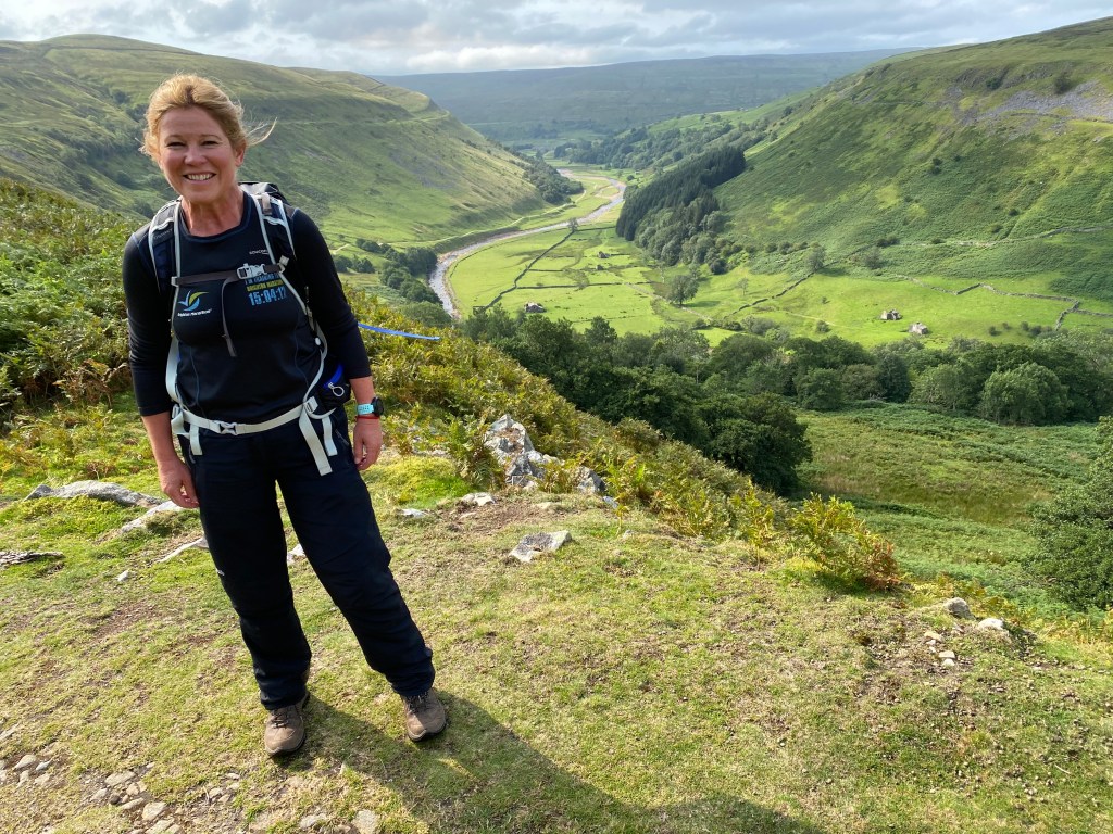
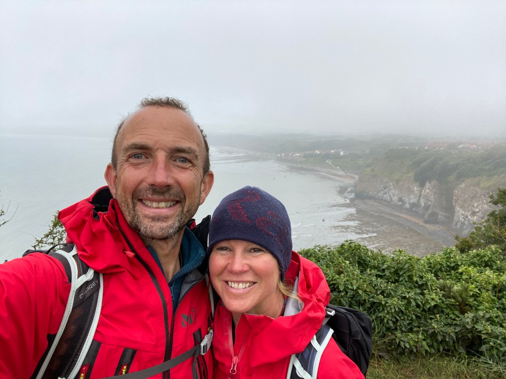
The sea was of course a lovely sight to behold, even if we couldn’t see much of it due to the fret. This stretch of coast is only 30 or 40 miles south of where I grew up, and so I began to feel very nostalgic at this point, and a bit poignant that our walk was nearly at an end.

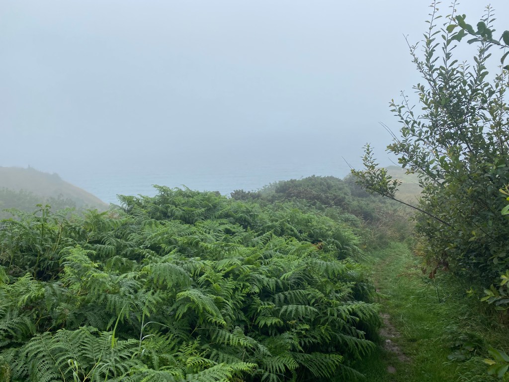
The last three or so miles then match the same way the whole route started, via a coastal path along cliffs at the very edge of the sea, with Robin Hood’s Bay itself finally showing us its face through the fog.

Ronin Hood‘s Bay finally appears, just!

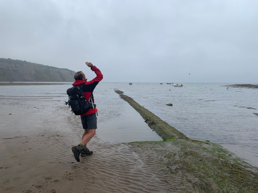
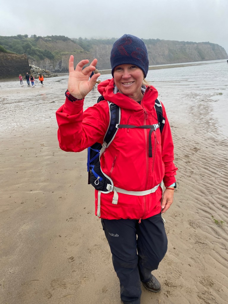
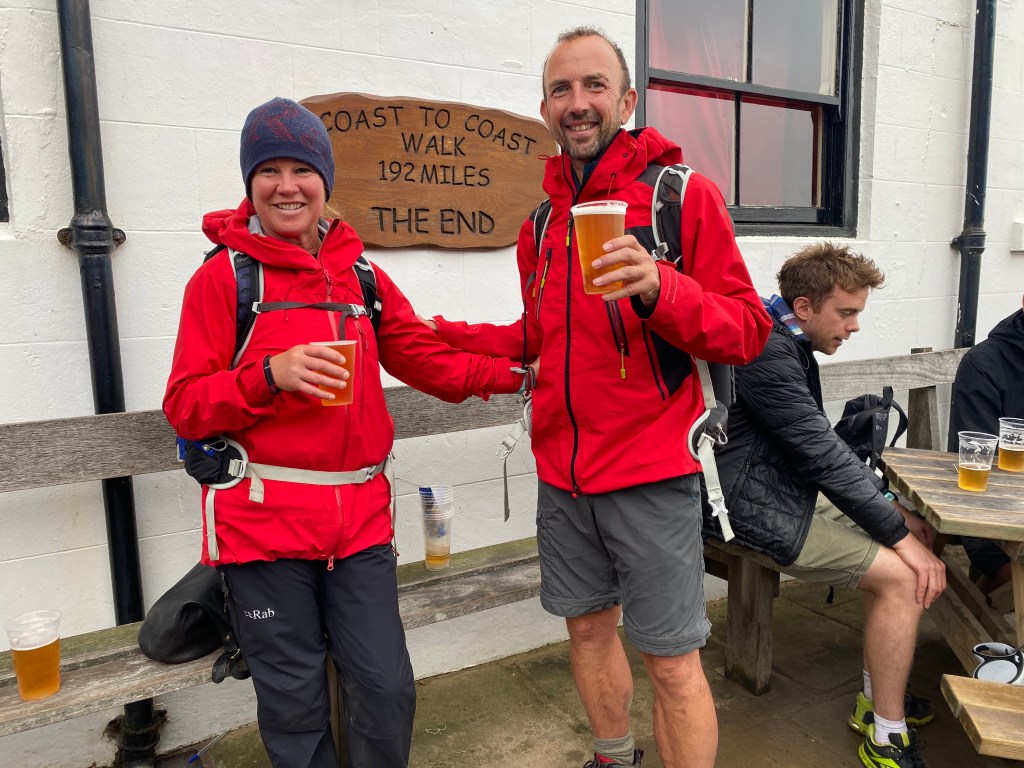
The walk down into Robin Hood’s Bay is steep, past a series of seaside shops and pubs and the like. It’s somewhere between quaint and tacky, and whilst on balance I don’t think I’d choose to come here for my holidays, it was a fitting end to the adventure, as traditional as it is. It was also where Wainwright finished his own adventure all those years ago, and so like the many pilgrims before us, we ended by completing the ceremonial parts: First we cast our pebbles that we had carried from the Irish Sea into the North Sea; then we had our picture taken by the sign at Wainwright’s Bar of The Bay Hotel, which very fittingly says “The End“.

The ‘throwing the pebble’ ritual is duly done for me….
….and about to be done by Mel too!
And it’s all over now – the sign says it all!

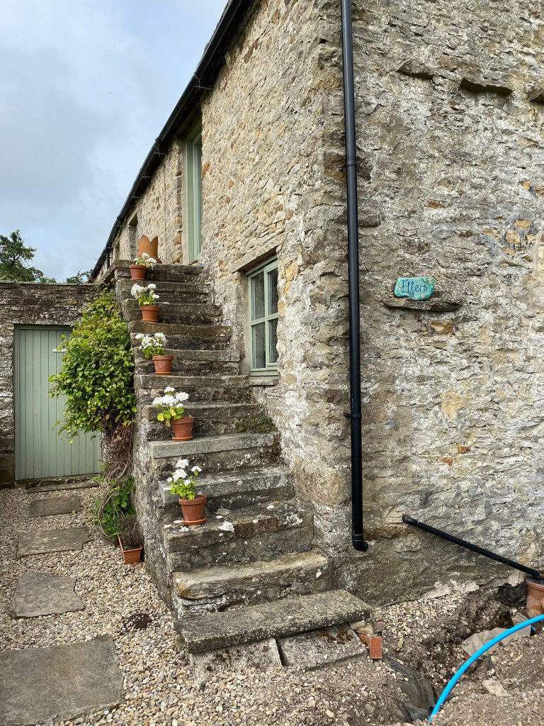
Our trip ended with a struggle for food amongst the mayhem of a very busy and touristy set of pubs, but with a beautifully appointed B&B in the form of Lee-Side. There was a bit of an unfortunate middle of the night search for a lost purse of Mel’s (which thankfully turned out not to be lost after all!), but that’s a story perhaps for another time.

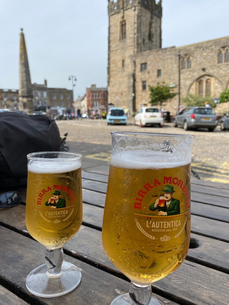
The next day we went back to collect the car at Scarborough and return homeward and reminisce on all that we had seen and done. There had been so many highs and really no lows at all.

When I first coined thoughts of doing this trip I did so due to Covid and the search for a home soil adventure. I thought it would be a good and interesting path and it would be fun and a bit challenging in parts. It was all of those things in equal measure and more, and I’d unhesitatingly recommend it to anyone thinking of doing the same. If anyone reading this wants any more information or suggestions about it then do leave a comment below.

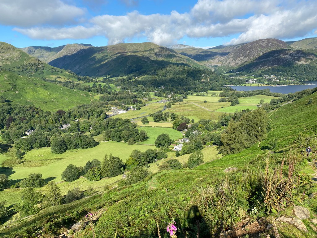
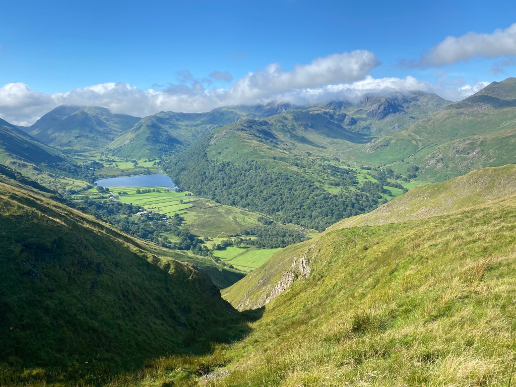
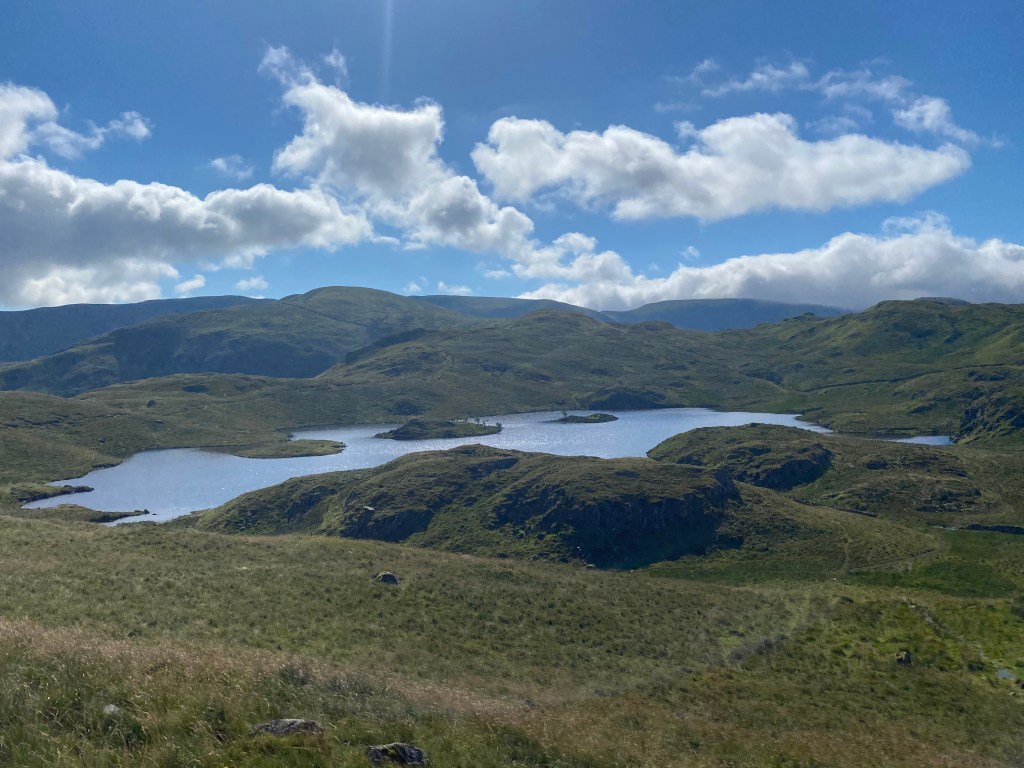
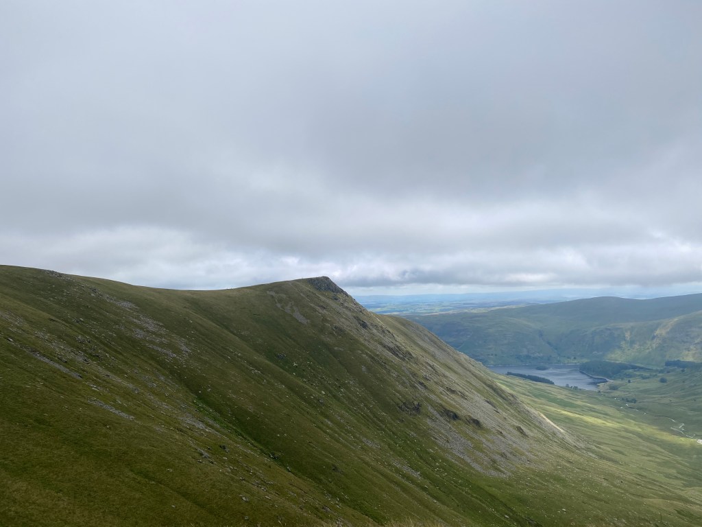
Ultimately the Coast to Coast walk provides a magnificent, close as you can get view, of one of the most beautiful parts of England. You get to see the inside parts of three of the country’s most impressive National Parks: The Lake District, the Yorkshire Dales and the North York Moors. In fact you get to see parts of those parks that I would wager that the majority of people who even live there never get to see. The navigation is hard at times too, most of it not being signposted, and so without a good map or other navigational aid like Henry Stedman’s excellent book it would be a very difficult (and indeed longer) trail to take.

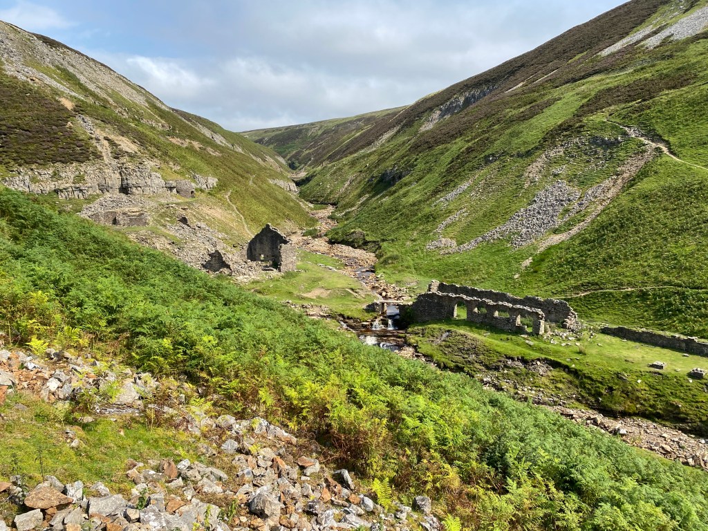
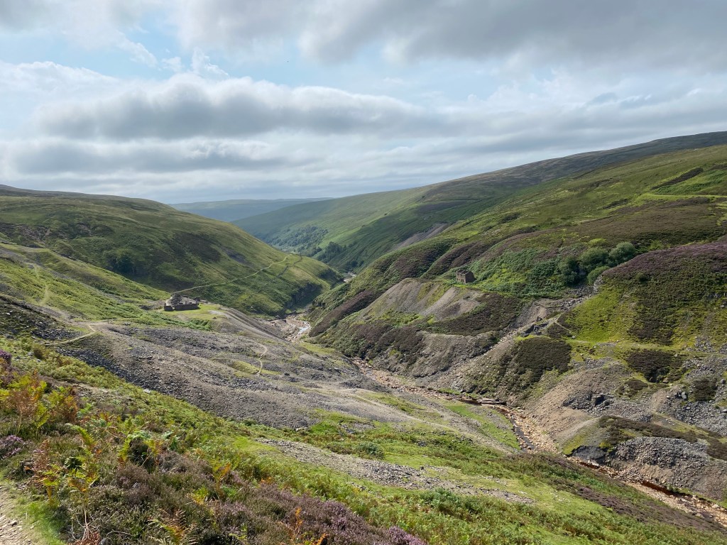
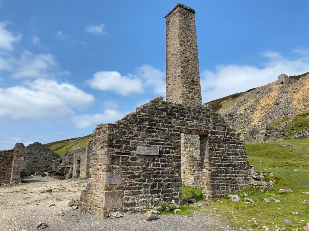
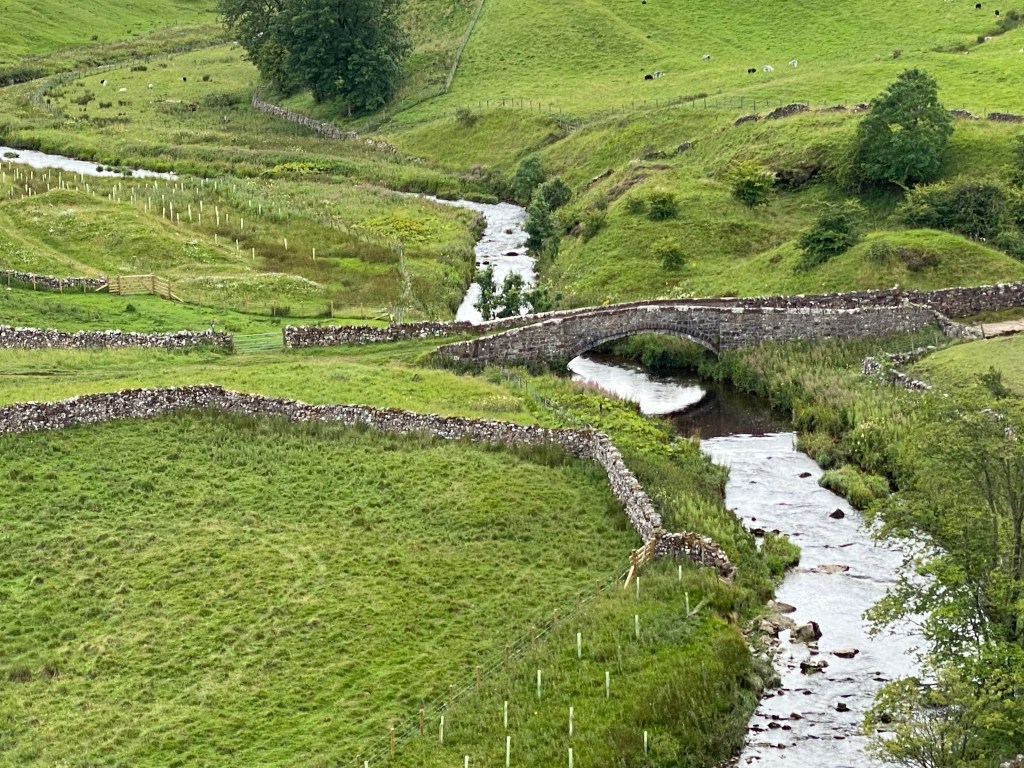
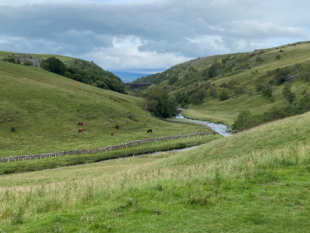
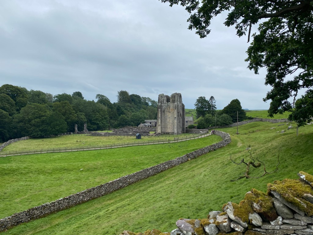
You get to see some beautiful villages and paths, and the farmland, mountains, dales and streams which accompany some of the countryside along the way provides some rare and majestic wildlife. You also see great nods to England’s past, with the lead mines and railways of the Dales and the still agricultural farmland and waterways of the most rugged parts of the Lakes. Then there are old mills, stone circles and Iron Age sites along the way too, and so much more.

For me ultimately the overriding memories are the beauty and the quietness – we spent many days (although being out for 9 or more hours at a time) seeing practically no-one whatsoever; then the surprising variety of the days themselves, as truly every day saw a different landscape and new horizons; and then also the challenge of it all – it saw us do around half a million steps in 198 miles and lots of hard slog – It was harder than I thought it would be, and indeed most nights we were glad to get into bed by 10pm very tired but also always looking forward very much to the new challenge of the new day ahead.

I’ll pay tribute and thank the travel firm Mac’s Adventures here too. Frankly without them having arranging all of the logistics and accommodation for us it would never have happened, and the quality of that accommodation was by and large first class too. I had (with hindsight perhaps somewhat dreamily) thought of doing this originally by camping along the way, and then of carrying all of our kit. Both would have been mistakes, particularly with the weather that we experienced at times. The comfort of a homely B&B is actually very satisfying, particularly when you just want to get wet boots off and get them dried for the next day.

The final tribute and nod must be to Mr Alfred Wainwright himself. He himself coined this walk In 1972, and his books and illustrations of the Lake District formed an important part of my upbringing and my love for the hills and mountains. Many people have followed this path and will of course do so again – there are many videos on You Tube and the like to whet your appetite for this walk if you wish to follow in his footsteps too. I’d in fact as a final thought do it all again if the opportunity arose, or heaven forbid another global pandemic prevented me from leaving the country again. There is of course a very big world out there, and this country has lots of other places to go too, but it truly is a fabulous representation of the best that exists in so many ways. I thus heartily recommend it to anyone who is considering it.

Coast to Coast Day 11 – Clay Bank Top to Glaisdale.

So we were nearly there! We’d done 10 days and 160 odd miles, and all that lay in front of us were two days on the moors. We were even promised (well maybe not promised exactly) our first view of the sea today, and so we could almost smell the finish line! Well not quite as it turned out, as the North York Moors had other ideas and things in store for us. In fact this day turned out to be just hard in every way, and a good example of how weather conditions even in mid August of a British summer can absolutely beat you up.

We had a day ahead of us of around 19 miles, and started it strangely in the back of someone’s car from the hotel in Great Broughton. They brought us back to the finishing point of yesterday’s walk at Clay Bank Top, and a very different day it was. It started out misty and drizzly, one of those days when you think you’ll probably end up getting a bit wet but don’t really want to don the waterproofs yet just in case. So we soldiered on for a bit and thought we’d see what it did.

Today’s vlog entry before the bad weather started.

After not very long it became clear that the weather and the visibility was just going to get worse and worse, and it stayed like that all day. We ended up with probably 40 or 50 mph winds, and lashing rain for probably 80% of the day. Such a shame, as other people’s pictures of this area have been spectacular and we would have loved to see it that way. But sometimes you just have to take the crap days with the good ones and put your head down and take them as all part of the wonderful adventure you’re on.

You get the idea…

Much of the walk until the middle of the day was on a former railway line through the moors, which at least made navigation simple.

The ex railway line that lined much of the first half our route.

Whilst we carried on getting wetter and wetter, we figured that even attempting to eat our packs lunches in this was going to be a bit tricky. There was certainly nowhere to sit down and the rain was getting ever worse. We knew that the only place we would pass all day was a famed pub up on the top of the moors called The Lion Inn. It was famed for being having not been decorated in about the last 500 years, but also for being very hospitable. Oh and it is apparently the second highest pub in the UK I think too. Unfortunately the hospitality didn’t extend to us, as when we arrived (just before noon) it was shut. Not wanting to hang around in the doorway like desperados in the rain we thus decided to trudge on and give it a miss. Shame, and maybe one for another day.

When it says ‘All-Day’, that was maybe in pre Covid times 😦

The second half of the walk was half along a road, and then back across Danby Moor, which from what I saw it is the most desolate place on the planet. Mel quipped (true black humour if ever you heard it) that she half expected Myra Hindley to jump out on us from behind the mist swept heather. If she had, then she would have been the only person who was mad enough to be out on the moors that day apart from us!

The afternoon was punctuated briefly by a visit to ‘Fat Betty’, another C2C tradition. Fat Betty is a once white stone marker, where the tradition dictates that you must both give and leave a sweet offering for other Coast to Coasters to do the same. This being the middle of a pandemic the pickings were lets say both slim (certainly not fat at all!) and also unappealing. We did however leave a treat or two ourselves, which I assume will be there for some time to come.

Giving our offerings to Fat Betty.

I think this picture sums up how much fun was had today!

The walk through Danby Moor and Glaisdale High Moor were then just ‘head down, let’s get there as soon as we can and dry off’. The waterproofs kept us largely dry, but boots were completely wet through. Eventually we got to Glaisdale (much to Mel’s relief, and mine too I have to say) but found it was at least another mile until our B&B, which turned out to be a pub (The Arncliffe Arms), actually the only one we stayed in on the whole trip. Whilst the room was fine and the beer was pretty good, it I’m afraid left a lot to be desired when it came to Covid precautions, and we both ultimately ranked it in 13th place out of the 13 establishments we stayed in on the walk. It was a high bar though, as apart from this and The Wainstones we had stayed in the previous night, all of the rest went from great to fantastic. The staff were very friendly though it has to be said.

The Arncliffe Arms was also memorable for two other things. One it would be the last place we stayed in before we got to reach the sea at Robin Hoods Bay on the final leg, our twelfth. And secondly it had the most ferocious drying room fuelled very literally by a massive 12 foot square biomass boiler which the owner was very proud of. I was going to place my wet boots on top of it, but thought it might melt them altogether. It was also down a rickety set of dark steps with no light, and was thus almost dungeon like inside. We were glad in any case to be able to leave the next day (which unfortunately was also to be in waterproofs and woolly hats the whole day) in warm and dry clothes. Just 19 miles to go then…….

Coast to Coast Day 10 – Ingleby Arncliffe to Clay Bank Top/Great Broughton

Day 10 was a simply brilliant day in every single aspect. It started from the very charming hamlet of Ingleby Arncliffe and ended in the North York Moors at a village called Great Broughton (or so we thought, see later on!). Only a short stage of 12 or so miles, it was nonetheless full of ups and downs.


Despite the shortness of the stage, we had seen the profile and knew this would be a testing day, described as ‘Difficult’ in the Mac’s Adventures, and with over 3,000 feet of ascent. We’d also get onto the North York Moors for the first time today – we’d seen them looming towards us all of yesterday’s flat stage from Reeth to Richmond. I was really looking forward to getting up there.


Covering an area of about 550 square miles, the North York Moors is one of the largest expanses of heather moorland anywhere, certainly in the UK. I’d been over here just once before, when cycling the Coast to Coast about 4 years ago, and remembered more than anything just how lumpy it was. There are a large number of hills and dales, and we’d cross quite a few of them in the now final three days of our trek.

On our way up to the Moors we passed a house selling these – it would have been rude not to, pandemic or not – they were bloody delicious!


Setting out past the Blue Bell, the pub we’d eaten in the night before, the path turned up through Arncliffe Woods and then quite steeply up before hitting the moorland. We were lucky in that the weather was quite glorious, and en route we passed a “48 miles to Robin Hood’s Bay” sign. Reaching the first moor, Scarth Wood I think, the expanses of heather seemed to stretch on for ever, and almost on cue some wisps of mist rolled in. It was like being on the set of An American Werewolf or the like.

The other notable thing about this day was the fact that at around about Scarth Wood, three paths coincided – The Coast to Coast, The Cleveland Way, and the Lake Wake Walk. We would follow the signs for the Cleveland Way in fact for most of the next two days.

Heading through the woods out of Ingleby Arncliffe, a sign reminded us what we had done so far, and what lay ahead.

The Moors stretch out before us at last, the mist didn’t disappoint one bit!


There followed around four hills, none particularly steep or long, but all ones which got your heart racing a bit. Mid way through the day we also passed a hangliding club at the top of one of the hills, and there were about half a dozen seemingly very happy souls up riding the thermals and enjoying the fine day.

More notably though, we passed and were passed by on this day ‘Biscuit’ and his owner. Now Biscuit was a lovely dog who we had seen as early as day three on our way down to Grasmere, and her owner helped us across a raging stream. We’d seen them a fair few times along the way too, as you do with fellow C2Cers. They were on their way this day to Blakey Ridge, ahead of us. The guy was lovely, and was trying to get back home on the Friday – we hope they made it safely – Biscuit was one of our highlights of the trip and I wish I had a photo to share here for posterity.

Heather, heather, and more glorious heather 🙂
The last hill ahead of us, with The Wainstones at the top.

Climbing through the Wainstones.

And made it!

Not long before we got to the Wainstones themselves at about mile 11, I’d looked at my Macs Adventures map and details, and there was a note on there to say ‘when approaching the Wainstones, phone your hotel who will come and collect you from Clay Bank Top car park’. I thought this a bit odd, but then realised that where the walk finished was about three miles from Great Broughton in the wrong direction, and that furthermore, Great Broughton was not on the Coast to Coast path! It also said that they’d come and bring us back the following day, so therefore it didn’t feel like cheating at all.

Our hotel, The Wainstones, looked from the website like it was a bit grand for us, but it proved I have to say quite the opposite. In fact it was the most tired place we stayed in the whole trip and not a place we’d recommend. Also the temperature in the bedroom was close to that of the surface of the sun, and sleeping was not at all easy. I was determined not to eat there in fact, and damaged to find a brilliant little pub in the village called the Jet Miners – the food (and everything about it) was outrageously good, and the best of the whole trip, so I was prompted (by myself this time!) to write a Tripadvisor review right away:

https://www.tripadvisor.co.uk/ShowUserReviews-g1077003-d1853490-r764482485-The_Jet_Miners_Inn-Great_Broughton_North_Yorkshire_England.html

So we were now down to just two days left – time had flown, and we had walked already about 160 miles. The next day was also right through and over the moors to Glaisdale, and what a totally different (in practically every respect) it would prove to be. But every day is a massive adventure on this walk, and you just have to live every moment and totally embrace them all.

Coast to Coast Day 9 – Richmond to Ingleby Arncliffe.

Day 9 was the longest day on our trip, at a shade under 24 miles, and saw us head through the Vale of Mowbray from Richmond to Ingleby Arncliffe. It is also characterised as being the only flat day on the whole trip. And flat it pretty much was.

The day was also very notable for two other things – one the heat, and the second midges and thunderflies. The day was really hot at about 26 degrees, which when you are walking 24 miles really takes its toll. And the midges and other little biting insects in the middle of the day around the Danby Wiske area absolutely drove you (well me anyway!) completely nuts. Mel afterwards told me that it was about as freaked out as she’d ever seen me. And I think she was right, I was completely driven to distraction by them, and couldn’t even sit down to eat my lunch because of them.

We had set out from the very quirky and very old Williance House in Richmond at about 8am after a lovely cooked breakfast. I’ve been fairly good this trip (Mel has been better) at not having a fry up, but sometimes you just need one.

Leaving behind Richmond Castle, the view here from the river Swale.
Oooohh I love a good signpost me!

We passed some lovely villages en route, still following the Swale river as we had been doing for a few days now. Bolton on Swale in particular was very pretty, with a very lovely church. And overall, despite the distance, it never felt like a massive walk, the terrain helping hugely with that.

The pretty church at Bolton on Swale – the official walk goes right through the churchyard.

Around half way to Ingleby Arncliffe is a small hamlet called Danby Wiske, which has a pub and is a usual stop off point for coast to coasters. This year however, due to Covid, it is closed, and so that has meant on a 24 mile day you have no means of getting water or other provisions en route. We were asked however by someone stepping out of their house if we’d like a water refill, which was rather nice of them. We politely passed up on the offer and stopped just outside to eat our packed lunch, Mel sat down relaxed, and me dancing like a demented muppet up and down the road waving my arms in the air to try in vain to waft away biting insects.

Who the hell is Frank??
sometimes you just have to find shade where you can!

Much of the afternoon’s hike was just a hot slog, but in really beautiful surroundings. It just goes to show that things don’t need to be hilly to be beautiful!

One of the highlights of the afternoon was a well stocked fridge in a field with an honesty box!

At nearly the end of the walk however, an almost crazy thing happened. I knew that Ingleby Arncliffe was just the other side of the A19 from where we were. And for those who don’t know it, the A19 is a big, almost motorway sized behemoth of a road linking Yorkshire to Middlesbrough and the North East. It’s a road where traffic is going at 80mph all day long. We approached it at about 5pm to find, guess what? No bridge! (Or underpass or anything). We basically had to play chicken with 80mph traffic to get across to the village – great!

Having survived to write this blog, we duly arrived at the very lovely Ingleby House Farm, after a quick snifter in the local pub, The Blue Bell. It had taken us forever to actually book The Blue Bell for dinner the night before, but I won’t go into that here, it would take all night. Suffice to say its a great pub if you are ever passing this way. They also serve the local delicacy, chicken parmo, which if you aren’t from the Middlesbrough area you will neither know about or even understand. I’ll only say that there is a very good reason why it hasn’t transcended from the Middlesbrough area, and that also explains why half of mine didn’t get finished.

Chicken Parmo – ‘don’t’ would be my advice!

Tomorrow would see a moderate stage in terms of length, but lots of ups and downs as we entered for the first time the North York Moors. I’d cycled through these a few years ago and knew they’d be pretty lumpy and very interesting. It would also turn out to be the best day in terms of walking alone of the whole walk – bring on The Wainstones!…….

Coast to Coast Day 8 – Reeth to Richmond.

Day 8 saw us leave the very lovely Reeth and head to Richmond. Reeth had been lovely, it is such a perfect setting and it definitely needs another visit when there is time to explore and do it justice. It just captivated me from the moment of arrival and had something very magical about it.

Certainly one thing we’ve noticed on this trip is that (particularly doing it in 12 days) there just isn’t time for anything other than getting from place A to place B, eating and sleeping! By the time you have also of course packed and re-packed and tended to topping up water, supplies, arranged packed lunches and the like too. As an example of how margins are tight, when we were in Grasmere on the way through to Patterdale there wasn’t time for me to stop at Sarah Nelson’s Gingerbread Shop, and that is nothing short of sacrilege!

Setting out from Reeth – low cloud hanging in the hills and a cooler morning for us.

Reeth was part of the hugely successful Yorkshire stages of the 2014 Tour de France, the riders passing through the town itself.

This day was however a shorter day (and in fact the shortest distance wise of the whole trip at just 10 miles) and so we afforded ourselves a slightly later breakfast at 8am and a later start. You still however have to get up and pack all of your bags by then ready to be collected by the Sherpa Van service, and so there’s still a lot of early morning faffing going on!

Setting out from Reeth we continued to follow the River Swale as we had done for the last few days, and headed along the river on a lovely (if slightly cool still) morning. There were no real hills for us to climb today, just undulating ups and downs each side of the Swale valley.

Today’s vlog attempt – the one from yesterday failed to load 😦 I should edit these things really but I don’t know how!!

We passed a couple of lovely villages en route, one called Marrick, where there was a little old priory, and as total of 375 (no I didn’t count them!) steps to the village above through some lovely woods.

The steps up through the woods to Marrick – apparently put down by nuns a long time ago.

Then we also passed through Marske, where it looked like everyone had cut their lawns and hedges with nail scissors, this despite the remoteness and what must be bleakness of the place out of season. These villages have no amenities, like a shop for instance, but are just idyllic. And if I lived there I don’t think I’d ever want to leave.

Passing through Marske – a lovely place.

And finally the edge of Richmond coms into view.

Finally we reached the town of Richmond, a large and lovely place of around 8,000 people, with a big castle, and quite a few almost ‘high street’ shops. It felt weird, as we’d walked for a week without seeing anyone at all, quite literally on some days, and then getting into Richmond it felt like walking into New York City!

Also arriving early we thought we’d best stop for a drink before getting to the B&B, but discovered that Richmond isn’t blessed with great pubs, which was a shame. We also tried in vain to try to get a restaurant. Thinking the day before that it was a big place and that we wouldn’t struggle, but we did big time, although eventually found a very good Indian, called Amontola if I remember correctly.

I never drink lager normally but you just wouldn’t have touched the bitter in this pub believe me!

We stayed at a little place called Willance House – a 17th century building which was very quaint (in a good way!). We opted before retiring for the earliest breakfast slot we could get, as the following day was going to be the longest day of the trip, a 24 mile slog to Ingleby Cross, which would take us through the Vale of Mowbray to the edge of the North York Moors. I couldn’t wait :).

Coast to Coast Day 7 – Keld to Reeth

Day 7 of the C2C saw us begin the second half of the overall walk, quite literally, as we had just reached the half way point (mile 96) last night. After also some excellent beef stew and sponge pudding last night we were set up for another full on day, even if this one would be the shortest so far in terms of distance covered. In fact it would be just 12 miles that took us to Reeth, also in the Swaledale valley.

Leaving behind Keld Lodge and heading down into Keld itself…..
…..which is basically a hamlet, but a very lovely one at that.
The start of the Swale River, which we would follow for the next three days (and indeed had done yesterday too).
Looking down at the Swale from the start of our high route.

Swaledale is one of the smaller, and I think the most northerly of the main dales (valleys). It runs east to west and is punctuated by much limestone and of course many many sheep. It is the first time either of us have been here and it is an absolute delight. The end of the day in fact was to reveal for me what I think is the highlight of the trip so far in the shape of Reeth.

The journey to Reeth can be taken by either a high route or a low route. The low route passes many pretty Swaledale villages like Muker, but we were told at the Lodge that it would be very busy with tourists, so we avoided it and took the high route. This route takes in two climbs up to around 2,000 feet, but is generally it has to be said not very scenic in the main, although it has many redeeming features.

The walk across the top of the Dales at around 2,000 feet up is a bit featureless….

……but then dips into very attractive ruins of old lead mining plants.

The area round here was in bygone times the capital of the lead-mining world, and used to apparently produce over half of the world’s lead. We saw much evidence of old lead mines along the route, including smelting chimneys and some old machinery from the mines. The two climbs weren’t difficult, but took their toll on tired legs, and we had a fair old headwind at times too. The weather was also a bit cool at times – while the rest of the country is apparently basking in a heatwave at around 35 degrees, we had around 16 or 17 degrees, and my fleece stayed on for most of the day.

Starting on the descent now towards Reeth.

Another lead smelting relic.

Nearly in Reeth now, a lovely day and a really great walk for any day out.

We got into Reeth early at around 3pm. Reeth Apparently hails itself as the capital of Swaledale, and was formerly the mainstay of the lead mining industry. You wouldn’t know that today though – it is a very pretty natural amphitheatre with a large green in the middle and surrounded by the local hills. Apparently the old TV show All Creatures Great and Small was filed here. We both loved it. It has the feel of being very welcoming, and it very much is exactly that.

Wee stopped in for a beer at the Kings Arms Hotel, where we had also booked for dinner. A good place and very much recommended, even if the sticky toffee pudding was a bit weird and covered in wayyyyyyy too much custard, but there’s a first world problem if ever there was one!

The green at Reeth…..
…….and the very lovely Ivy Cottage at one end of it.

Our accommodation, Ivy Cottage, also serves as a tea room. The hosts were (as everyone has been on this trip) extremely welcoming, and the room had a view of the green and the surroundings and a lovely little window seat where you could have sat for hours. It was a fantastic spot, and I would love to revisit. The breakfast and indeed everything about it was perfect. In fact we both agreed afterwards when ranking (as you do) all 13 B&Bs that we stayed in on this trip, that this was number one. That’ll be a 5 star Tripadvisor rating from me then 🙂

So 108 or so miles done now, and tomorrow would see us again head along the Swale Valley to Richmond, the largest town on the C2C, for another fairly short day. The weather was again set fair, and we looked forward to all that Richmond would bring.

Coast to Coast Day 6 – Kirkby Stephen to Keld.

Day six of the C2C for us was Kirkby Stephen to Keld in the Yorkshire Dales. Although a short day (at around 13 miles) in terms of mileage, the day starts with a five mile upward slog to over 2,000 feet to the top of Nine Standards Rigg.

Nine Standards Rigg is the summit of Hartley Fell, at 2,172 feet. It is almost on the border of Cumbria and Yorkshire, and sits at a very significant point in The Pennines from where all water landing to the east runs to the North Sea, and all to the west to the Irish Sea. The Nine Standards themselves are a set of large cairns of various shapes which sit in a row right on top of the fell. They can be seen for miles, and we could even see them from our room in Kirkby Stephen.

Setting off from the town go Kirkby Stephen, the local church in the background.

We had a stunning day for it, the best so far, and it was hot even as we left the town. Kirkby Stephen is a lovely village and I decided I’d love to return one day. We had a lovely Indian meal the previous evening and would have liked to have spent more time wandering around.

About to cross the river and set off for Nine Standards Rigg – a beautiful day.

It was a hot climb from the off, but bearable, and actually really enjoyable. We saw very few people, and one family of what the lady in the B&B described as ‘the flip flop brigade’. They were playing very loud music, something I can’t stand when out on the fells, and so we walked past and away as quickly as we could. Call me a snob if you want!

My vlog entry for the day 🙂

One of the other things that characterises Nine Standards Rigg (apart from the stones themselves) is the peat bogs. They are pretty big and pretty serious, and also pretty seriously eroded. Being such a popular walk, the path gets so eroded on the way up that it has been split into three different routes depending upon the time of year and the conditions. The red is apparently the most revered, and the green the easiest and safest in poor conditions, but we were directed to the blue by the signs and so stuck with that. I’m very much a conformist when it comes to National Parks and their regulations.

Approaching the top of Hartley Fell, with the Nine Standards clearly visible.
On the very top of the Pennines!

The trig point from which all water flows west or east in England.

The views from the top were great, and we soon made our way to the quite memorable trig point pictured below.

The views and waypoints on a clear day (which we had) were all marked out in detail here.

The route from here had partly been covered in flagstones which briefly lulled us into a false sense of security as I’d read in Henry Steadman’s fabulous book on the C2C about how bad the bogs would be. But then they ended, abruptly. We then spent the next almost three hours tracking and backtracking, squelching and jumping over bogs, some twenty yards or more across. If you’d just walked in a straight line along the path you’d have ended up either up to your waist or without your boots in the mire in places. It was almost comical. Having both of us suffered blisters from wet feet in the Lakes we were keen to try to avoid the same fate, and so did our best to stay as dry as we could. We sort of managed this, but it was tricky.

the flagstone section before the bogs took over!

We took the blue route, but I think most of them are pretty similar in length and difficulty – it is all about managing the erosion.

The peat bogs stretch on for what seems like forever – at least we could see where we were going!

Thankfully the path eventually emerged to run higher along the river along more farm like tracks, and whilst still wet and squelchy, were manageable. Eventually after what was approaching 7 hours, a crazy amount of time for a 13 mile walk, we reached the tiny hamlet of Keld. Keld has about 4 houses, two campsites, and a lodge/hotel, where we stayed, the Keld Lodge. The Lodge used to be a youth hostel, and still feels a bit like that, but the hospitality (and I have to say the food) that we had was second to none. It also had a great drying room, very useful when you’ve just tracked for hours through wet peat bogs. Oh they also served the best pint of Black Sheep bitter I’ve ever had.

The main thing to note about Keld though, is the fact that it lies exactly at the half way point of the C2C walk. It is 96 miles in each direction to the sea, and the commemorative photo above will be something for the long term scrapbook that’s for sure.

So here we were, 6 days down, and exactly half way. 92 miles to the North Sea, and tomorrow would take us through lead mining country, see Cow ‘Usses’, and go through the very beautiful Swaledale to the even more beautiful Reeth. The Coast to Coast was delivering everything we thought it would and more :).

Coast to Coast Day 5 – Shap to Kirkby Stephen.

Day 5 was our longest day yet, a 21 mile stretch from Shap to Kirkby Stephen.

Although not huge in terms of altitude gains, we’d had three really tough days before this, culminating in yesterday’s 18 mile, 3,500 feet day over Kidsty Pike to Shap. Mel got really tired at the end of yesterday and when you have a longer day ahead you just want to make sure that it goes to plan. Managing time therefore became a concern for me, and I didn’t want us to end up trudging into Kirkby Stephen really late, and after all the rain we’d had I had no idea how the ground conditions would affect us today, even if it was a much flatter day than before.

Today we also left the forever memorable Brookfield B&B behind too. Run by a lady named Margaret, very much in the old-fashioned style, it was a veritable home from home. Despite the fact that we were probably in the B&B for only about an hour in waking terms, Margaret couldn’t do enough for us, including all of our dirty laundry. She also completely dried out Mel’s very wet boots which looked almost beyond rescue post Lake District soakings. We actually hypothesised that she was up all night with a hairdryer on them, and hopefully that isn’t true.

Brookfield House in Shap. A treasure.

I must finally mention Margaret’s packed lunch. We’d had a packed lunch every day from wherever we stayed, as simply there isn’t anywhere en route to buy anything at all. The lunch we got from Margaret, as well as doorstep sandwiches and crisps, contained an apple, a banana, a bottle of lucozade, some buttered tea loaf, cheese, an almond tart, and a chunky piece of the best fruit cake I have ever had the privilege to eat. In fact it might be the best example of anything I’ve eaten ever. Margaret gets a mention in the C2C books as being a bit of a star, but that undersells her. I’ll remember her, and the visit there until I die, it’s as simple as that.

The walk from Shap climbs straight out of the long town over fields to a footbridge over the M6 Motorway. From here on, you definitely know you’ve left the Lake District well behind, even if you haven’t quite left Cumbria yet. The landscape changes dramatically to be much more rolling and overall gentle, and even if the the ups and downs don’t stop, they come at you less severely and less frequently too.

The (only) way you (can) cross the M6 as you leave Shap!

No idea why I have a photo of the M6 from the bridge, but I do!
And leaving Shap behind you are not left with the best of views……

The walk to Kirkby Stephen is effectively split into two, with a neat and well positioned stop at Orton after about 8 miles. Some people make Orton a stop for the night too. It is a pretty little village, and it earns a stop for most people (including us) because of Kennedy’s chocolate factory and shop. Although tiny, the place has some very famous and very delicious chocolate, and we duly obliged with some of their delicacies. I wished we could have picked up more, but I made a mental note to check if I can get some more online at a later date.

The start of the heathery moors which would dominate eventually most of the second half of the c2C.
Strange coloured sheep they have around these parts – maybe that plant was a nuclear one? :O

Kennedy’s Chocolate Factory in Orton – delicious stuff!

From Orton the walk continues over heather and part forested moorland and it is a really lovely walk. It was nice too to have another sunny (mainly, although it did start to rain lightly part way through the afternoon, reminding us that we were still in Cumbria) day after the horrors of the Lakes.

Bridge over Scandale Beck towards Kirkby Stephen, a lovely spot.
Smardale Viaduct towards Kirkby Stephen.

Approaching Kirkby you come down a fairly steep hill and through an old railway tunnel until you finally hit the town. Our B&B, Lockholme, presented us with a somewhat over-protective host who demanded that Mel took off not just her boots but also her trousers before he would let her in the house! He did give her a towel to wrap around herself so she could get upstairs with a modicum of dignity intact, but that is surely well over the top. Sure there was a bit of dried mud on the bottom of them, but why run a B&B for mainly Coast to Coasters if you can’t cope with a bit of grime on people’s clothes?

Oh and another thing – they refused to give us a room key for our bedroom when we went out in the evening, saying that ‘people run off with them’. I do understand the concern of course, but why even have them then? They were lovely in other ways and very friendly it has to be said, and there were some lovely touches like giving me some jelly babies the next morning for the climb to Nine Standards Rigg. But live and let live I say, especially when it is your livelihood.

I’ll say one more thing, and then I’ll shut up…….it really bugs me when people plead for Tripadvisor reviews, and especially when they say “please say nice things about us as we know where you live”, even if it is in jest. I actually write quite a few Tripadvisor reviews, and the jury is more than out as to whether I’ll actually do so here, but maybe a ‘constructive’ critique is in order.

Finishing off then, we had a really lovely curry in town that evening. I actually walked down there in my bare feet as I had two whopping blisters from my wet boots two days ago, and my flip flops really aren’t good for walking long distance in (it was about a mile and a half return), The Indian restaurant, The Mango Tree, was great, and deserves, and didn’t ask for, so will get, a Tripadvisor review. Give them a shout if you’re in Kirkby Stephen, which is a lovely little town with what looks like some nice pubs too.

This was on the wall of our B&B.

So 21 miles done, and 89 in total now for 5 days. The following day would see us go over the Pennines to Nine Standards Rigg and into the Yorkshire Dales, hit many a bog, and see the start of the very beautiful River Swale. It would be a great and very memorable day, as indeed every day of this trip was….

Coast to Coast Day 4 – Patterdale to Shap.

We woke at the very lovely Old Water View in Patterdale to something we hadn’t seen for a few days – the sun! Patterdale is such a lovely setting, and like most places in the Lakes and elsewhere, a bit of sun certainly magnifies its beauty.

We set out just before 9 on our trip to Shap which would see us sadly leave the Lake District behind, but on the way we would reach the highest point of the whole Coast to Coast, that of Kidsty Pike. And it was a stunning day. That was a good thing as I had tied my still wet boots onto the back of my rucksack (I’d brought a spare pair with me for this very reason) and they got to air well and get dry before the day was out.

The day started with a fairly steep climb up Place Fell, and it was a majestic walk.

About to leave Patterdale with a distinct lack of rain in the air!
The view back towards Patterdale and towards Helvellyn with the southern shores of Ullswater on the right – a truly beautiful place.
Looking up towards Brotherswater from the side of Place Fell and looking towards Sheffield Pike.

The views back over to Patterdale and the Lake and Helvellyn were mesmerising. I didn’t want to leave. Just as they were looking up to Brotherswater and Sheffield Pike too. We even saw other people (!) – something that the miserable rain and wind of the last few days had been bereft of.

Angle Tarn, which is a popular wild camping spot on the C2C for those hardier souls than ourselves.

We passed Angle Tarn after about 45 minutes and then onto Kidsty Pike after two hours or so. Kidsty Pike is officially the highest point on the C2C at around 2,600 feet, and the views are wonderful in every direction. It was the first time I’d seen Haweswater too, which would be our focus for the next several hours as we were to do a steep descent towards it and then a long undulating walk along its whole length.

I did a short daily video every day, intending it for YouTube – this was today’s brief offering.
Nearing the top of Kidsty Pike…..
And made it – the view down to Haweswater ahead.
I made it too!

Haweswater is a man made reservoir, having originally been a smaller lake, and today serves about 25% of the North West of England’s water supply. Although only 4 miles long it never seems short of water due to where it is, although there is apparently a sunken village (Mardale) somewhere in its depths which every few barren years a few people get a rare glimpse of. The trek around we thought would be flat, but it turned out to be very undulating and pretty wet in parts too from yesterday’s rain. It’s a very pretty spot though.

The start of the walk around Haweswater.

As Haweswater ends the Lake District is behind us, and almost immediately the landscape changes to be much flatter and more agricultural, but still very much rolling. Shap would be about 6 or 7 miles further on, and just before we got there we reached the very lovely ruins of Shap Abbey. Shap Abbey is a 12th century monastic house on the edge of the river Lowther in the Eden Valley, and very nice it looked. On another day we’d have stopped for a proper look, but we were by now 17 miles in and ready to get finished for the day, so on we went.

Shap Abbey, or what is left of it.

Leaving the valley we headed to Shap itself. Shap definitely (and apologies to anyone from Shap who is reading this) has none of the charm that the Lakes has, and I’m being kind. It also only has three places to eat, and two of them were closed due to Covid. The third, The Crown, was ‘fine’, and actually did the job. It will win neither a Michelin star nor a 5 star rating on Tripadvisor, but it served us very well after a 19 mile walk that’s for sure. The folk who run it are super friendly and so do stop in if you are passing – the outside isn’t too inviting (and actually neither is the inside come to think of it), but we left very content and that’s all you want.

The highlight of the day turned out to be (apart from those views of Patterdale naturally!) the B&B we stayed in – Brookfield House, of which more tomorrow. Suffice to say it is ‘old school’, and run by surely the best B&B host in B&B history, Margaret. We got all of our dirty clothes washed and folded, and nothing was too much trouble for her. A veritable oasis in an otherwise unpretty little town. I’ll remember it forever, so good was Margaret’s fruit cake!

So after another 3,400 feet of ascent and 18 miles, we’d done 68 miles in four days. Tomorrow would see us do 21 more, and leave Cumbria behind and enter the fringes of the Yorkshire Dales. Bring them on, that’s what I say………:)

Coast to Coast Day 3 – Borrowdale to Patterdale

You know when you wake up and look out the window and just think “ugh”? This was one of those days.

Regardless, today was always going to be a really big day. It was one of those earmarked as being big as it was 19 miles in distance, but also because it involved (or should have done) going past, or up, Helvellyn on our way to Patterdale. Those who know me know that I have been up Helvellyn more than any other mountain (maybe Pen y Fan excepted), and that I also love it with a passion. So walking past it, even after about 16 of 19 miles was going to be tough. And we are doing the Coast to Coast, so you can’t just walk past Helvellyn and not go up can you? It’s like going into town and walking past your favourite pub when you are going for a drink – it doesn’t happen in my world!

Waking up as we did in the Glaramara Hotel in Seatoller though, I knew however that the day was going to be ridiculously tough to even reach Patterdale at all. The weather was unrelenting since yesterday. Worse in fact if anything. The rain beat upon the windows and the wind was howling. The forecast (and it proved to be right) said it wouldn’t stop all day, and that the rain would get heavier. And we were in the rainiest part of the whole country, with many a hill to get over before we even got close to Helvellyn, which would come at about mile 15 or so.

We even skipped breakfast in the hope that we would get the day completed, and grabbing our things from the drying room of the Glaramara (the stuff we had left there was still damp at best, it wasn’t a good drying room), we set out at around 7:30am.

After an hour or less, despite being well protected, most things were wet already. Rain at this velocity just finds its way in eventually. What was worse though was the wind. We’d (or I’d, mainly courtesy of the Macs Adventures app) selected a route up a pass that I hadn’t been up before (Greenup Edge, via Lining Crag).

The main trouble however wasn’t what what coming down from the sky. It was what was coming along the ground by way of streams and running water. The paths themselves were like streams. The streams themselves were simply in torrents. Where there had been stepping stones they were covered, and not just covered but totally submerged with very fast flowing water over them. Fast enough to sweep you off your feet for sure. Mel was scared, and I was scared for her. It’s one thing to get wet feet. It’s altogether a different thing to get knocked over and hurt yourself. I know she was worried for me too – it was after all only three weeks ago that I was in hospital with a bleed on the brain following a crash on my bike.

This probably gives you a good idea of the paths that we were walking on, but not of the streams we had to cross, they were much worse!
The one bright spot on the way up to Greenup Edge – a rainbow!

Now what happened to those stepping stones again?
Still smiling, near the top of Lining Crag.

We passed about 7 or 8 of these fast flowing streams on the way up to Lining Crag and Greenup Edge, and negotiated most of them with just wet feet. The climb itself wasn’t too bad in the end. Coming down the other side to Grasmere however the fun started. At one fast flowing stream, it was very apparent that the water was moving so fast that it could be dangerous. And worse we couldn’t really even see the bottom of the stream so we didn’t even know how far we’d get into and thus how hard to would be to wade through – it was probably about 10 feet wide too.

I looked up and down stream in vain for possible other crossing points. All however were more perilous, and after about half an hour of looking, Mel decided that she didn’t want to try, so I had to respect her wish. There was no way round, and so we had to backtrack. I looked on the map and saw that we could retrace our steps for about an hour, and then take another route over higher ground to Grasmere, which would hopefully see us safe. I was worried already about time though, and figured that this was probably a two hour diversion at best on a day when we would already be out for 11 or so hours.

So back up towards Greenup Edge we went, it was the only thing to do. Just then, after about 5 minutes of going back, something strange happened, in that someone was coming down towards us! This was strange in that we had not since we left Borrowdale (some probably 3 and half hours earlier) seen a single soul anywhere. It was a guy on his own, and although he was soaked through, he clearly wasn’t going to let a fast flowing stream (I told him about it to warn him) put him off. He also showed us that inside what seemed to be a strangely bulging jacket that he had a small dog in there in a baby sling! The poor thing was shaking, cold and wet, and presumably he wanted to get her down too.

This turned out to be the inspiration that Mel needed. She asked him if he would mind helping her across, and he said he’d be very happy to, so we retraced our steps back down again. Upon getting into the water, he stood there in the fast flowing waters and took Mel’s hand as she waded through and got her safely to the other side, despite getting in to above his calves. He did the same for me too, before getting out and then almost dancing down the path towards Grasmere.

We talked afterwards about how this was clearly ‘meant to be’, given that we saw apart from him actually only one other person on the path after that the whole day. He was there at just the right time. It also made all of our progress after that much easier. Once you have wet feet then they are wet, and although I did actually wring my socks out, that was a bit pointless as everything was soaked up to my knees anyway and would stay so for the rest of the day, and this was about 11am.

We then made reasonable progress into Grasmere which we got to at about 2pm, and got some lunch from a shop there. We would have missed out Grasmere but had no packed lunch and had intended to come here anyway. We also tried to get some Grasmere Gingerbread (if Helvellyn is my favourite mountain then Grasmere Gingerbread is undoubtedly my favourite food substance) but there was a big queue at the shop, and very conscious (as I always am) of time, I decided we shouldn’t wait. We did after all have another 9 or more miles to get through in the rain, and had to ascend up to Grizedale Tarn, even if Helvellyn was definitely way way out of reach for this trip by now, as was any other side turning or distraction.

This was the view at Grizedale Tarn – not even sure why I got my phone out really!

The walk up to Grizedale Tarn thankfully passed without further incident, although we did have a further few streams to dip our soggy feet and boots into. In fact we even had to wade through the tarn itself to get across to the path down Grizedale valley. Having been there a lot of times before I’ve never seen it like that, but at least it didn’t pose any danger.

So down we went, heads down, straight down the Grizedale Valley. No Helvellyn and no St Sunday Crag (that was my alternative for the day origninally). There was no point as it was too wet and too windy, and we didn’t have time by then anyway. We eventually got into Patterdale just before 7pm, with feet as wet as wet can be, but good and safe in the end.

We found a great drying room too at our lovely B&B, The Old Water View, which was in a great location and on another day would have been an idyllic place to stay. As it was we were glad to put stuff on radiators and turn them up, and head straight out the local pub (The White Lion). Thankfully, despite a short wait outside in the rain (we couldn’t book in there as they weren’t taking bookings, and there is no other pub in Patterdale so that was it)

It has to be said that The White Lion does a fantastic Cumberland Sausage, and also (as Mel will attest) a damn good chilli, and we were very grateful of the food and the beer (Wainwright’s, what else?) after a really tough day. We’d done nearly 4,000 feet of ascent, and 19 miles of walking, in horrendous conditions. The forecast for tomorrow wasn’t for rain! That would be a very pleasant and welcome surprise and we’d at least get to see some (and some might say the best) of the Lakes before we actually left it. Tomorrow is after all, always another day :).