Himalayas Day 14 – Kyangjuma to Lukla

So this morning I woke up to beautiful clear skies, and the news that the two day backlog at Lukla airstrip had cleared, and that I would be able to fly today. Then I woke up properly from my dream. It was actually 2am, and it was snowing. My heart then sank at the prospect of even getting down the Khumbu valley today, let alone the airstrip reopening.

I tossed and turned for the remaining four hours of the night, and hoped that the clouds would lift by the time Saroz knocked on my door at 6am.  They sadly hadn’t, but a boy has to keep hoping, that’s all. The snow that fell in the night was thankfully just a dusting at this level, although my thoughts turned to the rest of the troupe up in tents at Island Peak, and I hoped that they weren’t snowed in altogether.

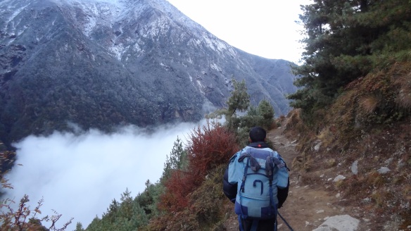
Saroz and I set off for our long trek at about 6.45am, accompanied by a porter to carry my kit bag and climbing stuff, which had come down from Island Peak the previous evening. We were in clouds for much of the way. The path round to Namche Bazaar was a quick one though, Saroz setting off at his breakneck speed, the porter in pursuit, probably not used to such a light load as 30kg on his head (some of them can carry over 100kg this way), and we got there inside an hour.

Following Saroz down the path from Kyangjuma - the clouds now below us...

After Namche (which I hardly noticed, so dense were the clouds) we set off down the steep hill and made the 500 or so metre descent to the Khumbu river in no time at all. Soraz was on the phone most of the way, either getting updates from Lukla or Kathmandu on the weather conditions. It was bleak bleak bleak basically. No planes were coming in or out due to the low cloud.

The problem is that the planes, being 8, 12 or 16 seaters, have to be flown entirely manually, and therefore rely entirely on being able to see the airstrip before attempting the hair-raising landing. If there is low cloud, they don’t fly, simple as that.

Saroz kept trying though, and told me that he had said a prayer for me. An ‘Om Mani Padme Hum’, or something like that. I think this is the Buddhist mantra but can’t rememeber what it means for now, but hope it works whatever it is. He also kept turning the prayer wheels on the way down, and never missed a prayer flag or mani stone, so he must have meant it.

We reached Monjo in about two and a half hours, and then Phakding, where we stopped for lunch, in about 4 and a half. Lunch was again my usual spaghetti with Tomato sauce, in case Ben is reading this once more – are you there Ben?

Setting off after lunch at about 12.45, the clouds appeared to lift, and Saroz got his hopes up when he thought he heard a plane. This thought vanished though when it turned out to be a rescue helicopter. They must be nuts, or it must have been a total emergency, for them to be even attempting to fly in these conditions.

The walk back to Lukla from Phakding is largely uphill, and gains in fact about 300m, making this at the end of a 20+ mile haul a real slog. I was therefore very happy to arrive at about 2.45pm.

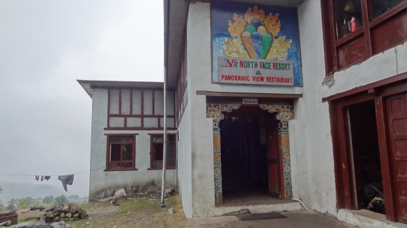
The North Face Lodge, my home for the next 'x' nights....

As we arrived at the North Face Resort, my lodge in Lukla for the night, it was chaos. There were bags and people everywhere, as most folk had been sat here for two days waiting for a plane. The airstrip is the only way out of the Himalayas, other than on foot, which would take a week or more, so there is simply no choice but to sit and wait. The problem will get worse day by day as more people arrive hoping to fly out of here too. I was told shortly after arriving that the forecast was for rain for the next four days. Oh heck, and words like that.

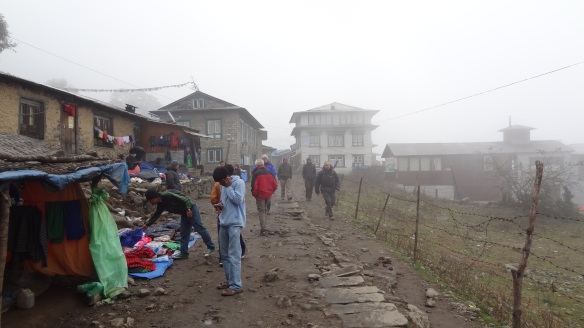
Lukla - not really much happening under the clouds at all.

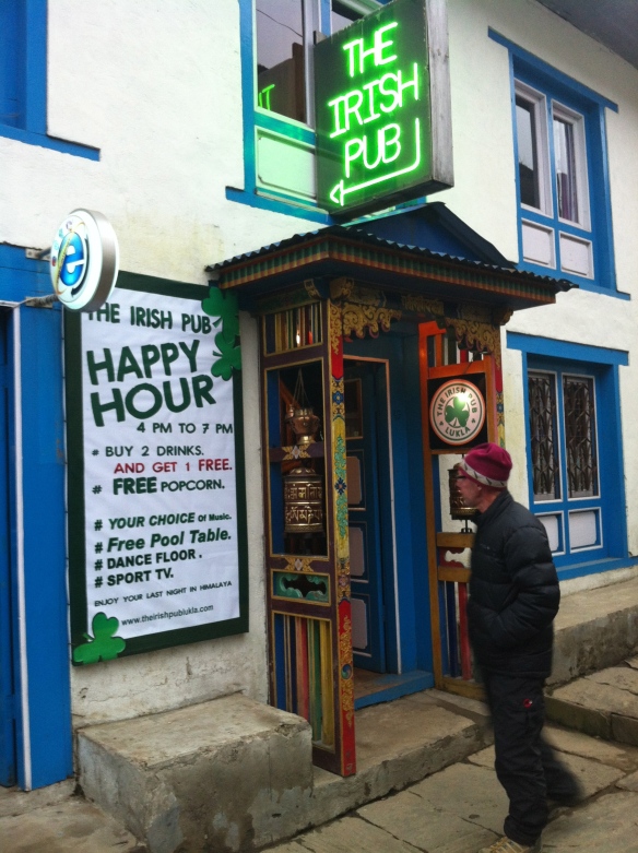
I had a quick look into Lukla, which is a pretty nasty place, but it does have a pub or two, for people to “enjoy the last time in the Himalaya”. I ventured into an ‘Irish’ bar, to kill the time, and had my first beer in a fortnight. It would have tasted good if I knew that I would be able to leave anytime soon, but instead I sort of stood there frustrated. There was a muted atmosphere everywhere in fact, people walking around a bit zombie-like.

This place at least offered me something to while away the odd hour or three.

Dinner back at The North Face Resort was a fairly somber affair. I did meet a Canadian guy, a dentist from Toronto, who had just arrived from Kathmandu however. He had managed to charter a private helicopter to get him to a village about two hours walk down the mountain. It was apparently the only helicopter to leave Kathmandu the whole day, so I am guessing he paid a rather large fortune for the privilege. He told me he is acclimatising in the Himalayas for a running event in the Annapurna circuit next week which is 250km over six days. He had to be totally nuts, as he does these things about 10 times a year apparently.

After dinner I caught up with Pasang, another Exodus trek leader, who we have seen several times up and down the mountain. He is in charge of around 16 sixth-formers from Wells School, and he told me that he has a place reserved for me on a flight at 11am in the morning. The chance of it flying of course was written all over his face.

I went to bed in the same state as the day before, hoping, praying for sunny skies the following day. Om Mani Padme Hum…….

Himalayas Day 8 – Dingboche to Nangkartshang Peak, and return to Dingboche

I woke up very early this morning in the Friendship Lodge in Dingboche. The temperature on my watch showed -1 C, and the water beside my bed is partly frozen. For the first time on the trek I slept with clothes on in my sleeping bag. Slightly too much information there perhaps, but normally I never ever wear clothes in a sleeping bag, no matter how cold. I even wore a hat. And this is inside, so I cannot imagine how cold it is outside. In under a week, if I make it that far, I will find out, as by then we will be camping, on a glacier, and at 1,200m above where we are now.

I said above “if I make it”, as if you have seen my previous entries you will know that for the last day or so I have suffered from mild AMS symptoms, and they aren’t pleasant. They aren’t exactly the end of the world either, being bad headache, nausea, dizziness and shortness of breath, but the point is you can’t let them get worse.

There are only two worse types of AMS, and without wishing to overdramatise the situation (although I have been called a drama queen many times in the past :)) they can both result in death within a day if not treated immediately. One is called HAPE (High Altitude Pulmonary Edema), the other HACE (High Altitude Cerebral Edema). With one you drown as your lungs fill with fluid, the other is fluid on the brain. I don’t want either, funnily enough.

Anyway, I won’t be getting any of those for two reasons. One is that we are being very well looked after on this trip by our guide Ngima and his assistants. They carry full medical equipment including a Gamow bag, which is used to pressurise the air and relieve symptoms, and also oxygen and dexamethasone. Secondly I know my body well enough, I think, to know when to cry for help. I don’t want or need to summit Island Peak that badly that I want to put my health at risk. I am reminded of the quote that Ed Viesturs (Ed has climbed all 14 of the World’s >8,000m peaks ) uses often in his excellent book “No Shortcuts to the Top”, which goes something like “getting to the top is optional, getting down is mandatory“. That’s an ethos I won’t have to try too hard to follow, believe me.

Anyway – back to today. We are now at 4,360m or so, having arrived here from around 3,800m yesterday, and so today it is very important to acclimatise. You can do this in one of two ways – either you stay put for a while (a day or so) before moving any higher, or you can do an acclimatisation walk. This means that you climb higher, and then you come back down so that you utilise the ‘climb high, sleep low’ philosophy. With this technique you are (even though you have just ascended higher than you would wish to stay), coming back down to more oxygen rich air, which your body craves. We took this latter approach.

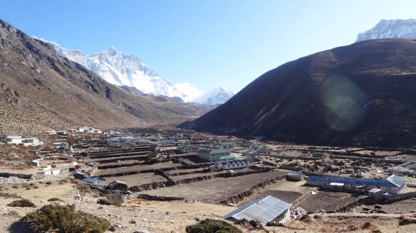
The morning was yet again clear and crisp, and also very frosty, and offering beautiful views of the surrounding peaks. It is now cold enough to merit down jackets, gloves, and hats are essential at all times. This was the view I woke up to in fact, of Lhotse in the distance:

Sunrise on Lhotse from the Peaceful Lodge in Dingboche

We began our ascent of Nangkartshang Peak (5,050m) at around 7.30am. The walk is steep, almost unremittingly steep, and a struggle for me right from the start. Very quickly however, some spectacular views were on offer, including our first proper view of Island Peak, nestling below the gigantic Lhotse. It still looks a fairly fearsome peak in its own right, and the snowy summit ridge was clearly visible.

Lhotse (distance, left) and Island Peak (centre in the distance) over the top of Dingboche

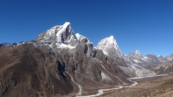
As we got higher, the massive soaring Ama Dablam was to our right, Lhotse in front of us, and gradually we got sight of Makalu, at 27,765 feet the fifth highest mountain in the world. Around every corner in the Himalayas you see something different, and as you get higher into the upper Himalayas the views get more spectacular still, as the panorama of ridiculously tall peaks gets more and more impressive. I have in fact now seen four of the top 6 mountains on the planet (Everest, Lhotse, Makalu and Cho Oyu) today alone.

The westbound view from here alone also shows just how substantially the landscape has changed:

Looking up the Cho La Valley from the ridge above Dingboche

The climb up also showed the difference in walking abilities/fitness in our group quite markedly. For example, Tony reached the summit in 1 hr 25 minutes, Rob in 1 hr 40. I brought up the rear with Maureen at a shade under 3 hours. How telling this is for Island Peak I do not know, but I am sure that Ngima has it figured out. I asked him on the way up (at a rest point where I could breathe) as to the ‘success rate’ on this trip. He said it was a little over 50%. If I’m terribly honest with myself I will be amazed if I make it, but we will see – I’m not giving up yet by a long chalk.

The summit itself of Nangkartshang Peak is very small, and adorned by prayer flags. I did manage to take a couple of panoramic shots, shown below. If you click on these they will expand and look more impressive….

West panorama from Nangkartshang Peak, 5,080m

South/East panorama from Nangkartshang

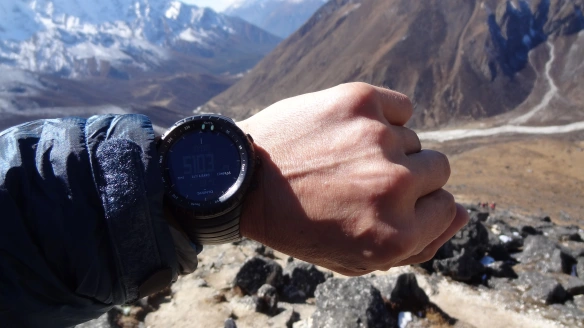
The whole vista was simply magnificent – and very cold, but I was very glad to have made it to over 5,000m – my watch showed 5,100m or so as seen below:

Made it to over 5km vertically!

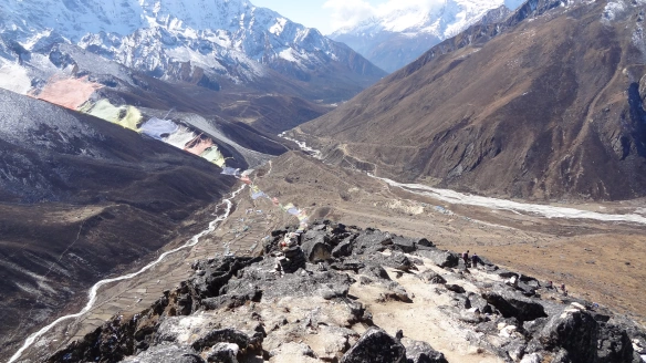
Looking down from the summit towards Dingboche in the valley below

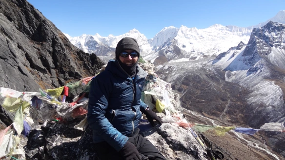
And the northbound summit shot, just to prove I got there.

The walk back down was straightforward, and it was nice to get to more oxygen rich air. The climb up was over 700m, and actually took us higher than we will get to tomorrow, which is a place called Lobouche, at 4,940m. I got back in around an hour and a half, the same time as it took Tony to get up. I really hope, that if I do get to attempt Island Peak, that I don’t hold these guys up. I got back with nothing more than a sharp headache, which after a couple of Paracetamol abated significantly.

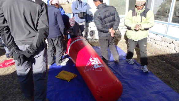
After a lunch back at the Friendship Lodge we were treated to a demonstration of how a Portable Altitude Chamber (PAC) bag works. It was fascinating, and Ngima showed how just by pumping air in with a foot pump, the effective altitude reduced from 4,400m to 2,600m by placing my watch inside.

The PAC bag demonstration back in Dingboche

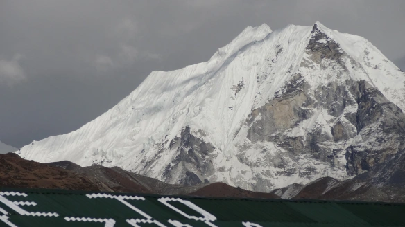
After a quick walk through the village with Rob to kill a bit of time (where we were afforded a great view of Island Peak) it was back to base for dinner.

The best view so far of Island Peak - starting to look intimidating!

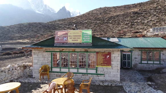
A very enterprising bakery in Dingboche offering hot and cold showers - not sure I fancy the cold ones though.

We then had our evening briefing for the walk to Lobouche tomorrow. It seems a reasonably straightforward affair (if anything can be straightforward at 5km up in the air), albeit punctuated by a pretty stiff climb in the middle.We will also apparently see a number of shrines and memorials to the many people who have lost their lives in and around Everest. That will be a very emotional experience I am very sure.

In just two days time now, I hope, I pray, I will be at Everest Base Camp, staring at the Khumbu Icefall, surrounded by Nuptse and Lhotse, and treading in the footsteps of giants, both animal and mineral, and getting no doubt even more nostalgic than I have been so far.

You have so much thinking time in the mountains, whether just when walking, or during the inevitable numerous times that you are awake in the night due to the altitude. I will share some of those deliberations another time. Bring on tomorrow.

It’s here, it is finally here

I almost cannot believe that I am writing this post. Tomorrow I will set off on the adventure of my life, to Everest Base Camp, and to (hopefully) the summit of one of the world’s great trekking peaks, Island Peak.

Island Peak, Himalayas, 6.189m

Since I decided to do this trip I have always felt incredibly nervous about it. So why do it, you may ask? Well there are several reasons why it is happening, and so let me explain.

Firstly I needed since doing Kilimanjaro to push myself higher and harder, and this has both of those elements.

Secondly I have a love affair with Everest, the whole notion of it, and have become a junkie to books, films, websites about it. I claim to have so far scratched only the surface of it, but I had to go there and see it, it has become a pilgrimage in that respect.

Thirdly, it is because of so many people saying that Everest Base Camp is so, well, uninteresting, that I had to do something else to combine it with. I am told that EBC is dirty, that you can’t see Everest itself from there (or not the summit anyway), that it is ugly and featureless. I care about none of those things of course – for me just being there will be the greatest thrill imaginable.

Fourth, it is about reaching a peak. If you have followed my blog previously you will know that whilst I don’t spend a lot of time on mountains, my greatest emotions seem to come out when attaining a summit. It can be a small ridge in the Lake District, or a massive climb with fixed ropes and ice axes like this one, but the attainment and the achievement is always the same, and something that I can scarcely put into words.

This trip actually is the product of a number of things, most particularly a conversation between me and a friend Paul, of “Darina and Paul” fame from Kilimanjaro (see previous blogs again, or let me know, I can send you links if you ask me nicely :)). So after we had been skiing earlier this year, Paul said that he’d like to go to Annapurna. I did too, but I felt that I couldn’t go to the Himalayas without at least seeing Everest, it just wouldn’t have been right for me. Paul then said that he wouldn’t like to just go to Base Camp without climbing a mountain, and I agreed, it would be frustrating. So we agreed to not do the trip basically, although then I decided that I just had to go and do it. Paul is now doing the New York Marathon, and will be off there soon (whilst I am away in fact) to do just that. So to Paul (and Darina, and Jason, and Ryan, and everyone else who is doing it) – I wish you the very very best of luck.

This trip for me is harder by a long chalk than anything that I have ever done. I will spend over a week at altitudes over 5.5km up in the air. I will be climbing an ice ridge which totally freaks me out.

I am so excited about it that I don’t know if I will sleep tonight at all.

There will be no more blog posts from me until I return from my trip, as I do not have the means to get them up here live as far as I know. I will do a daily diary however, and will describe to the fullest the things I experience, and this will be posted when I am back.

I am going on the same path as that followed by all of the great Everest expeditions themselves, from Edmund Hillary and Tensing Norgay, to Reinhold Messner and Ed Viesturs, and all of the mountaineering greats. I will move from the Dudh Kosi Valley to the Khumbu, passing through evocatively named places liked Namche Bazaar, until I reach the mighty Kumbu Icefall, which is the glacier coming down from Everest herself.

When I (hopefully) reach my destination of Island Peak, I will from the summit at around 20,400 feet be amidst (and be staring at) three of the highest five peaks on earth.

The words ‘bring it on’ seem sorely and hopelessly inadequate. I hope I am up to it……may I say wish me luck?

12kg? Impossible!

So yesterday I told you that I was about to try to squeeze a quart into a pint pot if you remember. Or more specifically I had the dilemna of having a massive amount of packing to do to get into a very small bag. The issue is that when I get to Kathmandu, my bag for the trek is weighed at the hotel, and can only weigh 12kg – yes you heard me correctly! That’s all of my kit for a 22 day expedition, all clothes, waterproofs, sleeping bags, boots, down jackets, equipment, the lot. I can tell you that my sleeping bag and Thermarest alone weigh about 3kg, and my various electrical items close on the same. It’s not even close to being funny. It all has to fit into a very small space too – i.e. the ‘expedition bag’ they gave me for the trip.

When I was told I was being sent an expedition bag I originally thought ‘oh good, a nice new bag, I could always do with one of those’. Then when I saw it I just laughed – it must hold about 50 litres max, and thought ‘no way’. Then I was told that my stuff had to fit into this bag for the trek, and could weigh not a gram more than 12kg, and so I knew I was in trouble. It almost leaves me with wearing the same exact clothes for all 22 days, and whilst I expect to be ponging to high heaven by the time I make it back to Kathmandu, there are limits as to how long you can live in the same pair of underpants – please!

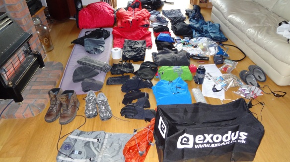
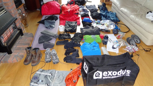
So anyway this was how things looked yesterday:

The sprawling kit as of yesterday.....

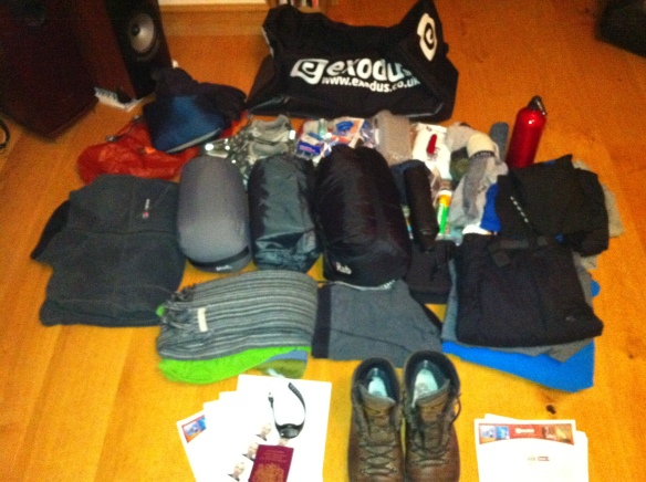
And so today I have been trying to squeeze things down via stuff sacs and compression bags. The compression bags are great -I bought a couple of the Exped Tele range from Amazon, and they are great. You can even suck the air out of them like those clothes bags that you see on QVC! Anyway, things are heading in the right direction, as it now looks like this:

Heading in the right direction at least.

So I reckon that after a day of huffing and puffing (and believe me, compressing a sleeping bag and Thermarest takes it out of you in my living room, and so doing this at altitude with no oxygen is going to be a killer) I have it do I can get it all into the bag, just. All good I thought, so let me weigh it. And the answer is……..18kg.

Yep, that’s without the boots as I’ll be wearing those, and without toiletries, as I haven’t packed them yet. Oh and it is without underwear, or any clothes other than those I listed in yesterday’s post, i.e just my trekking pants and fleeces and things. I was about to throw everything out of the window in the end. I then had to think about my stuff for Island Peak, as this is excluded altogether from the above. Oh Lordy!

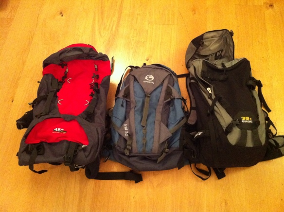
So I then decided to pull myself away from that and look at the rucksack situation, just by way of small distraction, as it were. My trip notes say “40-50 litre rucksack with ice axe straps”. I have to confess to being pretty bad with rucksacks this year. Bad that is in that I have already bought three :). One of them I actually used :). So which one to pick:

Eenie, meenie, miney moe.......

Now the one on the left is technically the only one that fits the bill, as it is a Berghaus 45+8 sack, and has as many attachments and pockets as you could wish for. The one on the right is the one I used for Switzerland in the summer, it’s a Deuter 35+ and has the bells and whistles too (if not all of the room). It is a great climbing sack, but not a great one for trekking though. The one in the middle is a Sprayway 30, and I love it, but it has no ice axe straps.

If I was just trekking to base camp I’d take the Sprayway, without hesitation. It is the most comfortable, has great access, has outside bottle holders etc etc. If I was just climbing I’d take the Deuter – it is made for ropes and axes and helmet etc, and I know it fits the bill. If I read the kitlist properly then I should go for the Berghaus, as it is the only one that fits the spec.

But then…..the list goes on to say that your total baggage of 15kg should be divided into your kit bag and rucksack, with the kit bag to weigh ‘no more than 12kg’. Now this means that the rucksack can weigh no more than 3kg. I can tell you that I weighed each of these this evening, and the Berghaus weighs 2.1kg on its own. Totally empty. That means I can fit in like a pair of sunglasses and maybe a bar of chocolate if I’m lucky. My waterproof jacket weighs 800g, and my camera about the same including its spare batteries and the like. What do I do with suntan lotion, lip salve, water bottle, camelback, fleece etc etc etc?

So I knew this was going to be a frustrating day. I really wanted to spend it trying to do some things around the house, maybe have some ‘me’ time, maybe even go out and not think about panicking about the trip at all to take my mind off it. Instead it is worse then before. I will get there somehow, I simply have to, but how?

Answers on a postcard please…….

Kit List for Everest Base Camp

So I have just four days to go, and four sleeps to go, until I embark on the greatest adventure of my life. I thought that Kilimanjaro was (and it was) massive, but this is simply bigger by miles. Kilimanjaro was a 7 day trek, and it took me to 19,340 feet. It was the best adventure I have ever had, and may stay that way, as I have no idea how this one will yet turn out. This trip is 22 days, takes me into the heart of the world’s highest mountain range, involves ice climbing with technical equipment, and takes me up to 20,305 feet. And to boot I get to stand in front of Mount Everest, the mother of them all.

If I told you that I was just a little bit excited at the moment, then that would be the ‘mother’ of all understatements. I have been like a cat on a hot tin roof all day today. I cannot keep still, my heart is racing, I have probably burned about 5,000 calories in nervous energy – who needs the gym! I started to lay out my kit too, and buying the last few items that I will need. More on those later, but for now I thought I’d put down here the kit that I am taking. If anyone out there wishes to comment on the appropriateness or otherwise of what I have here, then I’d be very grateful. I still have no idea how I am actually going to get it all in and under the weight limit, but for now I am still assembling, so I will get to think about what I take away later.

So here’s what I have so far:

Everest base camp kit

So we have here:

Clothing

3 base layer T shirts

2 sets of thermal underwear

1 pair lightweight trekking trousers

1 pair fleece lined trekking trousers

4 pairs of socks

2 marino wool tops

2 light fleeces

Outerlayers

1 Goretex rainjacket

1 Goretex overtrousers

1 (very toasty) Rab Neutrino Plus down jacket

1 Rab Generator Alpine jacket

1 midweight Polartec Fleece

1 woolly hat, 1 cap, 1 scarf, and one buff

1 balaclava (looks like a gimp mask, hope I don’t get to have to wear it :O)

3 pairs of gloves (inner fleece, outer shell, and goretex padded)

Walking boots (my trusty Meindl Burma Pros from Kilimanjaro, best bit of kit I have ever bought)

Trainers/approach shoes for camp

Electronics

Powermonkey charger

Suunto altimeter watch

Sony HX9V camera (bought today, hope it’s good!), plus extra batteries

iPad (I hope to keep my blog written up whilst away, charging it isn’t going to be easy though)

Spare mobile phone (Nokia C3 – hoping to be able to charge my iPhone en route so this is a back up really)

Headtorch plus spare batteries.

Other gear

Rab Summit 700 sleeping bag

Thermarest

Glacier glasses plus spare sunglasses

Camelback with insulated hose

Drinking bottles x 2

Gaiters

Rucksack (Deuter Guide 35+)

Toiletries etc

Toilet roll (may need to take 10 of these :))

Sunscreen (factor 30+)

Chapstick

Paracetamol

Immodium

Compeed

Various sticking plasters

70 pairs of contact lenses 🙂

Anti bacterial gel

Baby Wipes (my only means of washing as far as I am aware)

Travel towel

NO Diamox (I understand that I can buy it in Kathmandu, and buy it I will)

Other bits and bobs

Book (Bear Grylls’ “Facing Up”)

About 20 Clif Bars, about 10 Clif Shot Blocks, and 10 Zipvit Energy Gels (these may all be casualties, they weigh collectively 2.5kg :))

Water purification tablets (x 100 or so)

Compression sacks and bin liners

Travel Insurance documents

And that’s about it. Sounds like a lot, but this is only the stuff for Everest Base Camp. I also have to have harness, ice axe, helmet, figure of eight, Slings, jumar, plastic boots, hand warmers etc etc. for Island Peak. The above also includes no ‘normal’ clothes – no underwear, T shirts, jumpers, or anything else for that matter. There won’t be room of course, as the above list I have to get down to just 12kg! That is going to be a nightmare, but it will be apparently weighed at the hotel in Kathmandhu, and I have to do it somehow.

So as I said earlier – any and all comments welcome. The bag (that would be the small Exodus one in the foreground) will be packed and unpacked a few times in the next few days, and the air will be very blue indeed inside my house……I shall let you know how it is all going tomorrow.

Getting Scared Now

I don’t know if it is a good thing to admit if you are scared or not? As far as I am concerned, it is generally a good thing to have a healthy respect for the mountains, but to have fear, deep fear, is maybe just too much. I say this because today, I have to admit, I am now no longer just ‘looking forward’ to this trip, I am also worried, a lot.

It is now just six days (six days? – holy cow!) until I go to Island Peak. Today I wanted to remind myself of what I am I up against, to get ‘into the zone’ as it were, and so I did a little googling. As well as various YouTube videos of planes landing at Lukla Airport (and some not landing at all – I am still very haunted by the fact that none other than Sir Edmund Hilary’s wife and son were killed there in a crash landing) I came across various ones of the Island Peak climb. So I have posted one of them below.

The bits in particular at 1:46, 2:32, 2:47 and 3:16 give me the heebie jeebies. Did I tell you that I was scared of heights? Yes really! Check this out, the guy, who incidentally looks far more composed than I will ever be at sea level, let alone 21,000 feet with a cliff face each side of you whilst balanced on a tea tray width of ice, is at times on his hands and knees. I don’t think I’ll cope, seriously, with that section.

That’s all I have to say for now. I have so much to write about over the next few days, but it will have to wait. For now, I just need to absorb this, and worry a while. It is getting serious. Very very serious.

Let the games begin….and learn those lessons well.

I’m very happy to say that my blog is getting lots of new traffic recently, so thank you to you, whoever you are, for reading it. The course that I did in Arolla was great in so many ways, but one of them was that I got time to collect all of my thoughts, collate my pictures, and pull everything together before I got back. It helped massively that I took my iPad with me to put it all down on – I have had my iPad for about a year, and most of the times sits there as a big underused toy. It does however come into its own at certain things and that was certainly one of them.

So now having been back for two weeks I am in training, and serious about it too, for Island Peak. Whenever I go away, I always try if I can (though never consciously, as it were) to learn something, even if it is just a little thing, hopefully about me. On this trip I learned at least three things, which in no particular order of importance are as follows:

1. Listen to what people who know more than you tell you. Sounds bleedin’ obvious, doesn’t it? Well it should be, but I don’t always listen you see. Take as a case in point my camera. I own a very good Panasonic TZ7 digital camera. 12 megapixels, 15 x zoom, idiotproof, takes great pictures. I bought it just last year for Kilimanjaro and it continues to serve me well. I wanted better though. With Everest Base Camp and Island Peak looming, I thought ‘What if I had one of those fancy DSLR cameras – that’ll get the money shot, won’t it?’. So I researched until I was blue in the face.

Cut a long story short, I spent a month buying up every photography magazine youm have ever heard of, and some that most people haven’t. Joined a few photography forums too, asked around, that sort of thing. Went into Jessops about 18 times. In fact I went into three different branches of Jessops about 18 times each. Decided that the thing for me was a Canon 550D. Looks great, big long lens on it, takes great pictures apparently and that sort of thing. I bought it and took it back after two days. Why? Well a.) it was huge, like massive, and wouldn’t have even fitted in my suitcase let alone a rucksack, and b.) after I took a bunch of pictures with it, I compared them side by side with ones I took from my Panny point and shoot, and I couldn’t tell the difference.

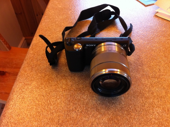
So that should have been that, shouldn’t it? Well for most people it would have been, but I don’t apparently listen, even to myself. I therefore asked a few more questions on various forums, and the advice from everyone, bar none, having told them what I wanted, and was expecting, was to “keep your Panasonic”, and “don’t bother with cameras with manual adjustments, especially when you don’t know anything about them”. Perfect advice. So here is my new camera:

The Sony NEX-5 - great camera....

At the ‘bargain’ price of £600, I decided that I had to have this. It is the smallest camera with interchangeable lenses, has a DSLR type sensor, and well, takes photographs and video. Excellent! Trouble is, when you are a.) hanging off a mountain, and b.) trying to minimise weight, you don’t need a camera with interchangeable lenses, and you certainly don’t need one that weighs about 4lbs and which takes up half your rucksack. What is even more galling, is that having got it back from Switzerland, whilst the pictures it takes are fine, and the ‘panorama’ mode is all well and lovely, I honestly wouldn’t be able to tell the difference between it and any other camera. I don’t after all even print photographs – I just download them and they sit there on my laptop like everyone else does. The ultimate telling factor was that I took more pictures with my iPhone than I did with the Sony – it was just too cumbersome to get out of the rucksack, especially when you are dealing with ice-axes, ropes and the like.

So when I go to Everest Base Camp, I will take my trusty point and shoot, and happily pull it out whenever the mood takes me, and just enjoy the pictures afterwards. Lesson learned for sure. Anyone want to buy a camera?

To be continued……

Island Peak

So having decided to climb Island Peak (or Imja Tse, to give it it’s correct name), I thought I’d put some information up here for those who (like me as of a month back) haven’t heard of it before.

The mountain of Island Peak is 6,189m (or 20,305 feet) high. It is officially a spur, or ridge extension coming off part of Lhotse, the fourth highest mountain on earth (the other three being Everest, K2 and Kangchenjunga). It was apparently named in 1951 as it appears to look like an island in a sea of ice when viewed from Dingboche, a popular trekking stop en route to Everest Base Camp. It was first climbed by a British team as a preparation for the first successful Everest trip that same year. One Tenzing Norgay was part of the team, apparently.

Imja Tse......

It is classified as a PD+ climb. PD stands for Peu Difficile in Alpine terminology, and a list of Alpine and other terms are included in the link below:

http://www.mountaindays.net/articles/item/snow_ice_alpine_grades_explained/

There are apparently two ways to the top. There is a base camp at about 5,100m from where you can make a summit attempt, or a high camp at 5,600m, leading to a shorter summit day. As far as I understand it , where you start from depends upon the conditions at the time and also the group doing it (i.e the climbing sherpas will assess snow conditions etc. and the liklihood of the group being able to sleep at the higher altitude). When I did Kilimanjaro the highest we slept was at about 4,800m, which was a struggle, and so this will in either case be a step up for me. We will stay in tents whilst there. All being well we will be reasonably acclimatised as we will get there after having been to Kala Patthar (5,545m) at Everest a few days before.

After base camp there is a climb and a scramble to get onto the glacier, after which it is a crampon and ice-axe approach. The final 250m or so is on fixed ropes, involving jumars and harnesses. A climbing sherpa will fix the lines for us, and the slope is at about 55 degrees on ice. The final ridge up to the summit looks terrifying to me, I cannot describe it in any other way.

Here is a picture that someone took on the summit:

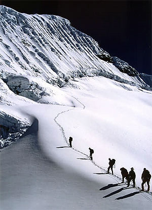
I so want to be stood where they are....

From the top, as long as the weather doesn’t hamper the view, there will be views of Makalu, Lhotse, Kangchenjunga (three of the five highest mountains on the planet). Everest itself will be hidden behind Lhotse, which at 8,500m or so, will still tower some 2.5km above us, even at the height we are at. Staggering!

The descent is an abseil down from the summit ridge over the headwall, and back over the glacier. Apparently there are potentially crevasses which may need the use of ladders to get over.

From there the trek back goes back over what is apparently a really fantastic ridge to a place called Phunki Tenga, and then eventually back to Namche Bazaar and the airport at Lukla. That will be day 20 of the trek, so there is a huge amount to get done in that time, including Everest Base Camp on the way.

If I told you here and now that I was excited about this, then it would be the biggest understatement that I may have ever made. I actually never thought after Kilimanjaro that I could ever rekindle the feelings that I had then. Little did I know that I would be doing this so soon afterwards, or that it would be as much of a thrill as it is to be heading out to the Himalayas.

So that’s Island Peak then. It is beyond my ability level, and will be way beyond my comfort zone when I am there, no matter what I do between here and then. I want to push myself though, as hard as I can, and this will not, I already know (or should I say I hope!), be my last trip to the Himalayas……….

Bring it on – I am already counting down the days.