Week 12 – the fine margins on which we sometimes hang….and some more adventures ahead!

Two things have occupied my thoughts as much as anything this week (except one other quite big thing, more of that at the end….), and both relate to just how fine margins are in running. The first relates to timings of runs, and the second to injuries, of which I am now suffering a bit…

This weeks programme called for 43 miles of running. The second last week of really big mileage before we start tapering in Week 14. The midweek runs were 6, 9 and 7 miles, and the weekend was 4 and 17, so a reduction from last week, which is good! It’s funny how all of a sudden 17 miles doesn’t seem too far any more!

The Tuesday run was a random Fartlek job of four miles, with a mile warm up and warm down. I got almost as wet as I did the Tuesday before and it simply lashed down the whole way. I didn’t really mind too much though, as it was almost a distraction from my leg pain, which is almost constant now, if still manageable.

On the Wednesday it was a tempo run of 9 miles. Despite the cold (3 or 4 degrees at 6am) I was really looking forward to it. It’s more or less the longest tempo run yet, and there will be quite a few more of these to come in the next few weeks. So the idea is to run at the pace we will run at in New York for the whole of the 26.2 miles. The run went well, and was followed on Thursday by more quicker paced running. This time it was 18 lots of 200m sprints (well, all things are relative as they say!) followed by 18 x 200m slow, as part of a 7 mile run. The weather was this time down to just 1 degree, and it felt colder still. I don’t think I’ve ever been as cold on a run, and was glad to get finished.

I also had more physiotherapy on Thursday. The physiotherapist is really good (from a local firm called Progressive Physiotherapy) and I have been now officially diagnosed as having a strain of the medial head of the gastrocnemius muscle, or gastroc. And in case you want to know more about the calf and muscles in it here you go, you’re welcome…….https://www.physio-pedia.com/Calf_Strain . I hadn’t even heard of the gastroc muscle until this week, but now thanks to the internet I’m an expert of the worst kind 🙂 The injury I have is also referred to as ‘tennis leg’ apparently. It’s manageable and that’s the main thing right now, so whilst it hurts when I’m running, it’s not terrible pain, and with lots of rollering, stretching and tlc, I believe I can (with help) nurse it all the way to New York. Time will tell! I’ve also been told that it has been caused by my anterior glute on my right side being weaker than the left (who knew?) and so I have to strengthen it. That I’ll do too.

The Saturday and Sunday runs were in Cambridge with Melanie. Saturday’s was the usual gentle affair of just four miles. It is funny how four miles now feels like it is not even worth breaking a sweat for. Yet when I started this programme I was averaging 14 miles a week – in September I ran 188 miles, averaging 43 a week – no wonder I feel crocked!

Sunday was a bit of a wet and windy affair, but I’m glad to say that our 17 miles passed without incident. No lost keys, no other injuries, no dramas of any kind in fact. Just the way we like it! The leg was achy and sore, but no worse than it has been, so I just keep ticking these runs off now. There are a mere 19 runs to go until New York, and four of them are just gentle jogs in the week of the run itself. One more big week this week (21 miles next Sunday, gulp!) and then we start to taper….but no taking anything for granted yet. I’m still giving this everything and more. I’m even going to start eating avocados and almonds this week – what has this turned me into!!!

And so, I alluded at the top to the things that occupied my mind. The running is (still) fun, despite my protestations and my injury niggles, and the finishing line IF I make it in just four weeks time, will be simply one of the absolute highlights of my life. It is wonderful though to also have adventures (other than the one you are on!) to look forward to.

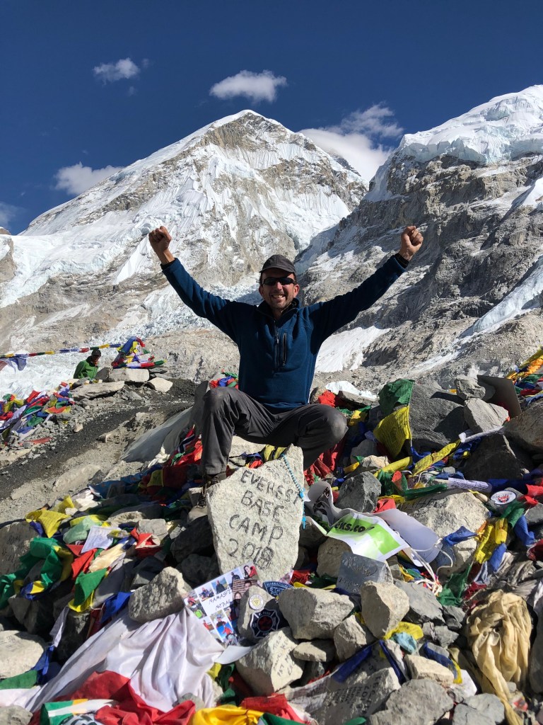
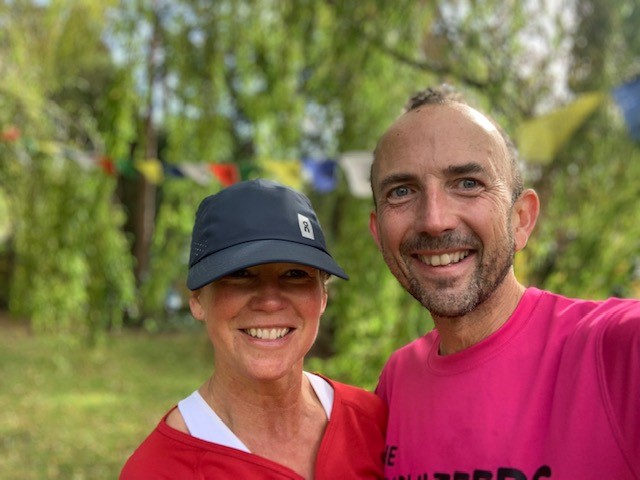
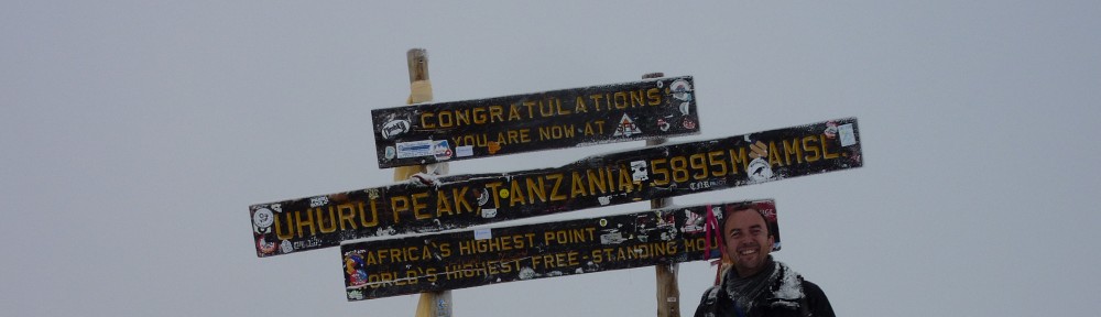
I thus asked Melanie this week if she’d like to share a little adventure to Nepal with me next year. She said she’d love to, and so that is amazing and wonderful at the same time. I’ve been to Nepal and the Himalayas/Everest Base Camp three times now, and anyone who knows me knows how much I love it there. It just gets into your soul, your whole being. Each time though I’ve travelled on my own, and this will be the first time I get to share it with someone special. Roll on next April therefore! Meantime, we have a bit more running to do……:)

Room for more than one person in this photo next year…….:)

Week 11 – tough for running, and feeling very philosophical.

It’s been a hard week in more ways than one. I started it on Monday by visiting a very good friend who is in a hospice. I then got news on Thursday about an ex-work colleague and friend who passed away on Wednesday after a long battle with cancer. He will be very sadly missed by all of those around him and who knew him.

Paul Kenny was one of those rare people in life. He was incredibly funny and unbelievably intelligent almost simultaneously. He could completely let his hair down (the expression ‘live life to the full’ could have been written for him) and also be the most professional and dedicated scientist at the same time. He worked in the field of gene technology and biomarkers, and had a past history in (almost ironically) oncology. I count myself very fortunate to have known him, and anyone who did would have been touched by his genuine humility, passionate and caring approach, and his brilliant wit and storytelling. And I totally looked up to him and admired him in so many ways. He was infectious and inspirational, and my thoughts and deepest condolences go to his wife Patricia and his children. The many eulogies that have appeared on LinkedIn already following a touching message from Patricia speak volumes for how much everyone who ever knew him were touched by his presence.

So the running this week pales into insignificance really, despite how tough and important it was, being the longest week of the entire programme. I got very wet (and that’s the understatement of the century) on Tuesday ( see https://aquavista.me/2019/09/24/week-11-tuesday-only-wet-wet-wet/ ), and I also got wet on Wednesday and Thursday too. The runs were 7, 10 and 7 miles respectively. The Wednesday 10 mile run was a progression run, where you go faster every mile by about 15 seconds per mile, it tests how well you can go through the gears and push towards the end of a run when you are more tired, which is great marathon training! Thursday’s run was 5 lots of 0.8m intervals at about 7:45 pace, and I have to say I enjoyed it, although it was hard on tired legs.

Each of my midweek runs were at about 6am in the morning, which takes its toll in the tiredness stakes. Melanie’s runs (in Cambridge) were all at the other end of the day after her work day. She did all of hers really well too.

My main problem this week (as far as running is concerned) has been a niggling leg injury. It started hurting when I did the Great North Run a few weeks ago and has really started getting a bit worse since then, but very gradually. It’s just a background pain (gentle) when running, but stiffens up significantly when I’m not. It’s been a week of ice, foam rollers, a bit too much moaning, and also a trip to the physiotherapists too.

The Saturday (with Melanie by now as she came to mine for the weekend) was a gentle four miler, and passed thankfully without any incident. I had my leg trussed up like a chicken with Direct Tape (a bit like kinesiology tape but slightly more rigid, done by the physiotherapist) and so running with it was a bit weird, but it felt ok. I was more worried about the Sunday run really, as this was a 20 miler.

Stretching after Saturday’s run – leg all taped up with ‘Direct’ tape.

So on the Sunday the weather was forecast to be terrible, with thunderstorms and strong winds. And indeed five minutes before we were due to be heading out (you have to plan 3 and half hour runs into your day, so they need a ‘time’) it was lashing down, and I thought ‘here we go again’. In the end the weather was actually fine. My leg was feeling quite sore by about mile four or five, and I wondered whether I would even make it to the end, but it was fine. Melanie had some blister issues along the way, and had to stop twice and take care of them (and also then change her trainers altogether), but was lovely and said to me to carry on so my leg didn’t seize up while I waited. I ran back and forth so I could recommence with her again, and ended up doing almost another mile in the meantime. By the time we finished the run I had thus done 21 miles, a new record for me!

It was a really hard run overall, and so glad to get through it at the end of a tough week. 47 miles have been done by us both this week alone, certainly a record for me. Melanie found the 20 mile Sunday run really tough for the last few miles, and I was lucky enough to feel like I could have gone on further (fuelled up by a few extra gels!), this a total role reversal to a few weeks ago when I was totally beat and she the opposite.

It is now only just over four weeks until we get on the plane for New York. We have two more tough weeks only, and then we taper. I can almost not believe that we are that close already, but am resting on no laurels and taking nothing for granted. The sad news about Paul this week puts almost anything else in life into perspective.

This week made me reflect very much. I want to enjoy life (who doesn’t, I know, but indulge me for a moment if you will). Work is a means to an end. I see like other people do messages on social media sites to the effect of “on your deathbed no-one wishes they’d spent more time in the office”, and those words are so profoundly true.

I thus finished the week not just thinking of the next four weeks and of completing my first ever marathon, but also of further adventures (watch this space as they say). It is so good to have things to look forward to, and also someone special in your life to be able to share them with. I feel thus very happy at the moment to have both :).

Just after Saturday’s run – there may just be a clue to next year in those flags behind us………:)

I’ll finish this post in reflective mood, having had so many thoughts about “life is too short”, and the like.

I thus had a look round the internet for something that might go some way to describe Paul Kenny. I found two things, the first being a definition of success by someone called Ralph Waldo Emerson.

Success:

To laugh often and much; to win the respect of intelligent people and the affection of children; to earn the appreciation of honest critics and endure the betrayal of false friends; to appreciate beauty; to find the best in others; to leave the world a bit better, whether by a healthy child, a garden patch or a redeemed social condition; to know even one life has breathed easier because you have lived. This is to have succeeded.

Paul was all of these things and more.

The second came from one of the tributes on LinkedIn, which was as follows:

Sending my heartfelt condolences to Paul’s family. I have worked with Paul for the last 7 months at OGT. What a man. He has left behind a massive hole, but a real legacy in the RA/MA department that he had been instrumental in creating. We will do him proud. He was a mentor for all of us. He had a story or experience or anecdote for everything. Genuinely one of a kind and the most inspiring person I’ve ever met. We miss him massively already. He truly was an inspiration to so many. Not that he would let us say that without following it with a funny quip! Sorely missed.

There are about 100 such tributes, and I could have picked any of them, as they all describe Paul perfectly. Paul was also a very keen runner for many years. When and if I do get that finishing line in Central Park, he will be one of the many people I will be thinking about very emotionally. Rest in peace my friend.

Paul Kenny RIP – a true inspiration in so many ways.

Himalayas Day 11 – Gorak Shep to Lobuche, via Kala Pattar

Today I would arise at the highest altitude yet on the trek – in the highest permanent settlement in the world in fact, at over 17,000 feet in Gorak Shep, and we were in the ‘Buddha Lodge’. It would therefore be the highest lodge we would stay at – the forchcoming tromp to Island Peak would be in tents, and then only one night higher than this, at about 18,500 feet in two days time. Today though, was all about getting to see Everest, and ‘properly’ this time.

If I thought that my previous night in Lobuche was my worst night’s sleep ever, then the night at Gorak Shep was sadly to surpass it. The only saving grace about the rooms in the Buddha Lodge were that they were relatively warm. The downside was that this was because they were directly above the kitchen, and the fumes and smells coming out of there turned the tiny room that we had into a noxious unbearable sweatbox, and you really really don’t need that when you are trying to sleep at 5,180m with mild altitude sickness. The smell was a combination of old cooking oil and yak shit (they burn this to fuel the stove), and it almost had me wanting to run out into the ice in the middle of the night.

I had actually gone to bed last night at the ridiculous time of 7.30pm, because a.) I was wiped out, b.) we had to climb Kala Pattar at 6am the following morning, and c.) it was so hot in the lodge room that you could have melted chocolate just by sitting it on the table in front of you. I was sat there in just a T shirt and I thought my contact lenses were going to melt in my eyes it was so warm.

Our rather too warm room in the Buddha Lodge, Gorak Shep

So after retiring and reading for a little while (finishing Bear Gryll’s excellent ‘Facing Up’ about his Everest climb) I turned my light out at about 9pm. By 11.17 precisely I was awake, and I was to never get back to sleep. I was too hot, had a raging thirst, a brutal headache, and was short of breath. If someone had said there’s a helicopter waiting for me outside I would have got into it, without even caring which direction it was heading in.

When 5.30 am came, although all I wanted to do was sleep, I realised that I couldn’t, and so I climbed into my walking boots, long johns and suitable mountain attire for the haul up to Kala Pattar. Kala Pattar, at 5,650m (18,530ft) would be the highest point of the trek so far if I made it, and I was determined to, despite feeling like a zombie.

The only saving grace about this morning at all in fact, was that for the first time on the trek, we did not have to pack all of our expedition bags up first thing before breakfast. We were being allowed to do it after we got back from Kala Pattar later in the morning.

After eating no breakfast whatsoever (I just couldn’t stomach it), I set off on the steep climb out of Gorak Shep with six of the other seven team members. Stefan had had a similar night to me it seems, and decided that he couldn’t face it, and so decided to descend to Lobuche, which at 4,940m would be the stop for the rest of later in the day.

Setting off up the frozen lower slopes of Kala Pattar, Gorak Shep in the background.

The start of the walk was incredibly cold. In fact it made yesterday’s -9 C start to Everest Base camp seem warm. I had my thick Goretex ski gloves on, which I nearly didn’t even bring on the trek with me, plus fleece inners, and my hands were so cold I was actually concerned about frostbite for a while. I kept just wigggling them around, and banging them against my legs in the hope of getting them some warmth from somewhere, and wished that I had brought hand warmers with me. By the time the sun came up some 45 minutes later all was fine, and I thankfully had no problems after that.

Problems were being had sadly by another one of our team however. Maureen has been fighting a sinus infection for the last couple of days, and I can tell you that this is no place to either have one, or to try to fight it. She is brave however, and attempted the walk, but was to give up after about 20 minutes and be helped down the valley to Lobuche by Pasang, one of our guides.

The climb to the summit took one and a half hours for Tony and Rob, who were out of our sight not long after the start, and just over two hours for the rest of us. The weather was again absolutely cloudless, and so the views (the whole point of this particular walk after all) were simply beyond compare. Pumori (7,165m) rose majestically in front of us, and the massive swathe cut by the Khumbu glacier below the west face of Nuptse (7,861m) was to our right. There were also more outstanding views of Changtse in Tibet, as well as countless other soaring 7,000m + peaks.

Panorama looking down the Khumbu Valley from Kala Pattar - breathtaking

From probably half way to the summit, the main attraction came into view. People climb Kala Pattar because it affords the best view of Everest from anywhere, including being on Everest herself. That was why I was there too, and I wasn’t going to let my dull headache get in the way of the greatest day in the mountains of my life.

Gradually the summit of Everest appears, complete with (thank you) trademark snow plume, and then you get to see the Khumbu Icefall in all of her glory, surpassing even the views from Base Camp yesterday by some considerable margin, and then Lhotse (8,501m) comes into view, with her own plume not to be outdone by her big sister.

Incidentally the plume on Everest is caused by the jet stream, which circles the earth at approximately 200mph, and at about 30,000 feet. Everest’s summit at over 29,000 feet means that the top is effectively buffeted by this the year round, and is is why she is unclimbable for all but a few days each year, when the jet stream briefly abates and rises post the winter monsoon. This weather window is what meteorologists are looking for to help climbers who anxiously sit waiting at the various camps on the mountain at the end of April each year. Anyone who tried to climb at any other time of the year would literally be blown off the face of the mountain.

So eventually we made it to the summit of Kala Pattar, a scramble at the very top, and the panorama from 18,550 feet was utterly majestic. The word majestic in fact is hopelessly inadequate here – just look instead at this panorama shot:

Lingtren, Khumbutse, Changtse, Everest (background), Lhotse, Nuptse, to name but a few

There laid out before us was the classic triangle of Everest, Lhotse and Nuptse. Everest at last revealing all of her gobsmacking 8,848m, or 29,028 feet. The picture I have (and I’ll have to choose which, I have lots) will be blown up, framed, and will take pride of place above whichever mantelpiece I ever have.

Dave, myself, Bruce and Ram our assistant guide also had a shot perched on the very precarious Kala Pattar peak with Pumori towering above us in the background:

The summit of Kala Pattar - I am very glad that Ram was holding onto me!

The reason people climb up to here is to admire the view.............

........of this.

Bruce, Ben, Dave, yours truly, and Ram our guide.

Oh and one more for luck, as it were, just me and Everest this time 🙂

We probably stayed on the summit for about 30 minutes. It was just utterly spectacular in every direction. Just looking down alone to Everest Base Camp, more than 1,000 feet below us, and the Khumbu Icefall alone was enough to hold your stare for what seemed like forever. In every direction though, words would only fail you to describe the sheer exultation of what is (as far as I am concerned) simply the best vantage point on this planet.

Eventually we made our way down again, looking back south towards the path of the Khumbu glacier. Amongst the so many different perspectives that I took away from this point in the mountains was just how almost, dare I say it, insignificant, Ama Dablam looked further down the valley. At a ‘mere’ 6,686m, she was beginning to get lost amongst these 7,000 and 8,000m behemoths.

But here was I, in the midst of all of them. The fact that I nearly didn’t get out of bed this morning as I felt so bad, is now so ridiculous to think about that it almost makes me shudder.

This is the crowning moment of my time in the mountains, in the great outdoors, and in fact of all the greatest things I have ever seen it is so far and away number one that I will never again stop to even think about the answer when anyone asks me.

The walk back down I can scarcely even remember. My brain was I think just numb from all that I had seen, and it is so emotional to take all of this in. I was drained in fact, emotionally and physically. But again words fail me as to be able to describe how incredibly happy I was to be here.

Upon getting back to Gorak Shep there was a brief time to pack, and to begin our descent back to Lobuche from where we had come yesterday.

Looking back down the valley as we begin our descent towards Lobuche.

Upon getting to Lobuche I think I just slept for about two or three hours. I practically collapsed into my sleeping bag mid afternoon.

I won’t go any higher on this trip, my body is too beaten up. I think I know that now. Tomorrow the path takes us to Chukkung, over the Kongma La pass at 5,600m, just below where we have been today on Kala Pattar, but if we choose we can circumnavigate this via Dingboche at 4,400m, where we were three days ago. At dinner we were able to choose which option we wished for, and six people are heading up, whilst Mo (still suffering from her sinus infection and now also AMS as well) and I will head down.

I am therefore not going to ascend Island Peak, and I will dwell upon whether that is a disappointing thing another time. Now I just need to descend, my body craves it. I have seen and done ‘my’ Everest. It will always, always, be etched upon my retinas, and upon my mind and my heart. No-one can take it away from me. My journey, whilst not complete, is now headed only in one direction, and that is to the safety and comfort of more oxygen rich air.

Tomorrow I will begin the rest of that journey – and what a journey it has all been.

Himalayas Day 10 -Lobuche to Gorak Shep, via Everest Base Camp

I had the worst night’s sleep of the trek yet in Lobuche at 4,950m. Perhaps it was the anticipation of getting up at 5am to get to Everest Base Camp that had something to do with it. It was more probably to do with a banging head and an inability to get my breath though. There was one (thankfully brief) moment when I just about couldn’t get my breath at all, and I thought that my whole trip was over there and then. Somehow I managed to get myself calmed down again, and tossed and turned the rest of the night until the 5am wake up call came.

The temperature in our room was -3C, and the outside temperature -9C as we set off after a hurried bowl of porridge. I was wrapped up in practically everything I had, bar my down jacket, as I figure that if I make to Island Peak I’d like to appreciate its benefits as much as possible. Daylight was just breaking, although the sun would be another hour before it made an appearance. I felt like a bit of a zombie for the first hour or so, but nothing was going to stop me getting to EBC.

Even the yaks have ice on their backs this morning!

The start of the trek towards Gorak Shep, at dawn, looking between Pumori and Nuptse

We walked along the edge of the same glacial moraine from the Khumbu glacier that we had finished off seeing yesterday afternoon. It is truly spectacular, although it was literally so cold that even with my ski gloves on it was too cold to grab the camera out for a while. The views ahead though, continued, as they have every day, to get better and better, and the crisp dawn air makes the mountains even more intimidating and monstrous than ever before. We had the gargantuan west wall of Nuptse on our right, and the eastern approach of Pumori on our left. It is truly staggering to think that in the photograph above, we are are walking at an altitude of above 5km, and yet there are peaks towering two and three kilometres above our heads still. This really takes some getting your head around, and is true mark of the majesty of the upper Khumbu valley.

Along the way are various memorials, and they put things, and this particular mountain that we are approaching, into some perspective for you:

One of many memorials en route which mark the deaths of those who have died up here.

As the sun starts to rise from behind Nuptse, it shines upon the great peak of Pumori, at 7,165m staright ahead of us, and the path we are on now gets significantly more rocky and harder to walk upon.

Pumori dominating our path ahead - another spectacular sky too.

The upper Khumbu Valley - Lingtren, Changtse, Nuptse. Colossal.

After about two and half hours we came to the highest settlement in the world (true that), called Gorak Shep, at 5,180m (17,000ft). It is not a true settlement probably, as it consists of just a few lodges for trekkers, but it must set a lot of records. We had our second breakfast of the day before setting out at about 10am for the highlight of the trip so far, Everest Base Camp. I actually don’t mind admitting that everything became rather overwhelming for me at this point, and I shed a tear. I was stood outside, and the enormity of everything that I was doing just hit me. Ngima came over to me and asked if I was OK, and I just told him that I was incredibly happy, which was a huge understatement.

Gorak Shep is finally in sight, the Khumbu Icefall in view in the distance too!

The weather by this time was gloriously sunny, and we set out to ascend the remaining 200m or so in height, and three or so miles, which would take us another two and a half hours. The walk is mainly along a ridge, with the Khumbu glacier on one side, and Pumori on the other. We were able to clearly see some climbers on Pumori making their way to the final summit ridge at about 7,000m. Rather them than me is all I can say, it is one steep and brutal mountain, but breathtaking too.

Stopping often, as I was determined to do, not just to breathe, but to take it all in, was just fantastic. I can’t use words to adequately explain any of this at this point. Here is a picture taken back down the valley now, which shows you just the sort of landscape we are in – this is the Khumbu glacier, the highest glacier in the world, cutting its way through 7,000m peaks like they weren’t there. It is ridiculous, mesmerising stuff.

Looking back down the valley along the Khumbu glacier

The sign points the way! The magnificent west wall of Nuptse dominates the skyline.

After a very undulating walk, Base Camp came into view! We could also briefly see the summit of Everest herself poking above Nuptse.

A teasing view of Everest's summit over the shoulder of Nuptse, the Khumbu Icefall on the left.

I just thought I would point out something in the above picture too, to put things into perspective here. The mountain on the left, the one under the wispy cloud, doesn’t look that big from here does it? Well it is Changtse in Tibet, and it is 7,583m, or a shade under 25,000 feet high. That might give you a clue as to what looking at the walls of Nuptse, Lhotse and Everest are like, and just how stonkingly monumental they are, even when viewed as here from 17,500 feet up. Nothing can possibly tell you what it is like to be in this picture unless you have been fortunate to stand here. I am so incredibly lucky, I really am.

At the far end of Base Camp, away from where the ‘public’ access is, were a number of yellow expedition tents – people choosing to climb either Lhotse or  Nuptse probably, as they share the same Base Camp. Everest herself is almost always only ever climbed when a small weather window opens in late April/early May. We were now very close, and the excitement soared.

Expedition tents visible at the far end of EBC - away from the 'public' area.

The view, albeit brief, of Everest today was a huge bonus too. I hadn’t expected to see it at all today, as I know that you cannot see it from Base Camp. The weather again helped – we have been so lucky, and the sun again shone on us incessantly. Pure magic!

The walk now to Base Camp itself is now a bit of a scramble over boulders and onto the glacier itself. The part where the expeditions go from in April/May time is further along slightly, so to be away from the trekkers and tourists. You are still in the same vicinity though – actually staring at the totally incredible Khumbu Icefall, a massively stacked section of seracs, some taller than houses, which starts up between the South Col of Everest and the Lhotse face at about 7,600m. From here you forget about the altitude altogether, as adrenaline just takes over – there is no way you aren’t going to make it to Base Camp, and everyone does.

And so finally at about 12.30 Nepal time, we arrived at the inscribed stone on top of the glacier which officially denotes Base Camp at 5,360m.

And here, recorded for all time, is the ‘money shot’:

"Everest" marks the spot!

The whole group, including our guides, at EBC.

The Khumbu Icefall as seen from Everest Base Camp.

What is Base Camp like? Well before I went on this trip, I had it variously described to me as ‘dirty’, ‘boring’, ‘just nothingness’, ‘a pile of rubble and rocks’, and ‘you don’t see anything at all from there’. Anyone who makes those remarks must have had the worst altitude sickness in the world, or just hasn’t been there. Look at the photographs and see for yourself. And what do people expect after all, a gift shop or something? We are at almost 18,000 feet up in the Himalayas for pity’s sake!

It is only a figurative, or commemorative place of course, but that is irrelevant. This is the place from which Sir Edmund Hillary and Sherpa Tenzing first ascended the world’s highest mountain. It is from where all the great Everest treks have commenced. You feel it almost. You see the start of the climb in the Khumbu Icefall, you see so much of everything that the Himalayas has to offer, and that is simply more than any other mountain range in the world. Consider this too: The world’s highest mountain outside of Asia, is Aconcagua in The Andes, at 6,962m, or 22,840ft. The Himalayas has over 100 mountains exceeding 7,200m, or 23,600 ft. You get to stand in the heart of it all, the place of giants. You get to say that you have been here too, and I am so happy (ecstatic in fact) to have that particular T shirt.

So after about half an hour or so, we turned and headed back towards Gorak Shep. The walk back was long and hard, which although was overall a descent of 200m or so, has many ups and downs, and after about 8 or 9 hours of walking above 5,000m, every part of your body feels it. I was absolutely drained, emotionally and physically when I got back, and don’t think I could have walked another step. My head pounded with the altitude, and after a couple of Paracetamol went and found my room and was asleep within about 30 seconds. It was just a short nap however, as I was conscious of not wanting to sleep for long and then not sleep tonight.

Back at Gorak Shep - in the shadow of Pumori, a mere 7,165m

Tomorrow we again get up at 5am, to get to the highest point of our trip so far. We also get to do a true summit, Kala Pattar, at about 5,650m, or 18,500 feet, which is about 1,000 feet above Base Camp. This is about the only place where Everest can be truly seen in most of her glory. If you have seen a picture of Everest before it was probably taken from the summit of Kala Pattar. At that sort of height, it is no mean feat of a mountain in her own right, and although not a challenging or technical climb, everything at this altitude is just bloody hard work, make no bones about it.

If I make it, I suspect that this will be the highest that my body lets me go on this trip, as I just feel drained with lack of sleep. I’ll be giving it my best shot.

Himalayas Day 9 – Dingboche to Lobouche

So I woke this morning for the second night in Dingboche at 4,370m or so, and my head was thankfully reasonably clear, despite not the best night’s sleep I have ever had. Nights at this altitude when you listen to your heart beating and you cannot properly get your breath are just not easy, and certainly not condusive to restful sleep. My terrible dreams (like really horrific grisly nightmares) seem to have abated slightly however, which I was having slightly further down the valley.

Yesterday we did an acclimatisation walk up to around 5,100m, which involved my first ever Himalayan peak, called Nangkartshang. It was stunning in every way, if very hard work at this altitiude.

The morning was again totally beautiful, without a cloud in the sky, and barely a trace of wind. We would again today get to an altitude of around 5,000m (16,500ft), with our destination being Lobuche, the final resting place before Everest Base Camp on Saturday.

Ready for the off to Lobouche, and a very cold start despite the sunshine.

The walk begins at around 7.20am with a fairly steep uphill section, the start of the same trail that yesterday took us up to Nangkartshang Peak at 5,050m for our acclimatisation walk. It then flattens out into a valley, and is a beautiful walk between the peaks of Cholatse (6,440m), Taboche (6,376m), and Pokalde (5,749m), mountains that we haven’t seen before, but are breathtaking the whole way.

Not a bad spot for a cup of tea......

After about an hour and a half the path then descends and reaches the Khumbu river and crosses it at Thokla (4,600m). We stopped here for tea before a brutal uphill section which takes us up a further 300m or so. During this stretch I thought on several occasions that my heart was going to literally burst out of my chest, and that was walking almost as slowly as I possibly could. It made me think (or should I say ‘know’) that I will struggle even more than this when more than one and a half kilometres higher and on a 50 degree ice wall.

I did make it to the top however, alongside my now very regular walking partner Mo. She and I are ‘on a par’ I would say in the struggling stakes, although I should give her the benefit of the doubt as she is feeling terrible with a bad cold and sinus pains. She christens us the ‘tail end Charlies’, which is very apt I have to say.

Reaching the top I had my biggest (in terms of emotions) ‘moment’ to date. At the top of the pass, at 4,840m (15,479ft), there are a large number of memorials. These are to the climbers who didn’t make it back down Everest, including Babu Chiri, a very famous Sherpa who summitted Everest 11 times, but died in 2001, and Scott Fischer, a legendary climber who was one of the eleven who perished on that fateful night in May 1996 (and to anyone who hasn’t read “Into Thin Air”, I would heartily recommend that you do so).

The memorial ground to Everest's fallen heroes

The Scott Fischer Memorial

The Babu Chiri Memorial

At this point my emotions come out totally, and I have to walk to the other side of the plateau so the others do not see me shed a tear. I realise that here am I, struggling to walk up a path to 15,500 feet, and here I stand, totally unworthy, in what is effectively a graveyard to the greats of mountaineering. In total, 162 people have lost their lives on Everest. At this point in time I want to be at home, with a glass of wine. I stand here, inadequate, but very humbly respectful and in tribute to the people who have succumbed to the mountain.

The views from here are breathtaking too, and composing myself I take a few shots (click to expand these, as you can actually with all the photographs in my blog).

Looking back down from the memorial ground towards Thokla

And a wider shot back down the valley again. I think this photograph is going on my wall as a picture somehow.

From hereon upwards the walk changes perspective quite considerably. We are now in the main part of the Khumbu valley itself, in what is principally miles of moraine (debris, rock etc) from the glacier as it originally was. It is again stunning, and we are now in the shadow of even more staggering peaks. In front of us looms Pumori, at 7,165m, and on our right the towering mass that is Nuptse (7,851m). In the distance now also are Lingtren (6,813m) and Changtse (7,583m). We are looking in fact now directly at Tibet (Changste is in Tibet, as in fact is half of Everest) which just makes me have yet another gasping awestruck moment.

We cannot yet see Everest or Lhotse as they are hidden behind Nuptse – they will (hopefully) be tomorrow’s reward, but today’s rewards are more than anyone could wish for in a normal lifetime. Around every corner everything gets simply better and better and better. I probably uttered the word “fuck” (excuse my French here, but if you were here you would too, believe me) in total astonishment about 30 or 40 times this afternoon.

Heading towards Lobouche, with Pumori (23,494 ft) left and Nuptse (25,790 ft) right

Further up the Khumbu Valley towards Nuptse as the clouds start to descend

We reach our destination, the Eco Lodge in Lobouche, in the early afternoon. We start early and finish early to get the views and the best of the weather, as in the afternoon the clouds always roll in up the Khumbu valley. I sadly have a crippling headache when we get here, and immediately take two painkillers. I’m just grateful it didn’t really affect me during the walk itself. Thankfully my appetite is ok, and I wolf down a rather enjoyable (and surprisingly good) Spaghetti Carbonara. The lodge here though is not terribly nice, and has outside dirty squat toilets with icy floors where you fear that you are going to slide through the hole. I have to say it didn’t bother me, but just thought I would mention it in case you expected something else!

The "Eco Lodge" at Lobouche, 16,400 feet - pretty it certainly wasn't.

The settlement of Lobouche, a desolate place indeed

After sorting our stuff out in our rooms and a quick half hour’s sleep (I am exhausted), at 3pm we walk up to the glacial moraine to the right of the lodge, so gaining another 75m or so in height to around 5,050m. Sadly the clouds have rolled in by now, but all the same the sight is totally incredible. The swathe cut into the valley by the Khumbu glacier is incredible, the blueness of the now receding glacier itself still shining through in places.

The swathe cut by the Khumbu glacier below us

Better still, there up the valley, clearly visible, is snow on the Khumbu glacier itself, alongside Kala Pattar, the iconic viewpoint for Everest herself, and in the far far distance, Everest base camp. It is not really visible from where I stand, but Tony points to me where it is. We will, I hope, stand there tomorrow morning.We are nearly there! For now, I feel like I have almost made it. I am at 16,700 feet, and I can ‘see’ Everest Base Camp. The Khumbu Icefall, about which I have read tens of books in the last six months, will be there in front of me tomorrow. I feel like I can almost touch it, that I can smell it, feel it.

Looking up towards the head of the Khumbu Valley, and the Khumbu Icefall itself.

Back at the lodge, and after dinner, we are informed that tomorrow morning we will get up at 5am for our trip to Everest Base Camp. It will be a very long day, the longest day so far in fact, but this is the reason I am here. I so want to be able to be there. I know it will be an incredibly emotional day whichever way it goes.

The feelings I have here right now stagger me, I can’t even describe them to you, but if you ever hanker to go into the Everest region, all I can say is do it, experience what I did this day, and you will get the biggest buzz of your life.

From everything that I have now seen, and knowing that tomorrow is Everest Base Camp, I know full well that if this were a world of superlatives, then tomorrow would be the day when the world simply came to an end.

Everest Base Camp Trek Overview, plus map

So here is a brief overview of the trek which I undertook, and also a few notes on the places and the geography of the place, which I hope puts it all into context:

Under the “Map and Places Visited” section further down there is a pointer to where I went each day, referenced to a copy of the map that I took on trek with me.

Dates

I went on trek on the 19th October 2011, and returned on the 9th November 2011, a total of 22 days. This should be an ideal time for anyone wishing to visit Nepal. It is a principally very dry time of the year, being after the summer monsoon, and the weather is fairly mild for most of the trek.

Climate

Expect (daytime) temperatures of 25C or so In Kathmandu pre trek, and temperatures warm enough for shorts in the Himalayas if the sun is shining for the first few days. Nightime temperatures in the Himalayas will always be below 0C, even in the tea lodges (see below). When you are above about 4,500m, expect even daytime temperatures of below zero. I will talk about kitlist and clothing separately.

Trek Organiser

I went with Exodus Holidays. If you copy and paste this link here:  http://www.exodus.co.uk/holidays/tni/overview  into your browser you will get all the information you need to tell you if it is the sort of trip for you. There are also trek notes, prices and what have you, in case it piques your interest more to make you wish to do it yourself. I should say that this was the first time I had travelled with Exodus, that I have no affiliation with them whatsoever, and that I found them to be excellent in every regard. I compared Exodus primarily against Jagged Globe before going, and I have no reason to suggest that Jagged Globe would have done a better or worse job. I am still very happy with my choice though.

Brief Overview

My trip was to take in essentially two elements, which are highlighted on the overview map included below:

The first is a trek from Lukla, at the base of the Himalayas, up though to Everest Base Camp and Kala Pattar, which is (although technically very much a mountain in its own right at 5,545m) the iconic and much celebrated viewing platform for Mount Everest herself. The second would then be an attempt to scale Island Peak, at 6,189m on of the highest ‘trekking peaks’ in the Himalayas. It is called a trekking peak as it is capable of being climbed as part of an organised trek, even though it does involve technical equipment including ropes, jumars, ice axes etc to get to the top.

To get to Lukla where the trek, and almost all Everest treks that have ever been, starts, it is necessary to fly from Kathmandu. Once at Lukla you are in the Himalayas themselves. It is at 2,800m, or around 9,500 feet. From here there are no cars, no transport of any kind in fact other than two or four legs. The four legs bit refers to either yaks, or djos (a cross between a cow and a yak, used at lower altitudes), who carry the bulk of the loads throughout the region for trekkers and locals alike.

The region is called the Khumbu, after the glacier and river that flows from the south face of Mount Everest. As can be seen from the maps the geography is all in Nepal, but borders Tibet (in fact half of Mount Everest is in Tibet too), so many of the influences in the region are as much Tibetan and Buddhist as they are Nepalese.

Type of Trek

There are essentially just two types of trek available in the region. You can either camp in tents, or go into tea houses, or combine the two. Most trekkers opt for the tea houses, as they provide a roof over your head, and they also provide hot food, cooked and prepared for you. A typical tea house has a dining room, twin-bedded rooms, and a toilet or two. Some toilets are western style, most are ‘squat’ style. Some toilets are indoor, some are outside. Most lodges don’t have shower facilities, but some do, often just a hut outside where they will pour hot water over you for a few quid. Although there are ‘bedrooms’ you will still need a good sleeping bag to stay there. Our trip was tea house all the way except for nights 13 and 14 below, which were in tents.

The lodges by the average Nepali standards are actually pretty clean, but don’t expect western style cleanliness or warmth. I measured -5 C in my bedroom one night, and running water of almost any kind is fairly rare. They will typically have one heater in the whole lodge, which is a yak dung fuelled stove in the dining room. Be prepared otherwsie, especially higher up, to keep your hat, gloves, thermals and fleeces on inside the lodge. Most have electricity of varying quality, depending upon their solar heaters etc.

Most lodges charge around $1 or $2 a night for you to stay there, and make their money on food. The food is varied, fairly plentiful, and of a good standard.

Overall I was pleasantly surprised at the quality of the lodges that Exodus used. It is fair to say that some of the lodges we saw en route I am glad that we weren’t staying in. It is also very true that the higher you get up the mountain, the facilities get more basic, more expensive, and dirtier as a rule. Again that is to be expected – getting anything up to 16,500 feet will take forever by yak train, so don’t expect a lot.

Map and places visited:

Route map in yellow of the whole trek to and from Lukla

OK so am not sure how easily the above map is to read for you, but if you click it (like all other photographs on my blog) it will expand:) I will explain further below….

The days of travel are as follows:

Day One and two were travelling, and spent getting ready for the trek in Khatmandu.

The days below correspond then with the dates as planned in the trip notes, so the first entry “Himalayas Day 3” is the first day of the trek proper. You will see however from my blog (although I haven’t yet posted it all as I write this) that it didn’t all work out that way for me. This is the way that it was supposed to be therefore.My blog entries will ultimately tell you why things ended up as being different.

The places referred to are more fully described in the individual entries in my blog, and are as marked on the route in yellow on the map above. Most of these places are just settlements of perhaps 20 or 30 houses and lodges, but they vary greatly. Basically again as you get up the mountain everything is less abundant. There are probably 30 lodges and 100 buildings altogether in Lukla, the first and lowest point on the trail at 2,800m. By the time you get to Gorak Shep at the top, I think I saw three building in total. I’ve not provided links, but Google of course is your friend as always.

The distance from Lukla, our starting and finishing point, to Everest Base Camp, is approximately 35 miles, so the total distance covered including Island Peak is probably something like 80-85 miles I would say.

Himalayas Day 3 : Lukla (2,800m, 9,200ft) to Phakding (2,600m, 8,530ft)

Himalayas Day 4: Phakding to Namche Bazar (3,440m, 11,287ft))

Himalayas Day 5: Namche Bazar to Kyangjuma (3,650m, 11,976ft)

Himalayas Day 6: Kyangjuma to Phortse (3,850m, 12,632 ft)

Himalayas Day 7: Phortse to Dingboche (4,400m, 14,436ft )

Himalayas Day 8: Dingboche to Nangkartshang Peak (5,083m, 16,677ft) and back to Dingboche

Himalayas Day 9: Dingboche to Lobouche (4,940m, 16,208ft)

Himalayas Day 10: Lobouche to Gorak Shep (5,180m, 16,996ft), via Everest Base Camp (5,360m, 17,586ft)

Himalayas Day 11: Gorak Shep to Lobouche via Kala Pattar (5,643m, 18,515ft)

Himalayas Day 12: Lobuche to Chukkung (4,730m, 15,519ft) via Kongma La (5,535m, 18,160ft)

Himalayas Day 13: Chukkung to Island Peak Base camp (5,100m, 16,733ft)

Himalayas Day 14: Island Peak Base camp to Island Peak High Camp (5,600m, 18,364ft)

Himalayas Day 15: Island Peak High Camp to Chukkung via Island Peak summit (6,189m, 20,300ft)

Himalayas Day 16: Chukkung to Tengboche (3,900m, 12,796ft)

Himalayas Day 17: Tengboche to Monjo (2,835m, 9,302ft)

Himalayas Day 18: Monjo to Lukla (2,800m, 9,200ft)

After Lukla the trek ends with a flight back to Kathmandu for a day’s recuperation before returning back home to the UK.

If there are any questions or comments on the above, then please let me know – I am always very happy to have feedback or constructive criticism as to how to make it all more useful and/or easier to understand.

Himalayas Day 5 – Namche Bazar to Kyangjuma

It’s the 24th October, and I wake up in Namche Bazar, on the trade route to Tibet, and just six days away from Everest Base Camp! Namche is the gateway to the high Himalaya, and almost everyone coming to this region will at least pass through here. Sadly I woke after a terribly fitful night’s sleep. This is the highest that I have slept since Kilimanjaro, and I certainly felt the altitude.

I went to bed at about 9.30 last night, but was awake again shortly after midnight, tossing and turning for most of the rest of the night. I could feel that my heartbeat was quicker than normal, and that my breathing was more laboured. The annoying thing is that I am also taking Diamox, and really hoped not to have any altitude symptoms at 3,500m. I was after all above 4,000m in the Alps only in July, and didn’t even notice the altitude at all. So this is really frustrating at best. Still I have to just get on with things, and the days are much better than the nightimes, for now anyway.

Oh and to add to this I have what I believe is technically called ‘Nepali Tummy’, and I am chomping down Immodium and Kaolin and Morphine tablets like they are going out of fashion, although sadly to no avail. A cork would be more useful, in fact.

Still I had a better night than one of our group did. Tony woke to find himself and his sleeping bag soaked from a leak in the roof in his room, and was to spend his day trying to dry it out, which I am glad to say he ultimately did. He was not able to walk with us though, and went straight to Kjangjuma, where at least the sun was shining for him to get his bag hung out.

So today was more or less an acclimatisation day, taking us from Namche Bazaar at 3,440m to Kyangjuma at 3,700m. In the middle however we would ascend to about 3,900m, our highest yet, and then descend, so deploying the well favoured ‘climb high sleep low’ philosophy.

We started the day with the obligatory ‘bed tea’ at 6.30, which I think is really the porters way of ensuring that no-one sleeps in. By 7.30 we had packed, breakfasted and were on our way. Our luggage gets loaded onto djos, and we just carry whatever we might need for the day, which in my case usually consists of a fleece, waterproof jacket and trousers, gloves, two hats (sun and woolly), a buff, suntan lotion, hand gel, my camera, a few snack bars, and then at least three litres of water. The water you can either get boiled for you in the lodge and then add (or not) sterilising tablets, or you can buy mineral water in bottles at great expense. I have been using boiled, but due to my ‘tummy’ I go onto mineral water – hoping that it wasn’t filled and sealed ‘Slumdog Millionnaire style’ if you get my drift.

We set off straight up the hill out of Namche and it is steep, really steep, and gets you breathing hard very quickly. We were rewarded almost immediately however with a great view back down into the Namche ‘bowl’ as shown below:

Climbing out of Namche Bazar - I did say it was steep !

Once at the top of the hill from Namche there is a great little museum at Choi Gang, showing a lot of interesting displays on the mountains and their history. From there we walked back downhill and then steeply uphill to Syangboche, where there is a dirt strip airfield capable of talking only tiny single engine planes and helicopters.

Syangboche airstrip (by the green hut, centre)

From there we climbed again to the most aptly named hotel I have ever visited, it being called simply the Everest View. From the terrace is afforded the most unbelievable views of Ama Dablam, Nuptse, Lhotse, and of course Everest herself. The view is immediately put onto my phone as the screensaver, replacing the Matterhorn. The view is so stunning of Everest, even from about 25 miles away still. The photograph just doesn’t do it justice at all.

Everest (with plume) and Lhotse in the far distance, Ama Dablam on the right.

The hotel interestingly enough is a haven for Japanese tourists. It has prices to match, at around $250 per night (the lodges round here are normally no more than $2 to put that into context), and the rooms apparently are replete with oxygen masks. It sits at 3,880m, and has a fantastic rear terrace from which to observe the pinnacles of the world’s highest mountain range. From this terrace Bruce suggests to me that a glass of wine would be very nice. I agree and sort of snarl at the same time, as I could have sat there all day, drank a glass of overpriced wine or two, and headed back down the mountain a very happy man.

Leaving the Everest View after a stupidly priced cup of tea, which was still worth every penny just to sit there and drink it taking in the views, we trekked to a village called Khumjung. It has many beautiful well kept houses and affords fantastic views of Ama Dablam, Thamserku and Kangtaiga.

Approaching Khumjung

We visited whilst there the local school, established by Sir Edmund Hillary in 1961, which was fascinating, and then stared open mouthed at the majesty of Ama Dablam.

The Stupa in the centre of Khumjung

The Sir Edmund Hillary School

Ama Dablam (left), at 22,500 feet a totally stunning mountain

This mountain’s peak rises almost impossibly up to 6,868m, and I have to say that no photograph will ever do it justice. Hillary himself described it as ‘unclimbable’ some 8 years after climbing Everest. It is stunning from every angle.

From Khumjung we trekked to Kunde, another picturesque village at the western end of the Khumbu Valley. Here can be found the famous Kunde hospital, established again by the Hillary Trust, and still funded by it to this day. This place has two full time doctors and serves the entire Everest region, from innoculations to emergencies, from locals to trekkers suffering from AMS alike. We were given a talk by one of the doctors, which was fascinating, and I felt very happy to give a donation to them at the end in the box outside.

The entrance to Kunde Hospital

From here we came back to the northern side of Khumjung. Here stands the local gompa, or Buddhist temple. It was quite interesting to see inside, although don’t be put off by the attempt by the guy inside to make you pay money to see the yeti’s skull behind a closed door. If I believed that Yeti’s existed I have been tempted, but I don’t and that’s that.

Inside the Gompa (temple) courtyard at Khumjung

We then left and trekked downhill to Kyangjuma, at 3,550m our resting place for the night. My first stop was the bathroom (TMI there I know), and Ngima our guide has told me that if my diarrhoea doesn’t not improve by tomorrow he will give me antibiotics. I order plain rice and a chapatti for dinner, which hopefully don’t disturb my system any more than it already is.

We stay at the Ama Dablam Lodge, in the shadow of the great mountain herself. We get a majestic view of the sunset on its western flank, which I sadly failed to photograph, but the memory of it will stay with me for ever.

We were to travel altogether 11.7km in the day, ascending 600m and descending 480m. Thanks to my roommate Rob for the stats as he has a fancy GPS gizmo with him. I feel happy to be sharing with him, not that everyone on the trek isn’t great, but I just think he is a great and generous person whom I have a definite affinity with.

Tomorrow we have a not too challenging (or so Ngima says) day which takes us to Phortse, at around 4,000m. We will now be above the tree line, and everything will start to get more serious, more bleak/mountainlike, harder, and even more exciting from here.

I head to bed early (8am) and hope for a better night’s sleep. I need it.

Himalayas Day Two

Day two in Kathmandu starts with breakfast at a fairly civilised 8am. I am tired as I had a bit of a fitful sleep due to having the window wide open all night, which in itself was entirely necessary due to the air conditioning in the room seemingly pumping hot air out instead of cold, and the dial not making any difference no matter which way it is set. Outside you can hear dogs, monkeys, endless traffic and all manner of other strange sounds. It is all so different too that it makes you want to listen to it and try to make sense of it all.

After breakfast we meet Ngima, who then does a full briefing with us. We have to get our trekking passes issued, and then he explains the route to us for Everest Base Camp and Island Peak. The journey will differ slightly it seems from the trip notes, but for the better. He gives us a map each which has been highlighted and noted where we will spend each day.

We will spend two days around Namche Bazaar it seems, which is great, as this will be the first night at altitude proper (above 3,300m). Whilst there we will also get to spend time at the Edmund Hillary hospital, which actually makes me really emotional thinking about it for some reason. We will also I think get to spend the 8th night at Everest Base Camp! This is so unexpected (whilst EBC was always part of the route it was due to be a very fleeting visit) it about floors me, and I have to look out of the window as I think I am welling up. We will also spend just two or three nights now (as opposed to what I thought was four) in tents on the glacier at Island Peak, which still seems like a long way away for some reason, probably because it is.

After breakfast we head back into Thamel, to ‘The Summit Brothers’ mountain hire shop.

A typical shopping street in Thamel.....

And the 'Summit Brothers' Hire shop.

We are duly decked out (for those of the group who don’t already have them, which is about half) with plastic boots, crampons, ice axes, helmets (mine looks like it is off a building site and it is suggested that I look like Bob the Builder) and the like. We have to pack all of our Island Peak equipment separately as it will be taken today to Everest Base Camp and we will thus not see it again on the trek until the climb itself.

After a leisurely lunch of pizza in Thamel, we go back and pack for the trip proper. Everything has to be sorted into four bags. One for Island Peak with the climbing stuff, one for the trek with all clothes, sleeping bag, toiletries etc, one day bag/rucksack with waterproofs and camelbak and the like, and then anything else is left behind at the hotel so that you have a clean set of clothes to change into when you return from the Himalayas. As I am packing I realise that I have forgotten to pack my Camelbak, and so I head back into Thamel again to buy one. After a bit of haggling I get a rather cheap and nasty looking one, which is probably because it is actually cheap (about 8 quid including an albeit flimsy insulating tube) and nasty, and I hope will last the course.

Duly packed and ready for the off, I get a message from a friend I used to very recently work with, Louise, who is trekking in Nepal with a friend of hers at the same time as me. She asks if I would like a beer and dinner, and that sounds like a perfect way to round off my stay here, and so we meet at 7pm. A thoroughly enjoyable evening is had and we have some great food and a copious supply of Everest beer. I find out during the evening that Lou had altered her trekking plans to come back to Kathmandu so she could see me whilst I am out there, which was very flattering. Thanks Lou if you ever come to read this 🙂

Lou and I at 'Old Orleans' restaurant in Thamel, much recommended if you are down that way.

I get back to the hotel rather later than I should for what will be a 5am start in the morning, but nomatter, it was so good to meet up, and I actually wish afterwards that I had stayed longer.

Tomorrow though is effectively here already. At 5.30am we will head to the airport to fly to Lukla. I have been dreading this flight for some time to the world’s shortest runway, banked at 15 degrees. Then shortly after arriving at Sir Edmund Hillary airport, (which sadly and ironically claimed the lives of his wife and son in a crash landing there) we will start walking right away, towards Everest. I will at last be on the path of giants, the same path that Edmund Hillary himself took in fact. The trip is now on, well and truly.

In just over a week’s time, I will stand directly underneath the tallest natural phenomena on the planet, Mount Everest. And if that doesn’t get you out of bed by 5am in the morning, then nothing ever will. See you in the mountains 🙂

It’s here, it is finally here

I almost cannot believe that I am writing this post. Tomorrow I will set off on the adventure of my life, to Everest Base Camp, and to (hopefully) the summit of one of the world’s great trekking peaks, Island Peak.

Island Peak, Himalayas, 6.189m

Since I decided to do this trip I have always felt incredibly nervous about it. So why do it, you may ask? Well there are several reasons why it is happening, and so let me explain.

Firstly I needed since doing Kilimanjaro to push myself higher and harder, and this has both of those elements.

Secondly I have a love affair with Everest, the whole notion of it, and have become a junkie to books, films, websites about it. I claim to have so far scratched only the surface of it, but I had to go there and see it, it has become a pilgrimage in that respect.

Thirdly, it is because of so many people saying that Everest Base Camp is so, well, uninteresting, that I had to do something else to combine it with. I am told that EBC is dirty, that you can’t see Everest itself from there (or not the summit anyway), that it is ugly and featureless. I care about none of those things of course – for me just being there will be the greatest thrill imaginable.

Fourth, it is about reaching a peak. If you have followed my blog previously you will know that whilst I don’t spend a lot of time on mountains, my greatest emotions seem to come out when attaining a summit. It can be a small ridge in the Lake District, or a massive climb with fixed ropes and ice axes like this one, but the attainment and the achievement is always the same, and something that I can scarcely put into words.

This trip actually is the product of a number of things, most particularly a conversation between me and a friend Paul, of “Darina and Paul” fame from Kilimanjaro (see previous blogs again, or let me know, I can send you links if you ask me nicely :)). So after we had been skiing earlier this year, Paul said that he’d like to go to Annapurna. I did too, but I felt that I couldn’t go to the Himalayas without at least seeing Everest, it just wouldn’t have been right for me. Paul then said that he wouldn’t like to just go to Base Camp without climbing a mountain, and I agreed, it would be frustrating. So we agreed to not do the trip basically, although then I decided that I just had to go and do it. Paul is now doing the New York Marathon, and will be off there soon (whilst I am away in fact) to do just that. So to Paul (and Darina, and Jason, and Ryan, and everyone else who is doing it) – I wish you the very very best of luck.

This trip for me is harder by a long chalk than anything that I have ever done. I will spend over a week at altitudes over 5.5km up in the air. I will be climbing an ice ridge which totally freaks me out.

I am so excited about it that I don’t know if I will sleep tonight at all.

There will be no more blog posts from me until I return from my trip, as I do not have the means to get them up here live as far as I know. I will do a daily diary however, and will describe to the fullest the things I experience, and this will be posted when I am back.

I am going on the same path as that followed by all of the great Everest expeditions themselves, from Edmund Hillary and Tensing Norgay, to Reinhold Messner and Ed Viesturs, and all of the mountaineering greats. I will move from the Dudh Kosi Valley to the Khumbu, passing through evocatively named places liked Namche Bazaar, until I reach the mighty Kumbu Icefall, which is the glacier coming down from Everest herself.

When I (hopefully) reach my destination of Island Peak, I will from the summit at around 20,400 feet be amidst (and be staring at) three of the highest five peaks on earth.

The words ‘bring it on’ seem sorely and hopelessly inadequate. I hope I am up to it……may I say wish me luck?

Kit List for Everest Base Camp

So I have just four days to go, and four sleeps to go, until I embark on the greatest adventure of my life. I thought that Kilimanjaro was (and it was) massive, but this is simply bigger by miles. Kilimanjaro was a 7 day trek, and it took me to 19,340 feet. It was the best adventure I have ever had, and may stay that way, as I have no idea how this one will yet turn out. This trip is 22 days, takes me into the heart of the world’s highest mountain range, involves ice climbing with technical equipment, and takes me up to 20,305 feet. And to boot I get to stand in front of Mount Everest, the mother of them all.

If I told you that I was just a little bit excited at the moment, then that would be the ‘mother’ of all understatements. I have been like a cat on a hot tin roof all day today. I cannot keep still, my heart is racing, I have probably burned about 5,000 calories in nervous energy – who needs the gym! I started to lay out my kit too, and buying the last few items that I will need. More on those later, but for now I thought I’d put down here the kit that I am taking. If anyone out there wishes to comment on the appropriateness or otherwise of what I have here, then I’d be very grateful. I still have no idea how I am actually going to get it all in and under the weight limit, but for now I am still assembling, so I will get to think about what I take away later.

So here’s what I have so far:

Everest base camp kit

So we have here:

Clothing

3 base layer T shirts

2 sets of thermal underwear

1 pair lightweight trekking trousers

1 pair fleece lined trekking trousers

4 pairs of socks

2 marino wool tops

2 light fleeces

Outerlayers

1 Goretex rainjacket

1 Goretex overtrousers

1 (very toasty) Rab Neutrino Plus down jacket

1 Rab Generator Alpine jacket

1 midweight Polartec Fleece

1 woolly hat, 1 cap, 1 scarf, and one buff

1 balaclava (looks like a gimp mask, hope I don’t get to have to wear it :O)

3 pairs of gloves (inner fleece, outer shell, and goretex padded)

Walking boots (my trusty Meindl Burma Pros from Kilimanjaro, best bit of kit I have ever bought)

Trainers/approach shoes for camp

Electronics

Powermonkey charger

Suunto altimeter watch

Sony HX9V camera (bought today, hope it’s good!), plus extra batteries

iPad (I hope to keep my blog written up whilst away, charging it isn’t going to be easy though)

Spare mobile phone (Nokia C3 – hoping to be able to charge my iPhone en route so this is a back up really)

Headtorch plus spare batteries.

Other gear

Rab Summit 700 sleeping bag

Thermarest

Glacier glasses plus spare sunglasses

Camelback with insulated hose

Drinking bottles x 2

Gaiters

Rucksack (Deuter Guide 35+)

Toiletries etc

Toilet roll (may need to take 10 of these :))

Sunscreen (factor 30+)

Chapstick

Paracetamol

Immodium

Compeed

Various sticking plasters

70 pairs of contact lenses 🙂

Anti bacterial gel

Baby Wipes (my only means of washing as far as I am aware)

Travel towel

NO Diamox (I understand that I can buy it in Kathmandu, and buy it I will)

Other bits and bobs

Book (Bear Grylls’ “Facing Up”)

About 20 Clif Bars, about 10 Clif Shot Blocks, and 10 Zipvit Energy Gels (these may all be casualties, they weigh collectively 2.5kg :))

Water purification tablets (x 100 or so)

Compression sacks and bin liners

Travel Insurance documents

And that’s about it. Sounds like a lot, but this is only the stuff for Everest Base Camp. I also have to have harness, ice axe, helmet, figure of eight, Slings, jumar, plastic boots, hand warmers etc etc. for Island Peak. The above also includes no ‘normal’ clothes – no underwear, T shirts, jumpers, or anything else for that matter. There won’t be room of course, as the above list I have to get down to just 12kg! That is going to be a nightmare, but it will be apparently weighed at the hotel in Kathmandhu, and I have to do it somehow.

So as I said earlier – any and all comments welcome. The bag (that would be the small Exodus one in the foreground) will be packed and unpacked a few times in the next few days, and the air will be very blue indeed inside my house……I shall let you know how it is all going tomorrow.